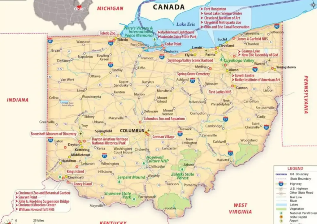
United States Political Map – USA Map with State Borders
A United States Political Map is a type of map that displays the political divisions and boundaries of the country. It shows all 50 states along with their borders, as well as the capital city, Washington, D.C.