Browse County Maps By State
click on any states to view and download county maps
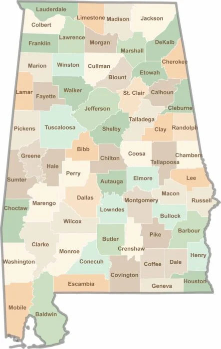
Alabama
67 Counties
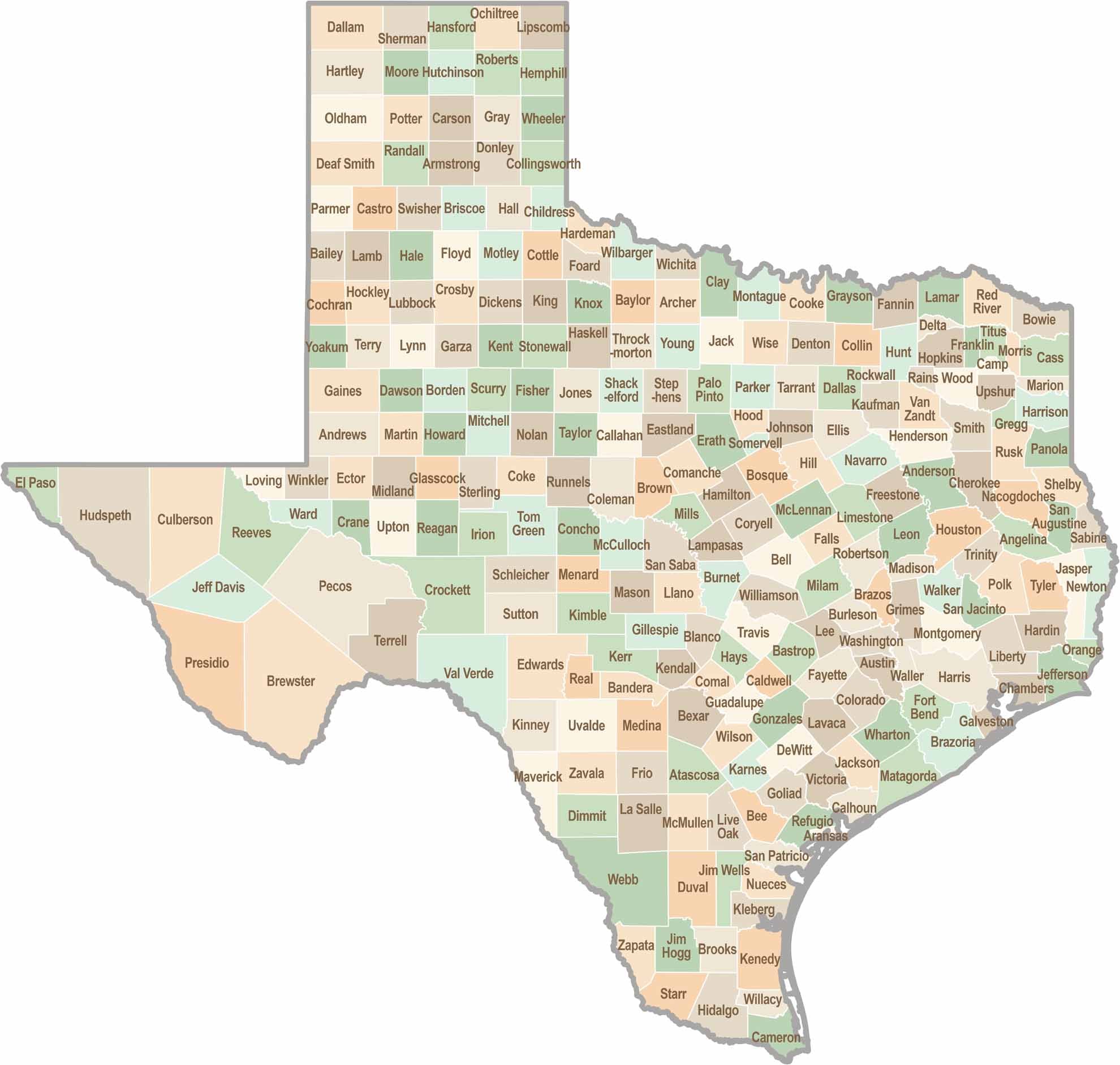
Texas
254 Counties
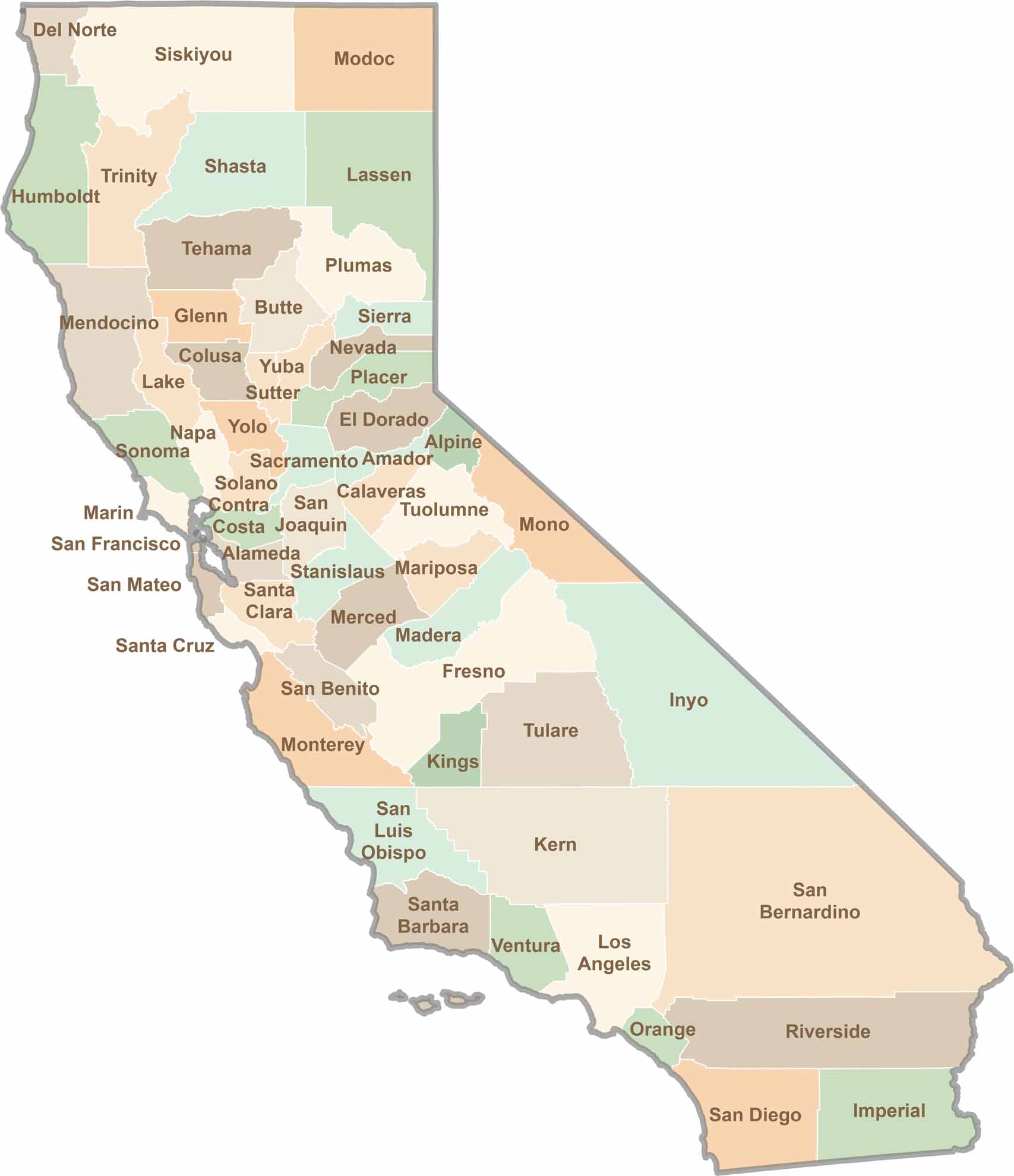
California
58 Counties
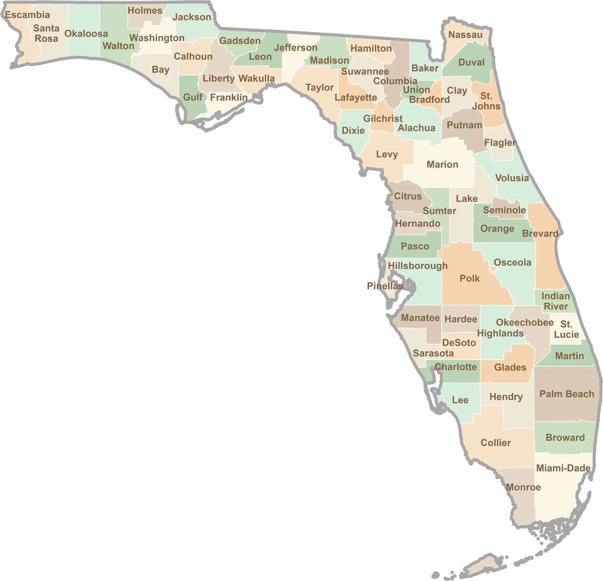
Florida
62 Counties
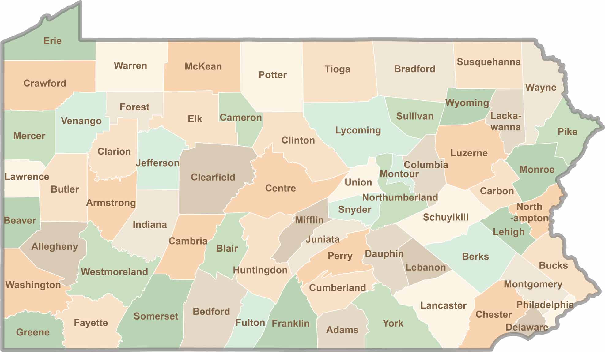
Pennsylvania
67 Counties
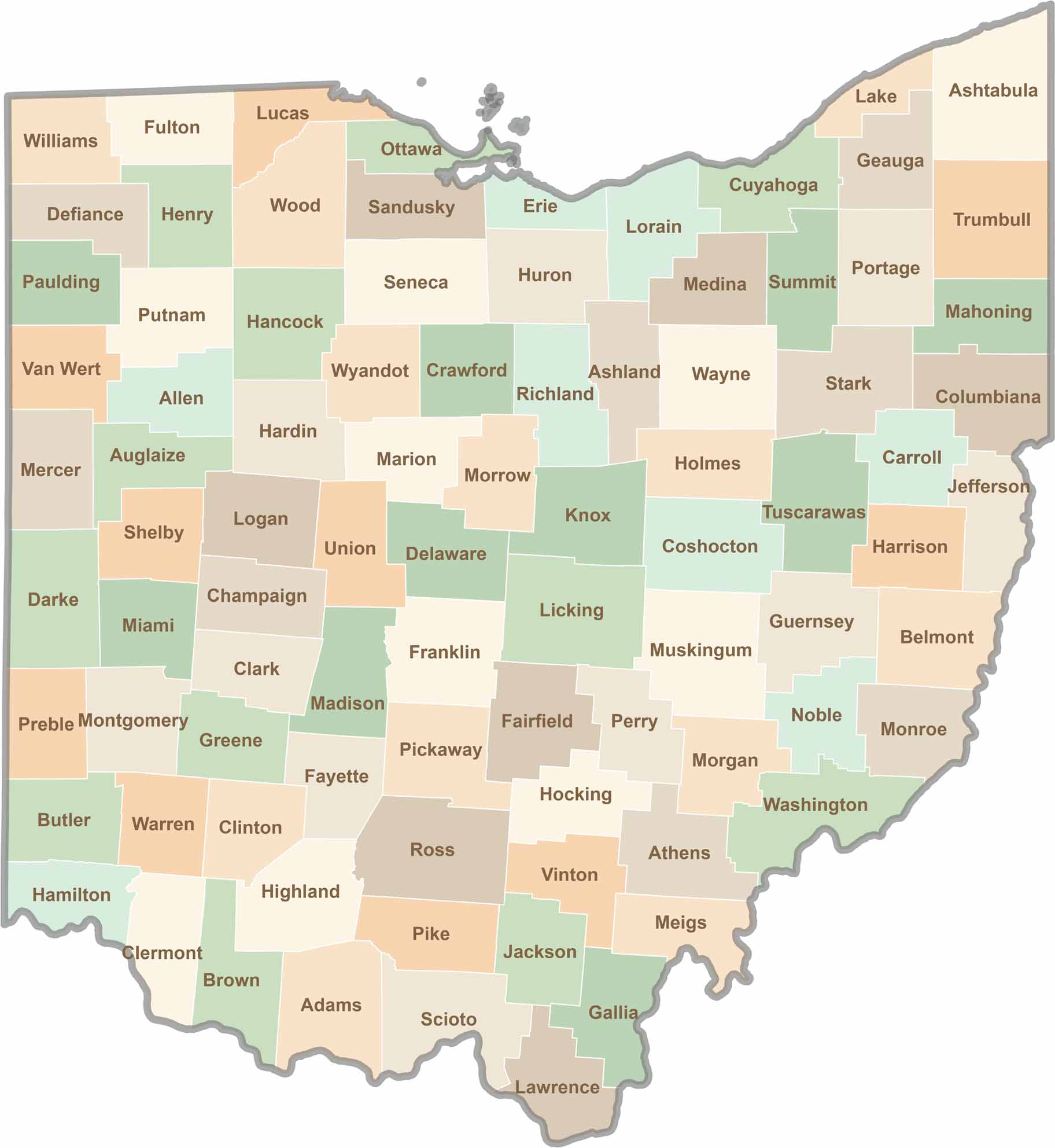
Ohio
67 Counties
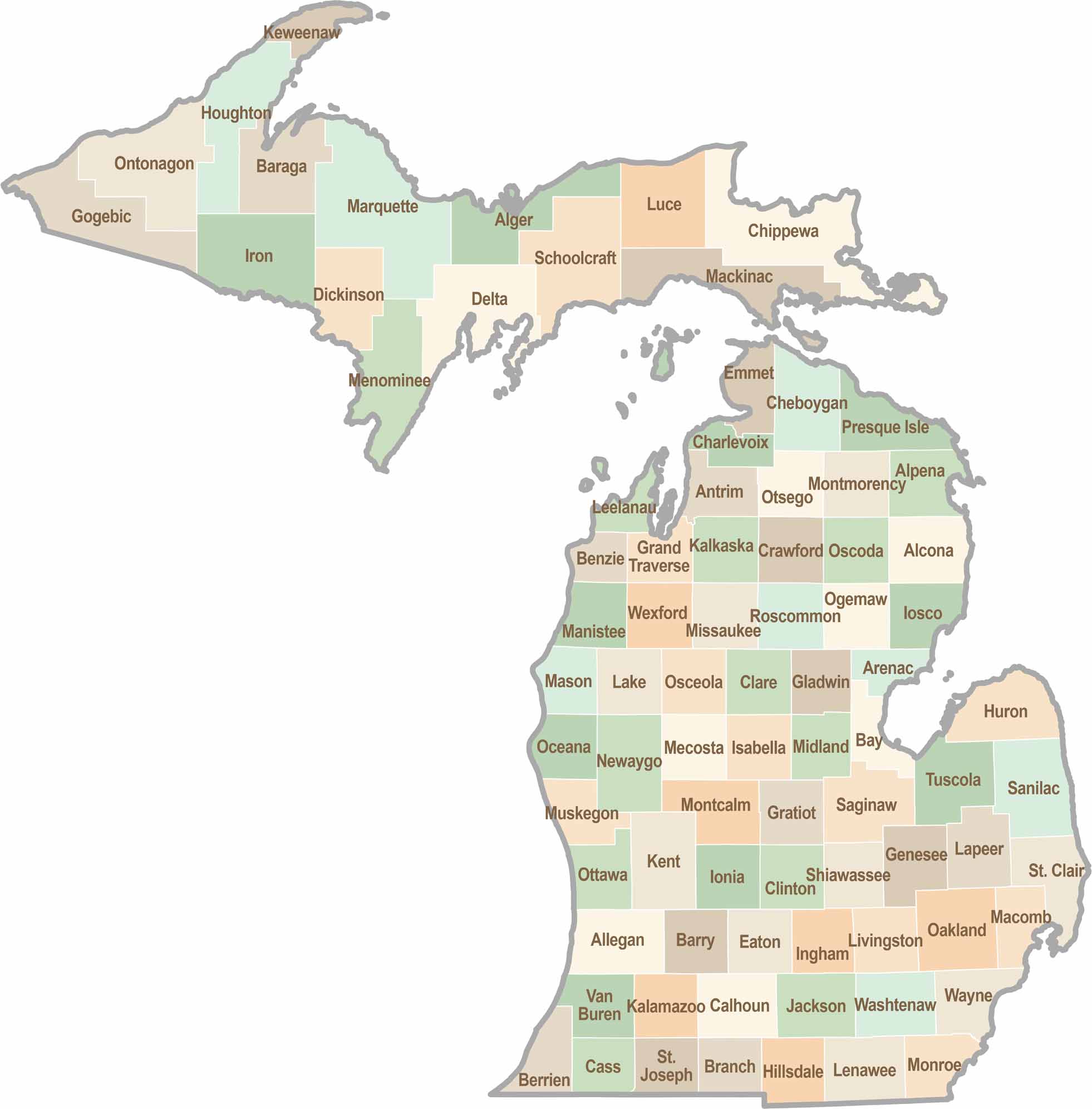
Michigan
83 Counties
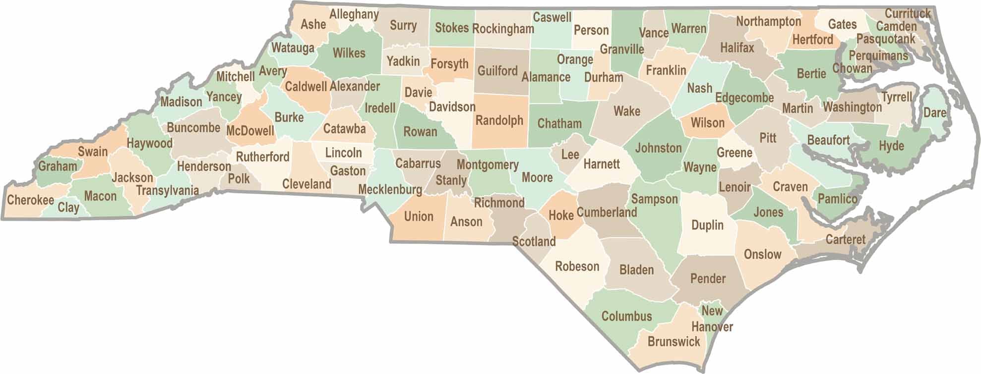
North Carolina
100 Counties
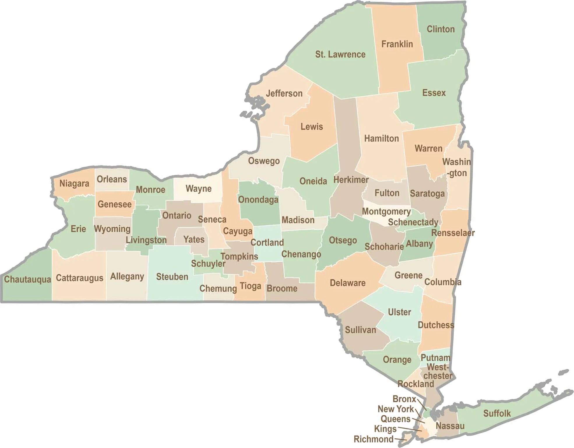
New York
62 Counties
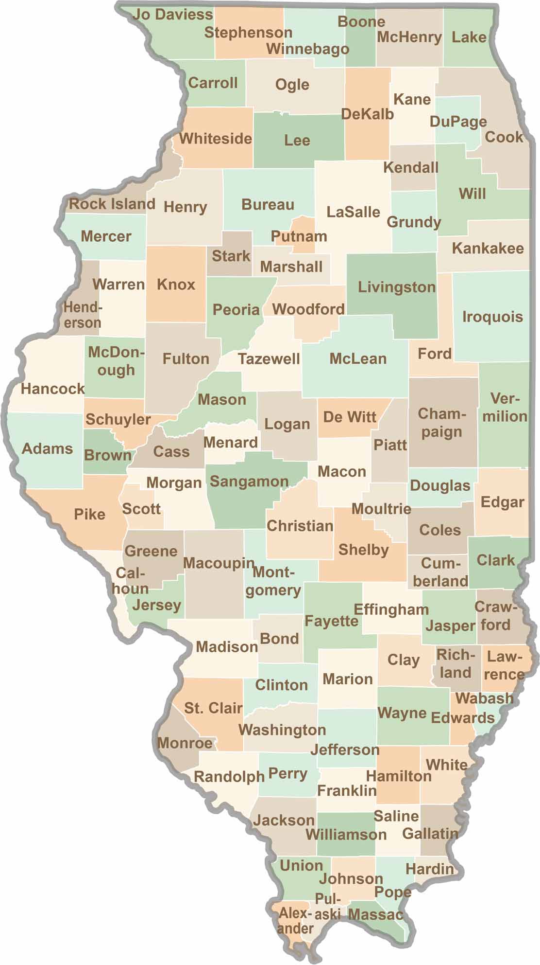
Illinois
102 Counties
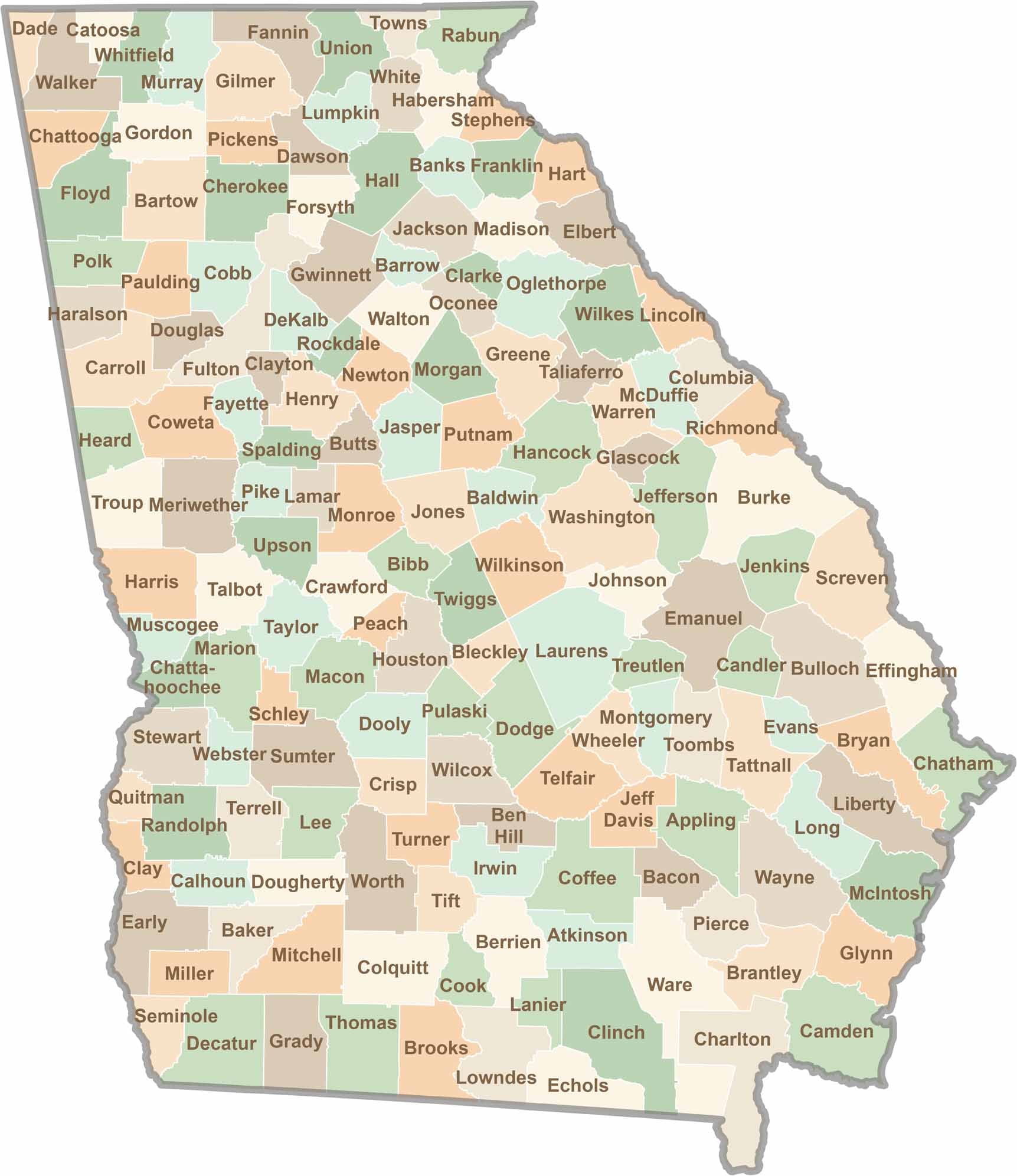
Georgia
159 Counties
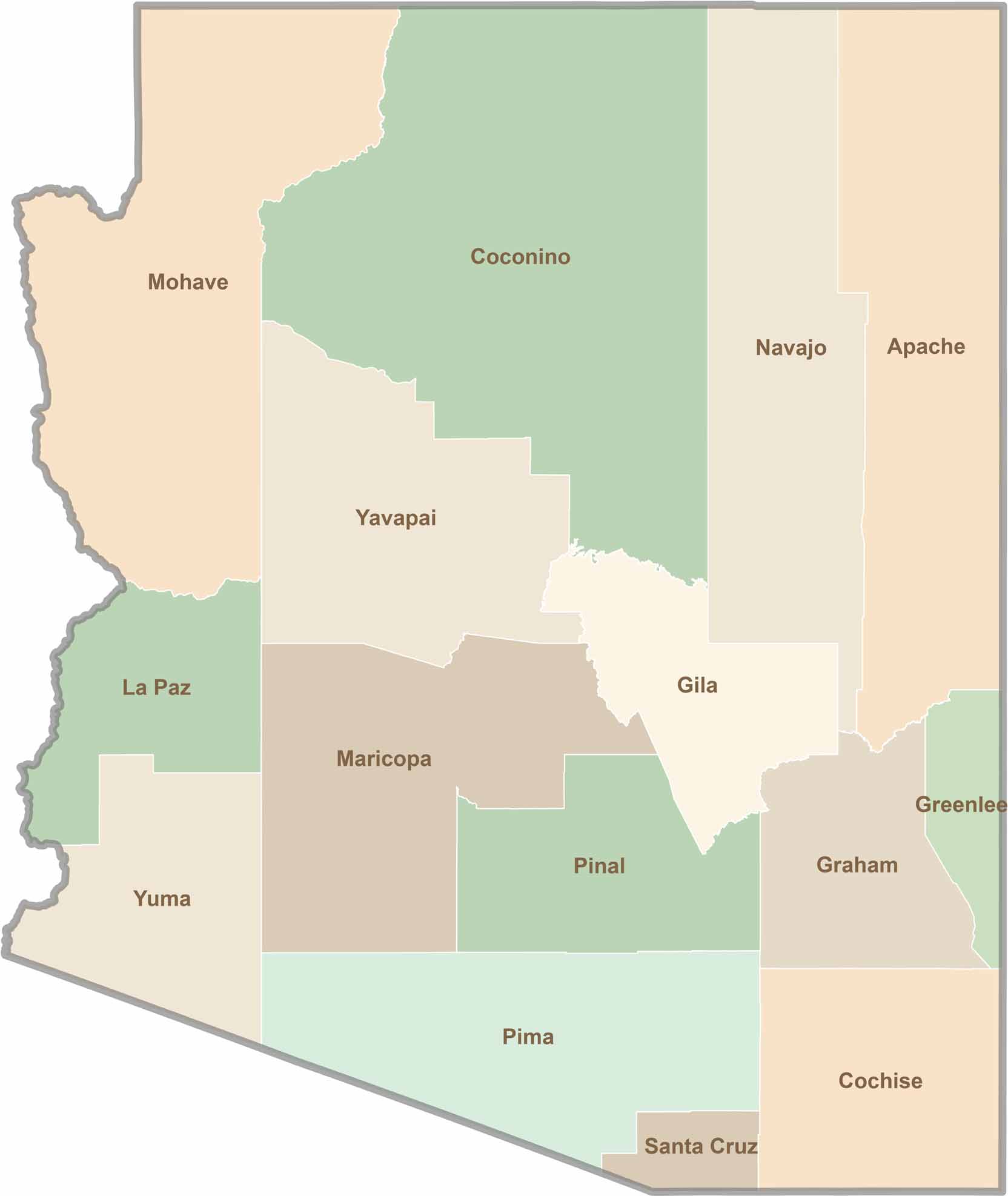
Arizona
15 Counties
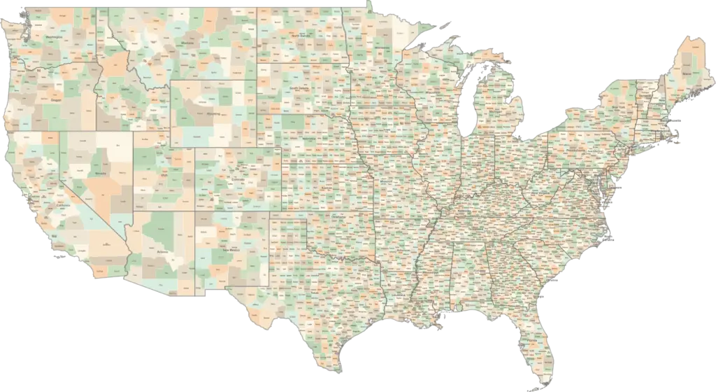
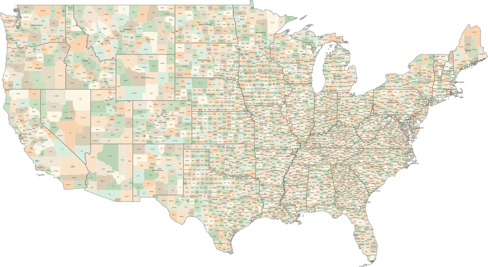
NATIONAL MAP
Explore the Complete US County Maps
View all county boundaries across the United States. Download or explore the interactive map to find any county in the country.
Most Popular Counties
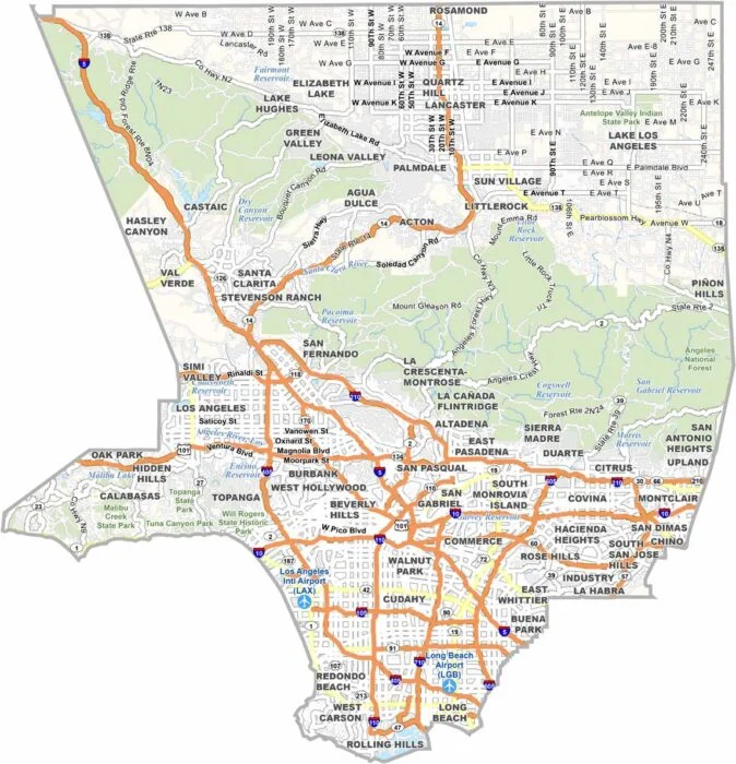
Los Angeles County
California
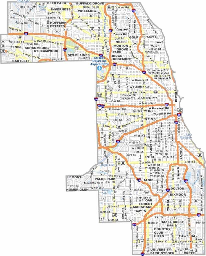
Cook County
Illinois
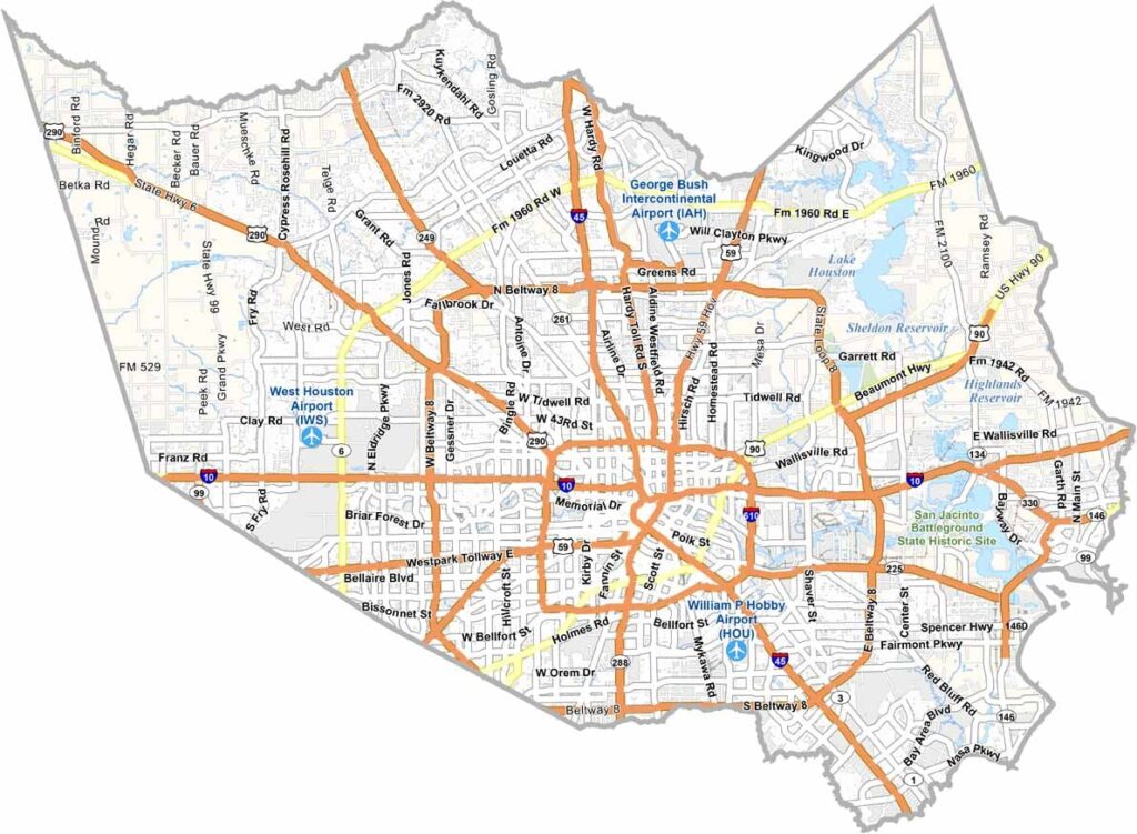
Harris County
Texas
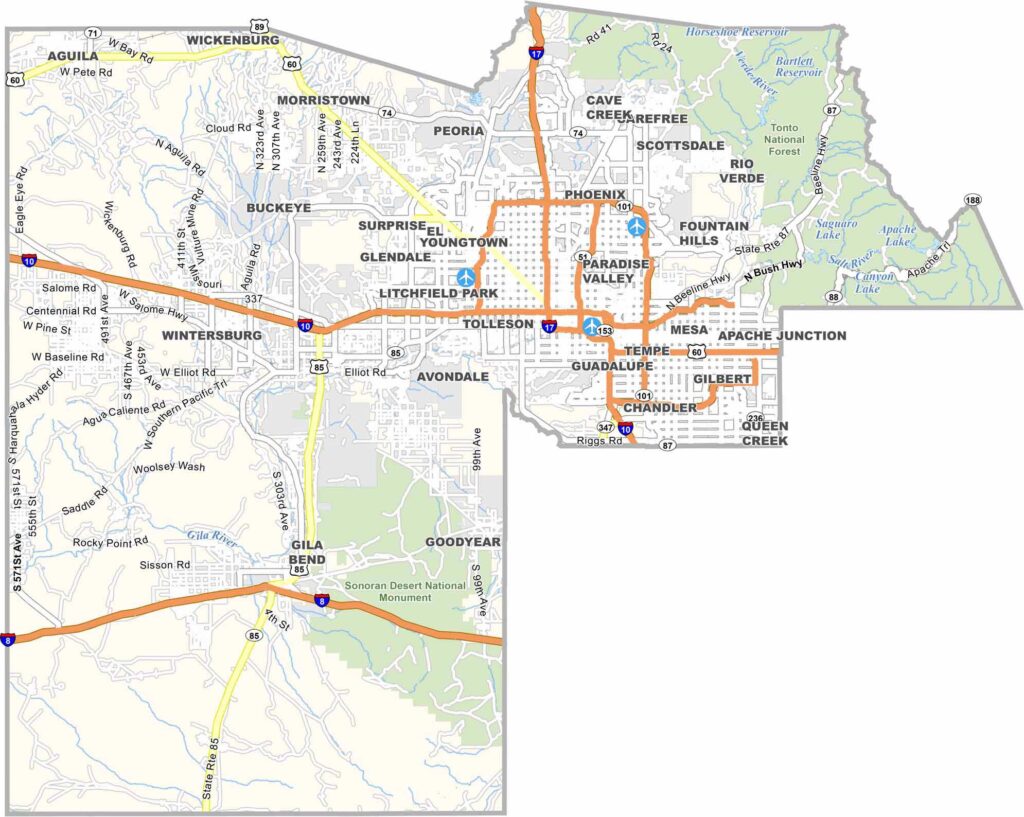
Maricopa County
Arizona


What Is a County Map?
A county map shows the boundaries and names of counties within a state or the entire United States. Our maps are ideal for education, research, business, travel, and reference.
How Many Counties Are in the US?
There are 3,142 counties in the United States across 50 states. Texas has the most with 254 counties, while Alaska has the fewest with 29 boroughs.
Perfect for Education & More
Our printable county maps are widely used by teachers, students, researchers, and travelers for projects, presentations, and reference.