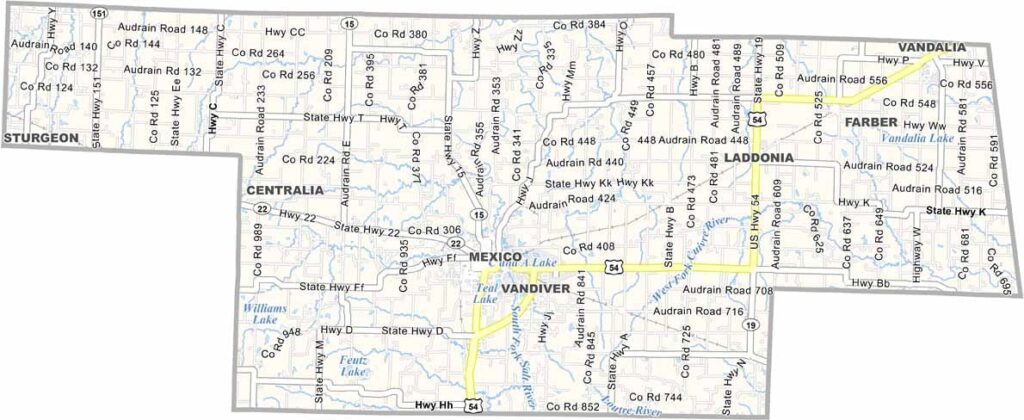
Audrain County Map Missouri
Audrain County is located in northeastern Missouri, roughly midway between St. Louis and Kansas City. The county seat, Mexico, is a welcoming community with a unique name and plenty of small-town charm.
Audrain County is located in northeastern Missouri, roughly midway between St. Louis and Kansas City. The county seat, Mexico, is a welcoming community with a unique name and plenty of small-town charm.
Audrain County is located in northeastern Missouri, roughly midway between St. Louis and Kansas City. The county seat, Mexico, is a welcoming community with a unique name and plenty of small-town charm.
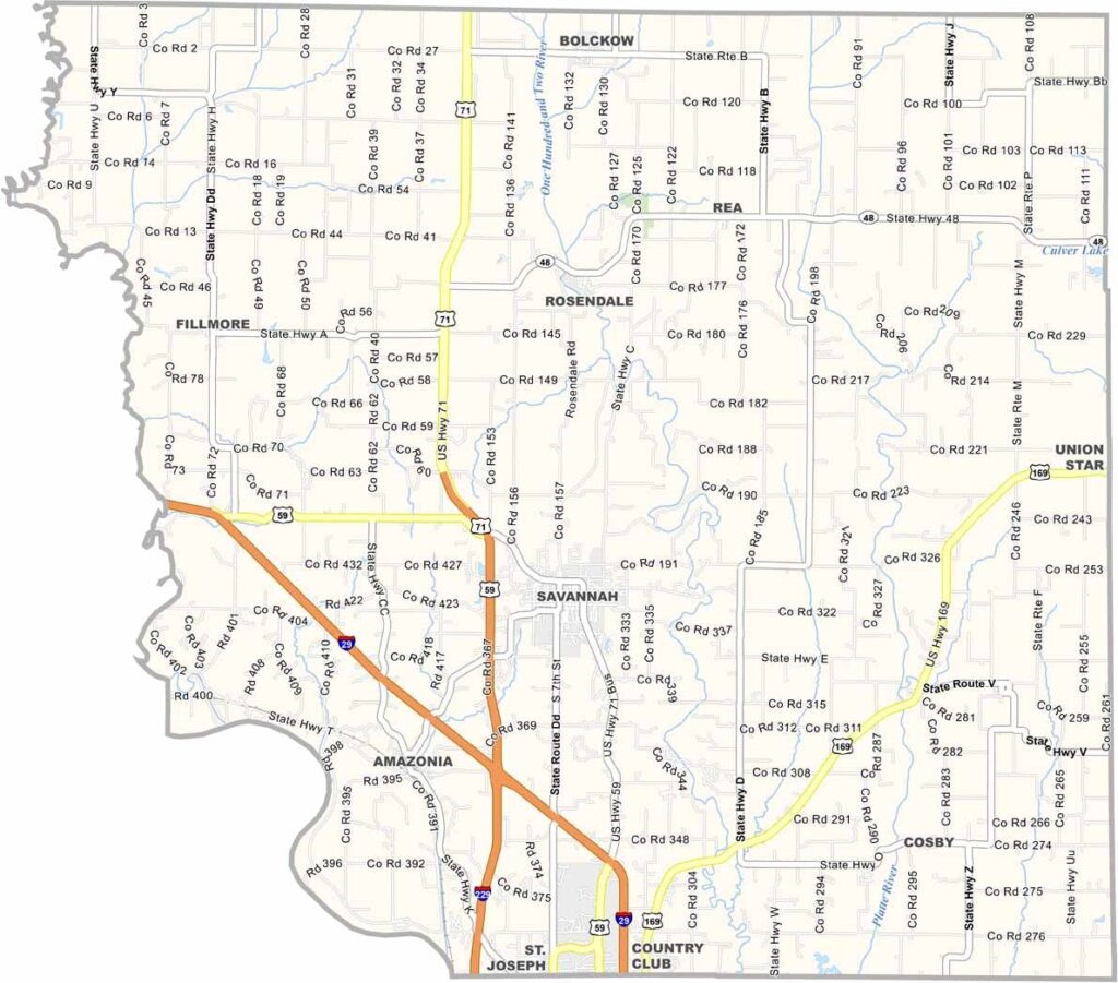
Andrew County is located in northwest Missouri, where history and rural landscapes come together. The Missouri River forms part of the county’s western boundary, adding to its scenic appeal.
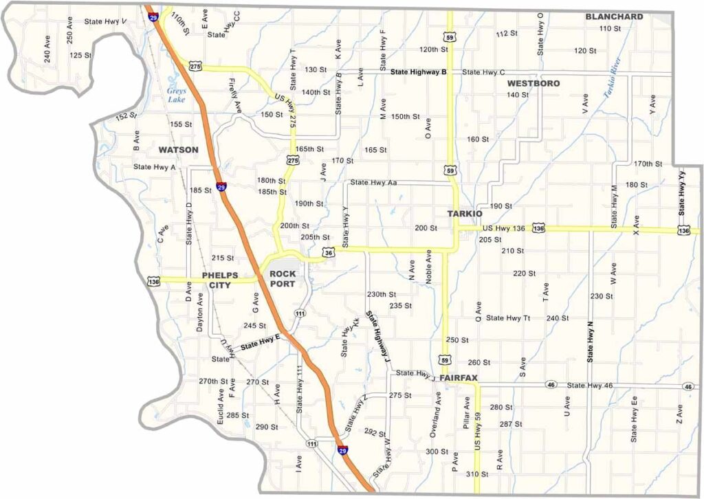
Atchison County occupies Missouri’s far northwestern corner, where the Missouri River forms the border with Nebraska. The landscape is shaped by fertile farmland, open plains, and scenic creek valleys that give the area a distinctly rural character.