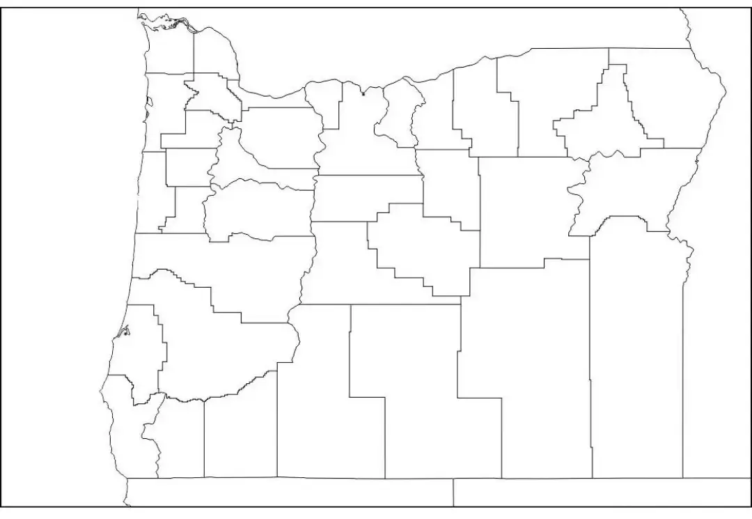
A Blank Oregon County Map is a valuable learning tool that provides a clean, unlabeled outline of the state, making it ideal for students, educators, and travelers who want to explore Oregon’s geography in a hands-on way. It serves as an excellent resource for studying the state's diverse regions, including its coastline, mountain ranges, rivers, and major cities. In educational settings, this map can be used for activities such as identifying and labeling important locations like Portland, Salem, and Eugene, as well as notable natural features such as the Cascade Range and Crater Lake
The Blank Oregon Map is a valuable educational resource that helps teachers create engaging activities focused on map-reading skills, geographic awareness, and understanding state boundaries. It is also useful for travelers, researchers, and individuals who want to mark destinations, plan routes, or study Oregon’s political and physical features. Whether used for classroom assignments, travel planning, or personal learning, this map provides a flexible way to explore the state. Its simple design makes it ideal for labeling, coloring, quizzes, and other interactive exercises, making it an essential tool for learning about Oregon’s geography.
Oregon is a geographically diverse state located in the Pacific Northwest of the United States. Renowned for its natural beauty, the state features a wide range of landscapes, including scenic coastlines, lush forests, towering mountain ranges, fertile valleys, and expansive high deserts. Oregon’s largest city, Portland, is well known for its thriving arts community, cultural diversity, innovative food scene, and strong commitment to sustainability and environmental stewardship.
Oregon is also home to remarkable natural attractions, including Crater Lake, the deepest lake in the United States, and Mount Hood, a popular destination for skiing, hiking, and outdoor recreation. The state boasts a strong and diverse economy supported by industries such as technology, agriculture, forestry, and tourism. With its rich cultural heritage, vibrant communities, and abundance of outdoor activities, Oregon offers countless opportunities for exploration, adventure, and discovery.
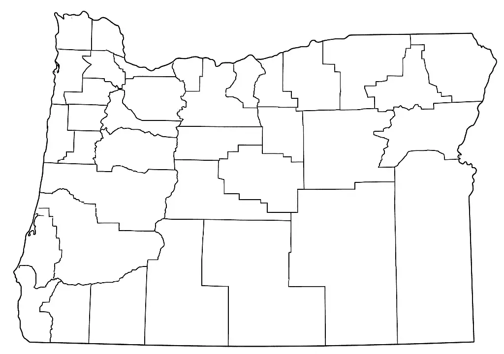
An Oregon Map Worksheet is a practical educational resource designed to help students and geography enthusiasts learn about the state's physical and political features. These worksheets typically include a blank or partially labeled map of Oregon, allowing users to identify and mark important locations such as major cities, rivers, mountain ranges, counties, and other notable landmarks. Commonly used in classrooms and homeschooling environments, they provide an interactive way to strengthen map-reading skills and geographic knowledge.
Read on to discover more about the Oregon Map Worksheet, a valuable resource for developing map-reading skills and geographic understanding. Commonly used in geography lessons, these worksheets help students improve spatial awareness by identifying and labeling important locations throughout the state. Learners can mark major cities such as Portland, Salem, and Eugene, along with prominent natural features like the Columbia River and the Cascade Range. By encouraging active participation through labeling and map-based activities, Oregon map worksheets make learning about the state's geography both engaging and enjoyable.
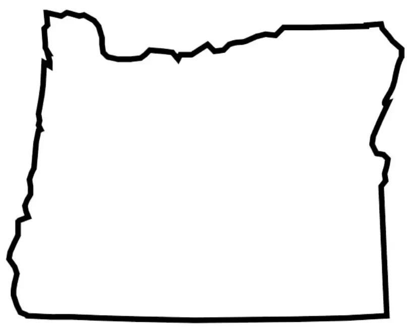
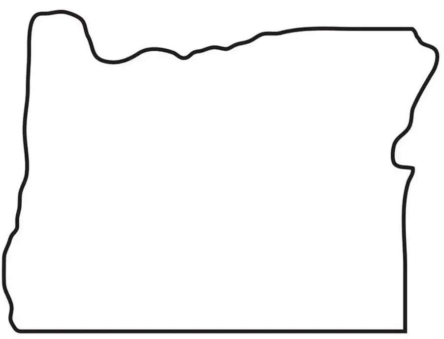
The Oregon map outline displays the state's shape and boundaries without any labels, making it an excellent resource for educational activities and geographic study. Widely used in classrooms, it helps students gain a better understanding of Oregon’s layout and key locations. Teachers often use the map for exercises that involve identifying and labeling major cities such as Portland and Salem, as well as important natural landmarks including the Cascade Mountains, Crater Lake, and the Columbia River. These activities encourage active learning and help students build stronger map-reading and geographic skills.
The Oregon map outline is also widely used for coloring activities and exercises that improve spatial awareness. By working with the state's outline, learners can better understand Oregon’s shape, location, and geographic layout. Activities such as coloring, labeling, and marking important features encourage active participation and help students develop stronger map-reading skills while gaining a deeper understanding of the state's geography.

