Rhode Island

Rhode Island

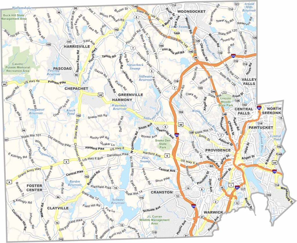
Providence County Map Download Rhode Island – Outline Map and Blank Map

Providence County is the largest and most populous county in Rhode Island, home to more than half of the state’s residents. At its center is Providence, the state capital and a major hub for education, culture, and innovation. The county is also home to renowned institutions such as Brown University and Rhode Island School of Design, which contribute to its strong academic reputation.

Rhode Island

Washington County Map Download Rhode Island – Outline Map and Blank Map

Washington County occupies the southwestern corner of Rhode Island and is often referred to by locals as South County. Known for its relaxed pace and scenic coastline, the county is home to some of New England’s most popular beaches, including Misquamicut State Beach and the shoreline around Narragansett. The region’s maritime heritage remains strong, particularly around Point Judith, where the fishing industry continues to play an important role in the local economy.

Rhode Island

Newport County Map Download Rhode Island – Outline Map and Blank Map

Newport County occupies Rhode Island’s eastern coastline and extends into the Atlantic Ocean, offering a blend of historic charm, scenic beauty, and maritime culture. The county is perhaps best known for the city of Newport, famous for its grand Gilded Age mansions, vibrant waterfront, and lively summer atmosphere. Alongside its tourism industry, the county is also home to an important naval presence, with military facilities contributing significantly to the local economy.

Scroll to Top