
Newport County occupies Rhode Island’s eastern coastline and extends into the Atlantic Ocean, offering a blend of historic charm, scenic beauty, and maritime culture. The county is perhaps best known for the city of Newport, famous for its grand Gilded Age mansions, vibrant waterfront, and lively summer atmosphere. Alongside its tourism industry, the county is also home to an important naval presence, with military facilities contributing significantly to the local economy.
The region features some of New England’s most popular beaches and coastal attractions, drawing visitors throughout the year. Beyond Newport, communities such as Middletown, Portsmouth, Tiverton, and Little Compton offer a quieter pace, with picturesque shorelines, rural landscapes, and classic New England character.
The county also includes Jamestown, situated on Conanicut Island in the heart of Narragansett Bay. With its combination of historic landmarks, coastal scenery, naval heritage, and charming small towns, Newport County showcases a diverse and distinctive side of Rhode Island.
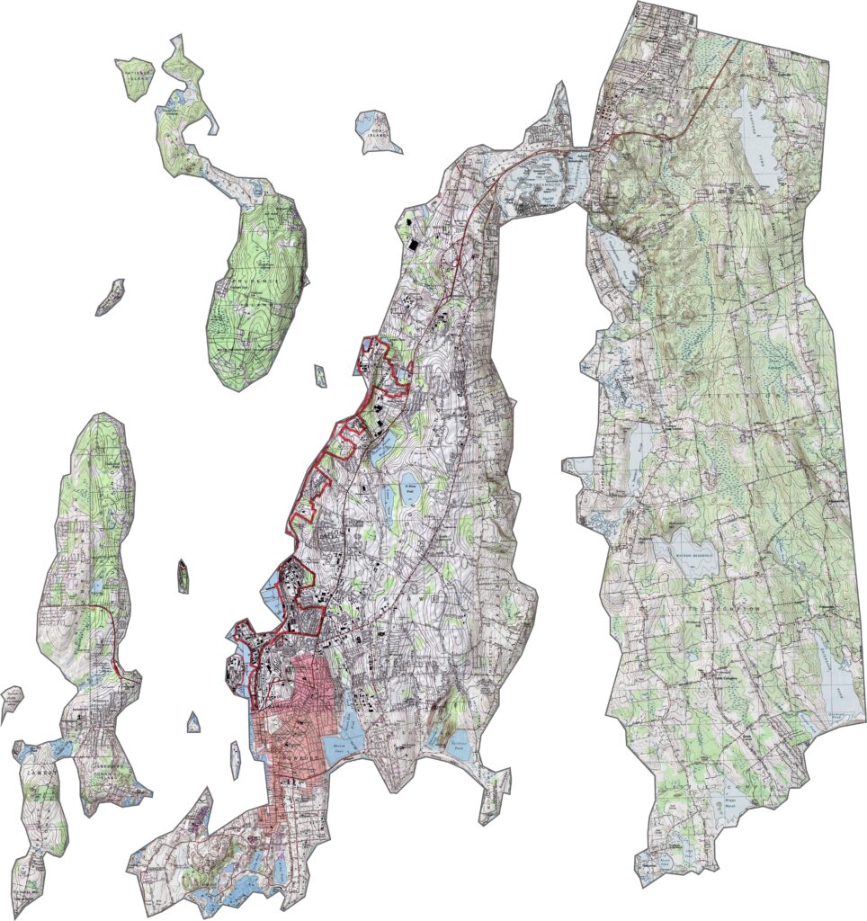
Our Newport County topographic map highlights a landscape shaped more by the ocean than by significant changes in elevation. The county remains relatively low-lying, with rocky coastlines, headlands, and coastal bluffs defining much of its shoreline. Across the islands, gentle hills rise modestly above sea level, creating subtle contours that add character to the terrain. Rather than dramatic peaks or valleys, Newport County’s topography is distinguished by its coastal landforms and rolling relief.
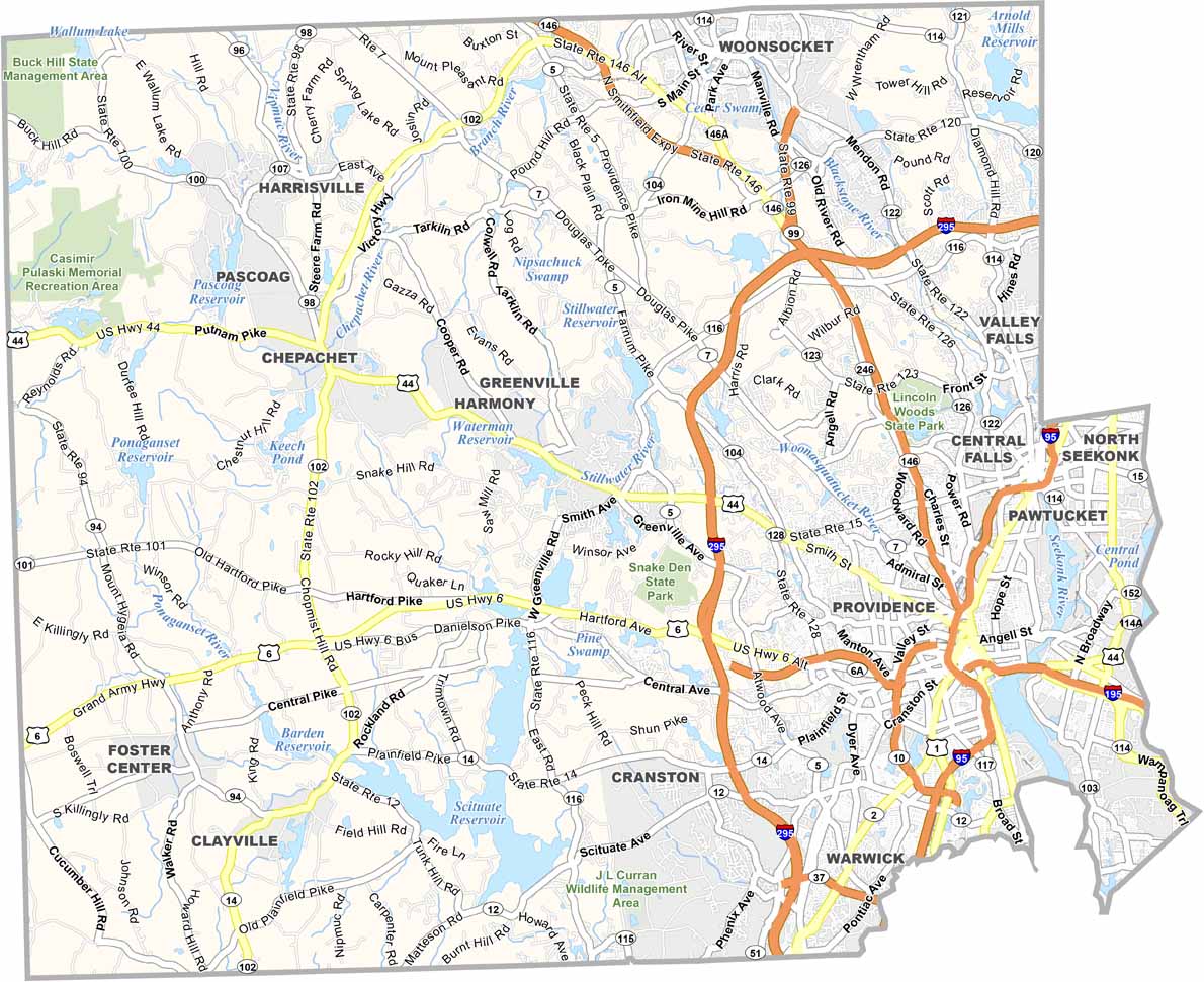
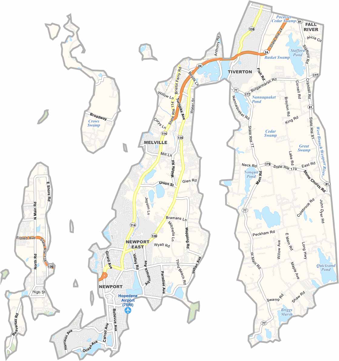
Our Newport County road map reflects a transportation network shaped by the region’s islands, bays, and coastline. Roads curve around inlets and waterways, connecting communities across the county while adapting to the natural landscape. Although there are fewer direct routes than in more inland areas, the road system efficiently links popular destinations and coastal towns. In several places, roads terminate at harbors, beaches, or waterfronts, where the land gives way to the sea.
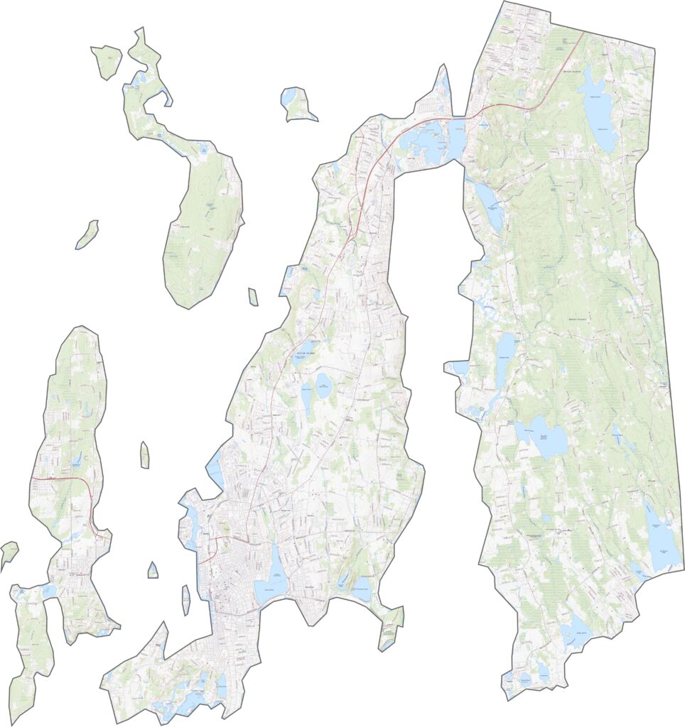
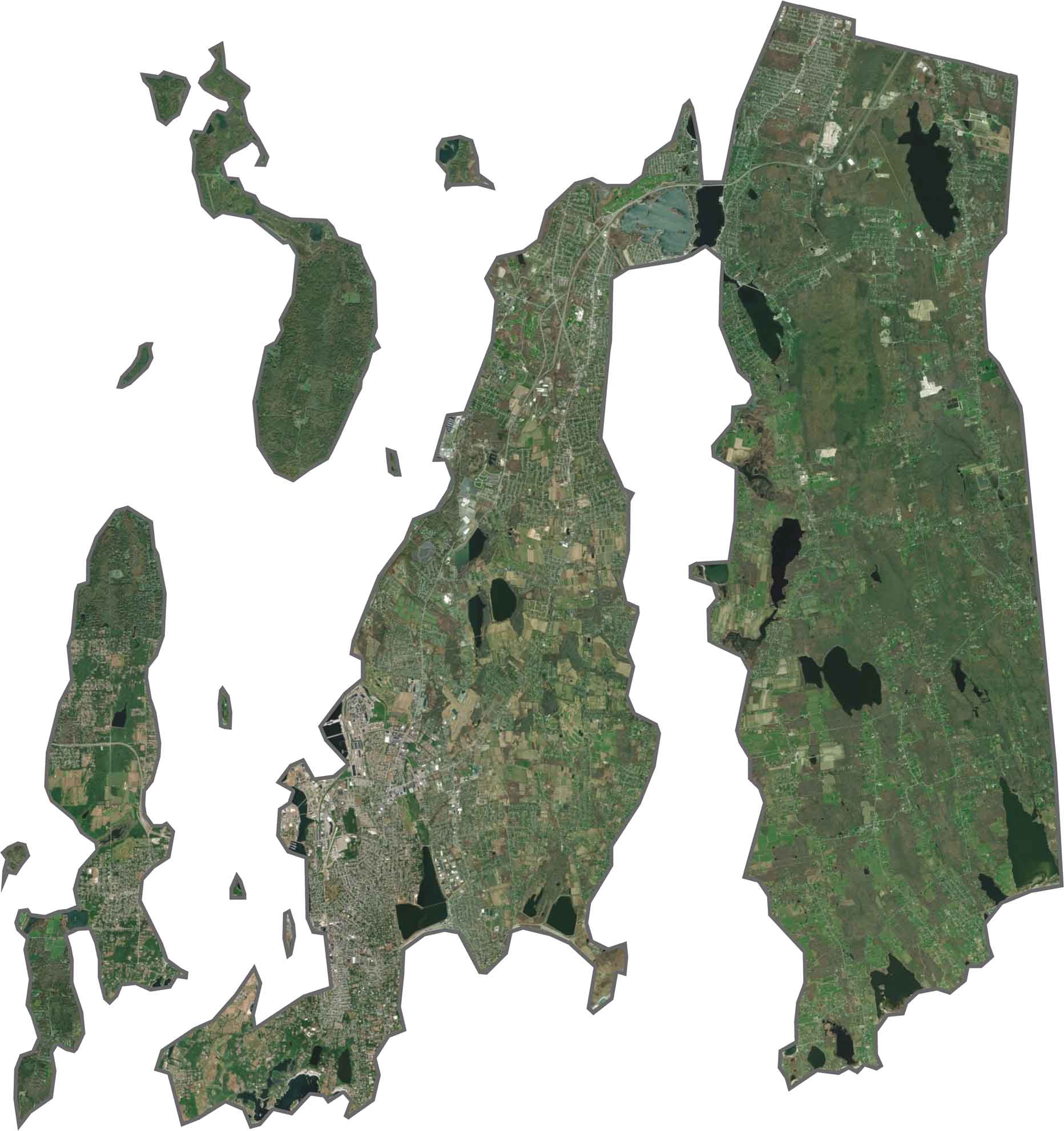
Our Newport County satellite map reveals a landscape where land and water are closely intertwined. Much of the county is made up of islands connected by bridges, creating a distinctive coastal pattern visible from above. Expansive bays and waterways surround the communities, while a balance of open green spaces, farmland, and developed shoreline gives the region its unique character. The contrast between natural landscapes and waterfront development is one of the county’s most recognizable features.

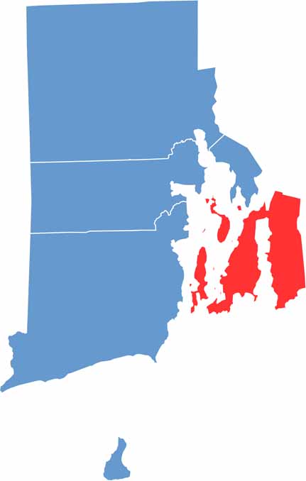
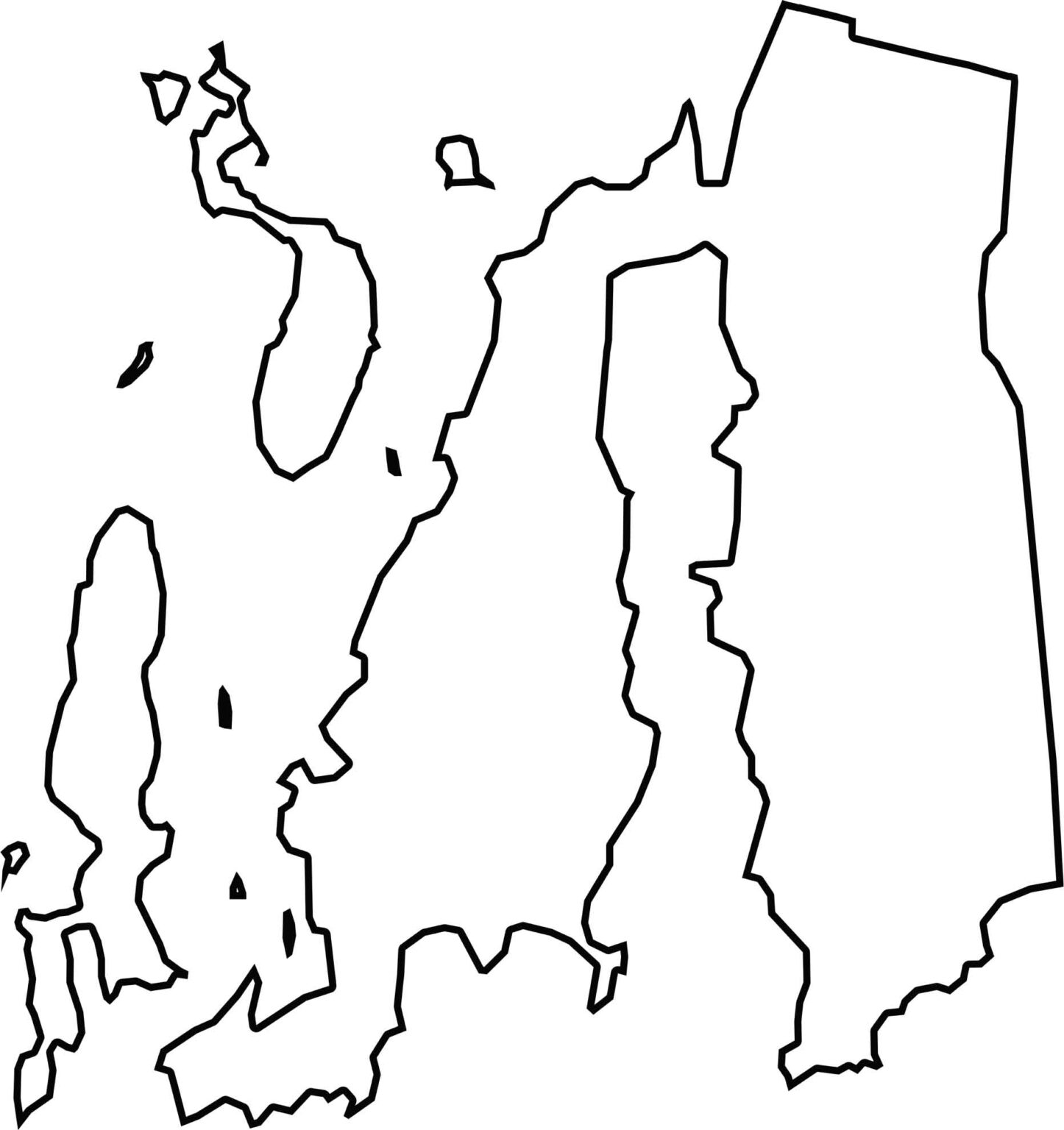
Newport County has one of the most distinctive outlines in Rhode Island, consisting of several islands and peninsulas shaped by the waters of Narragansett Bay. Much of the county’s boundary is defined by coastlines and waterways rather than land borders, giving it a fragmented, island-based appearance. While it shares a border with Massachusetts to the east, the majority of Newport County is surrounded by Rhode Island’s bays, sounds, and Atlantic waters, making its geography uniquely maritime in character.

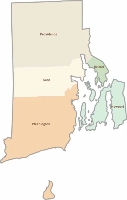
Rhode Island may have only five counties, but each offers its own distinct character. From scenic coastal communities and vibrant college districts to historic towns and peaceful wooded landscapes, the state packs a remarkable variety of places into a small area. Explore them all with our Rhode Island county map collection and discover the unique features that make each county stand out.