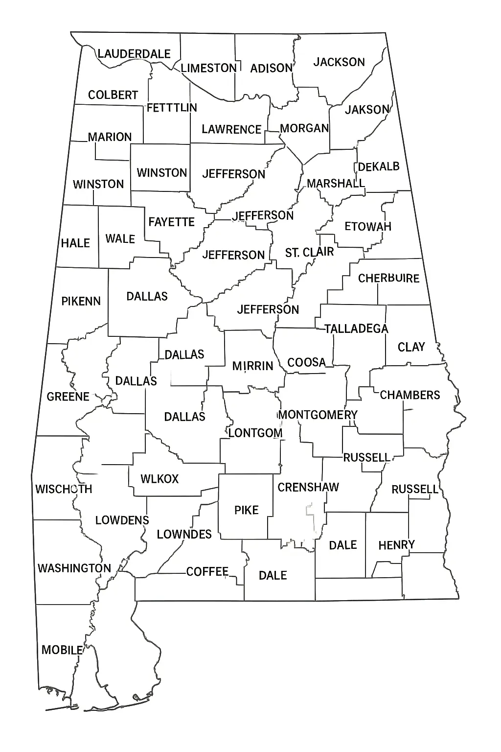
A Labeled Alabama County Map is a detailed visual resource that highlights the state's counties, major cities, highways, rivers, and important geographic features. By clearly identifying key locations and boundaries, it serves as a valuable reference for students, educators, travelers, and researchers. Whether used for educational purposes, trip planning, or general geographic study, a labeled map of Alabama provides an easy and informative way to explore and understand the state's layout and landmarks.
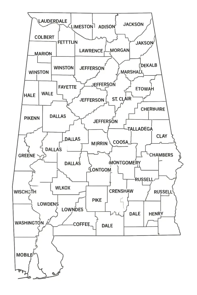
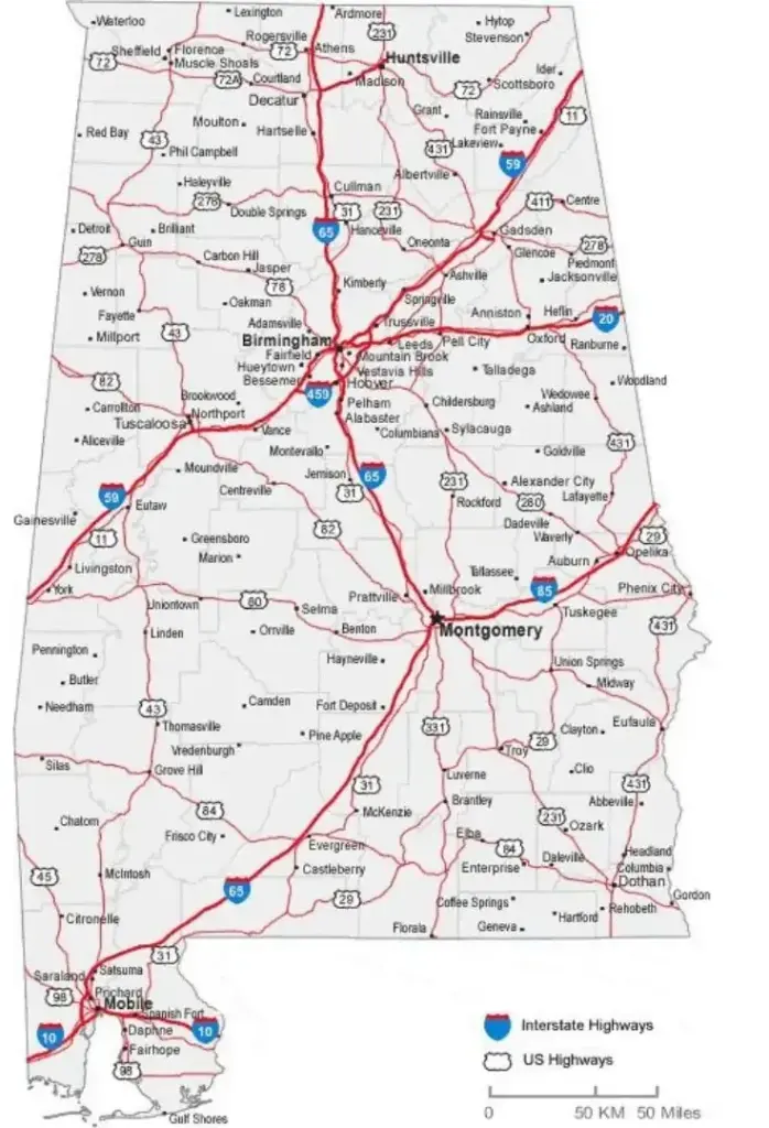
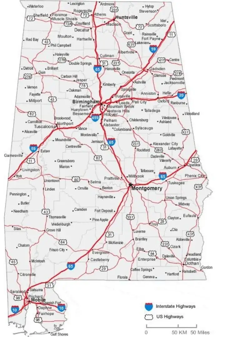
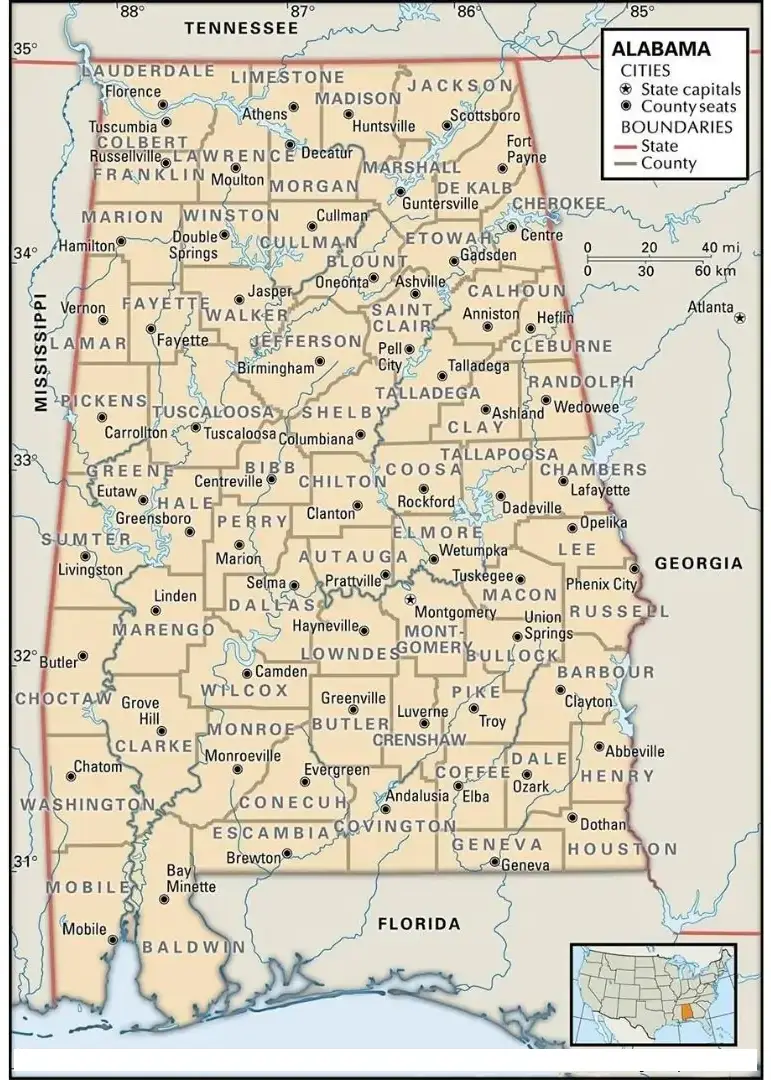
Labeled Alabama Map — Highlights major cities, including Montgomery, Birmingham, Mobile, and Huntsville, providing a clear view of the state's geographic layout and population centers. County boundaries are also shown, allowing users to easily identify political and administrative regions throughout Alabama.
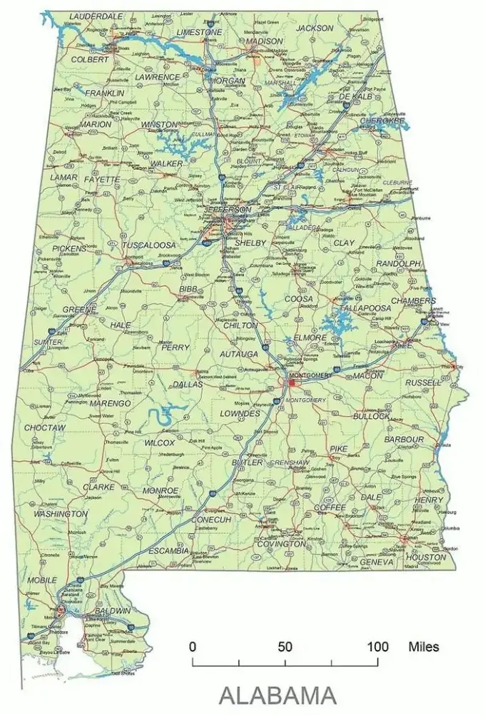
And it often features natural elements, such as the Tennessee River and the Appalachian foothills, giving insight into Alabama’s varied geography. These maps are useful resources in classrooms for students learning about U.S. geography, as well as for tourists and researchers who want a quick look at the region and its borders. A labeled Alabama Map provides an overview of the state, whether printed or digital, giving a structure to the land terrain.
This map makes it easy to navigate Alabama and understand how the state is organized both geographically and politically. Its clear design and detailed labels help users quickly identify key locations, boundaries, and regions. Whether for education, travel planning, research, or general reference, it provides a convenient and informative overview of the Alabama, also known as the Heart of Dixie.
One of the great states of the southeast, Alabama, is a place with dense forests, rolling hills, and deep history. It is bordered by Tennessee, Georgia, Florida, and Mississippi and contains a mixture of mountains, forests, and coastal plains. Montgomery is the state capital, and Birmingham is the largest city and a significant industrial center.
Alabama has played a significant role in American history, particularly during the American Civil War and the Civil Rights Movement. The state is widely recognized for its Southern hospitality, passionate college football culture, and distinctive regional cuisine. While Alabama continues to honor its rich traditions and historical heritage, it has also embraced economic growth, innovation, and modernization in recent decades.
Many people use maps to understand the size, location, and importance of cities across Alabama. This labeled map highlights major cities such as Montgomery, Birmingham, Huntsville, Mobile, and Tuscaloosa, offering a clearer view of the state’s geography and cultural landscape. Each of these cities contributes significantly to Alabama’s economy, education system, and historical development. Montgomery is especially known for its role in the Civil Rights Movement, while Birmingham remains a major center for industry, business, and culture. By identifying these key locations, a labeled Alabama map with cities helps users better understand the state’s regional diversity and the unique characteristics of its urban centers.
The map is designed to clearly display both the geographic and political features of Alabama. It outlines the state's boundaries while showing county divisions, major rivers, and neighboring states. Key cities, including Montgomery, Birmingham, and Mobile, are clearly labeled to provide geographic context and help users understand their locations within the state. This combination of physical and political details makes the map a useful reference for learning about Alabama’s layout and regional organization.
This type of map is especially useful for educational purposes, helping students and other learners become more familiar with the geography of Alabama. By clearly displaying boundaries and key locations, it provides valuable insight into the state's regional divisions while enhancing understanding of its political and physical features. The detailed labeling makes it easier to study Alabama’s layout, identify important areas, and develop a stronger understanding of the state's geographic structure.