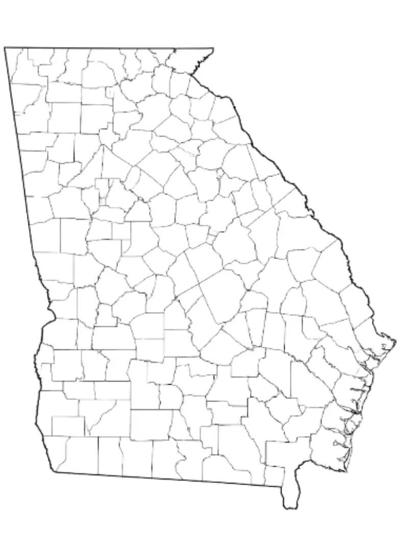
A Blank Georgia County Map is a simple, unlabeled outline of the state that provides a flexible resource for learning, planning, and geographic study. Widely used by students, teachers, and researchers, this type of map allows users to explore Georgia’s geography without any pre-marked locations or features. With a Blank Georgia Map, learners can identify and label major cities such as Atlanta, Savannah, and Augusta, mark important natural features like the Appalachian Mountains and the Chattahoochee River, and locate counties, highways, and transportation routes. Its customizable format makes it an excellent tool for classroom activities, quizzes, travel planning, and geographic research.
A Blank Georgia County Map is widely used in schools to help students learn about the state's geography, regions, historical landmarks, and political boundaries. Teachers often incorporate these maps into classroom activities, quizzes, and assignments to improve map-reading skills and geographic awareness. Beyond education, a Blank Georgia Map is also a valuable resource for travelers, planners, and researchers who need to create custom routes, plan itineraries, or analyze specific areas of the state. Whether used for academic purposes or personal exploration, it provides a clear and flexible canvas for studying Georgia’s layout, natural features, and regional characteristics. From tracing travel routes to marking important landmarks, a Blank Georgia Map offers an engaging and practical way to explore and better understand the Peach State.
Georgia is a state located in the southeastern United States, known for its rich history, diverse geography, and vibrant culture. The state features a wide variety of landscapes, ranging from the scenic Appalachian Mountains in the north to the fertile coastal plains that stretch along the Atlantic Ocean in the east. Georgia is home to bustling cities, charming small towns, and numerous natural attractions, making it a unique blend of urban development and natural beauty. Its cultural heritage, thriving economy, and abundance of outdoor recreational opportunities make Georgia one of the most dynamic and diverse states in the country.
Atlanta, the state capital of Georgia, serves as a major economic, cultural, and transportation hub, home to numerous multinational corporations, renowned universities, and historic landmarks. Georgia played a significant role in both the Civil War and the Civil Rights Movement, contributing greatly to the nation's history and cultural development. While Atlanta’s impressive skyline and thriving metropolitan area are often the first images associated with the state, Georgia offers much more, including picturesque mountain landscapes, charming small towns, scenic coastal regions, and a rich blend of traditions that reflect its unique Southern heritage.
A Georgia Map Worksheet is an effective educational resource designed to help students learn about the state's geography through interactive activities. These worksheets typically feature blank or partially labeled maps that allow learners to identify and mark important locations such as Atlanta, Savannah, and Augusta, along with major rivers, mountain ranges, coastal regions, and other geographic landmarks. Commonly used in classrooms, they help students develop map-reading skills, improve spatial awareness, and gain a better understanding of Georgia’s physical and political geography. Georgia map worksheets are also valuable supplements for history, social studies, and geography lessons, making learning more engaging and hands-on.
These worksheets often include labeling, coloring, and quiz-based activities that make learning more engaging and interactive for students. By incorporating a variety of exercise types, they cater to different learning styles and help maintain student interest throughout the learning process. As a result, students can develop a stronger understanding of geographic concepts while enjoying a more hands-on and enjoyable educational experience.
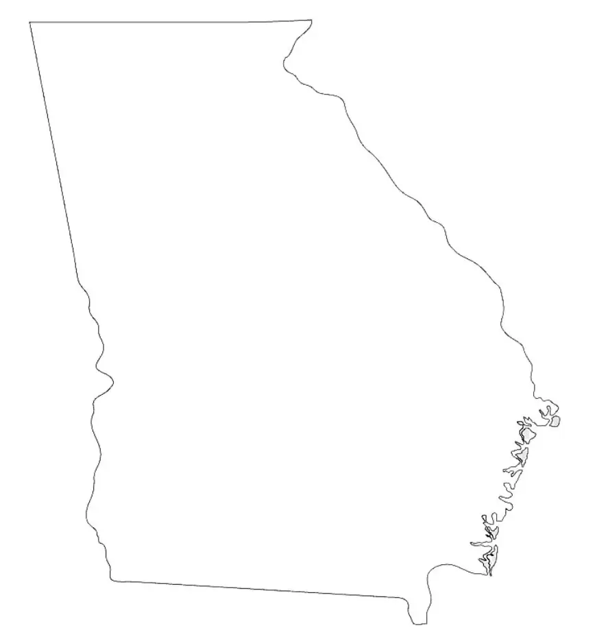
A Georgia Outline Map is a simple map that displays the shape and boundaries of the state without any labels, markings, or additional details. It highlights Georgia’s distinctive outline, making it a useful resource for educational and geographic activities. Located in the southeastern United States, Georgia is bordered by Florida to the south, Alabama to the west, Tennessee and North Carolina to the north, and South Carolina to the east. This type of map provides a clear foundation for labeling exercises, geography lessons, and map-based projects.
Georgia outline maps are widely used by teachers in classrooms to help students identify and label important geographic features such as cities, counties, rivers, and mountain ranges. By providing a blank template, these maps offer an effective way to explore and understand the state's geography. They are also useful for creating custom maps, planning trips, and studying Georgia’s natural landscapes and political boundaries in greater detail. As a versatile educational resource, a Georgia outline map helps improve geographic knowledge and map-reading skills.

