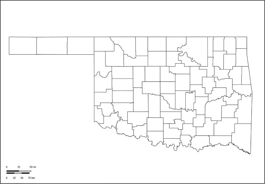
A Blank Oklahoma County Map is a valuable educational and planning resource that features a simple, unlabeled outline of Oklahoma and its counties. This type of map allows users to clearly view the state's geography and customize it for classroom activities, research projects, travel planning, or personal study. In geography and social studies lessons, teachers often use blank Oklahoma maps to help students identify and label major cities such as Oklahoma City, Tulsa, and Norman, as well as rivers, mountain ranges, counties, and neighboring states. By engaging with the map directly, students can improve their spatial awareness and gain a better understanding of Oklahoma’s geographic layout in an interactive and hands-on way.
A Blank Map of Oklahoma is also a practical resource for travelers, researchers, and educators who want to mark routes, natural landmarks, historical sites, or other points of interest without the distraction of pre-labeled information. Parents and homeschool educators can use these maps for interactive learning activities, encouraging children to explore state geography through labeling, coloring, and map-reading exercises.Additionally, a Blank Oklahoma Map serves as an excellent foundation for quizzes, school projects, reports, and classroom presentations. Whether used in printed form or as a digital resource, it offers a flexible and creative way to learn about Oklahoma’s borders, counties, major cities, and geographic features while building geographic knowledge and spatial skills.
Oklahoma is a diverse and vibrant state located in the South Central region of the United States. Known for its rich Native American heritage, expansive plains, and thriving urban centers, Oklahoma offers a unique blend of history, culture, and natural beauty. The state capital and largest city, Oklahoma City, serves as a major hub for industries such as energy, aviation, and the arts, while also featuring numerous cultural attractions and historical landmarks.
Another major city, Tulsa, is known for its unique combination of modern development and historic charm, featuring a vibrant arts scene, impressive architecture, and a strong business community. Oklahoma is also well known for its frequent tornado activity, as much of the state lies within the region commonly referred to as Tornado Alley. With its scenic landscapes, strong agricultural economy, and rich cultural heritage, Oklahoma offers a distinctive blend of tradition and progress, making it an appealing place to live, work, and visit.
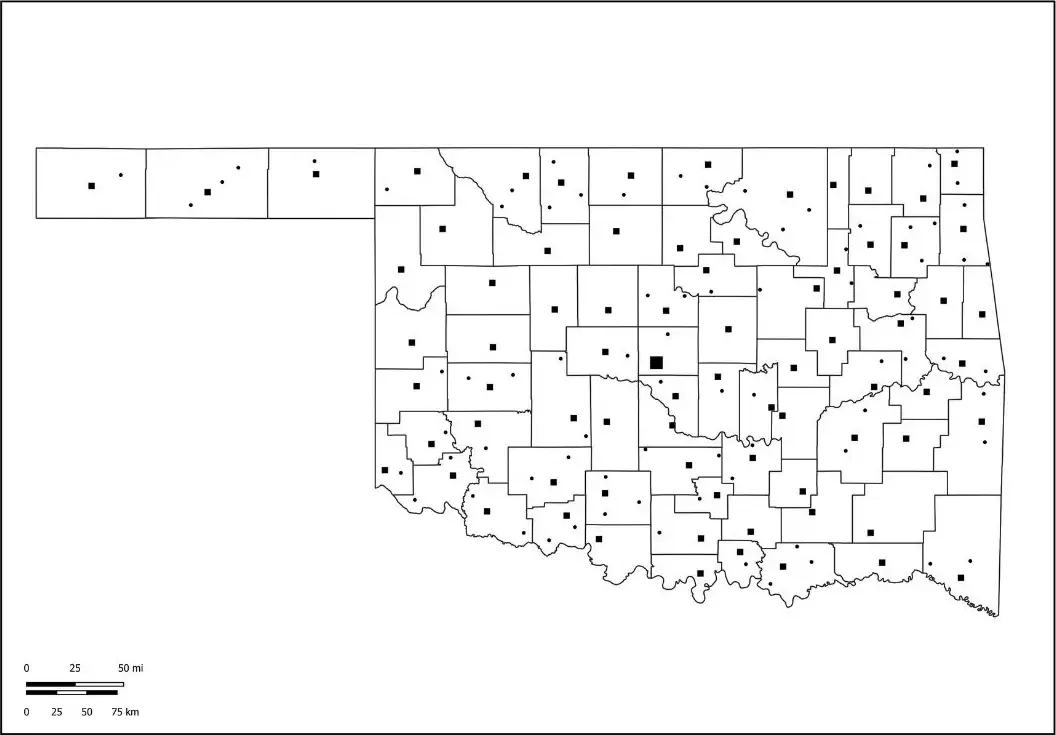
An Oklahoma map worksheet is a valuable educational resource that helps students learn about the state's geography, major cities, and notable landmarks. These worksheets often feature a blank or partially labeled map, allowing learners to identify and label important locations such as Oklahoma City, Tulsa, major rivers, counties, and neighboring states. By actively engaging with the map, students can develop a stronger understanding of Oklahoma’s geographic features and spatial relationships.
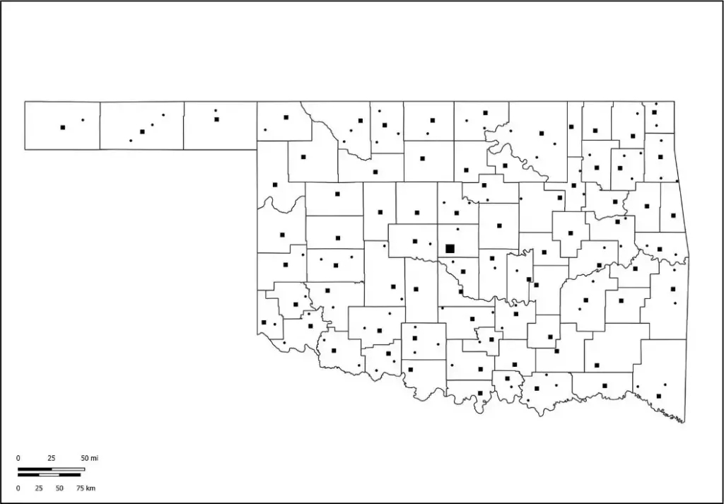
Teachers often incorporate these worksheets into geography and social studies lessons to strengthen students’ map-reading abilities and spatial awareness. They can be used for a variety of engaging activities, including coloring, labeling locations, completing map-based exercises, and taking geography quizzes. An Oklahoma map worksheet provides an interactive and effective way for students to explore and understand the state's geography while building important geographic and analytical skills.
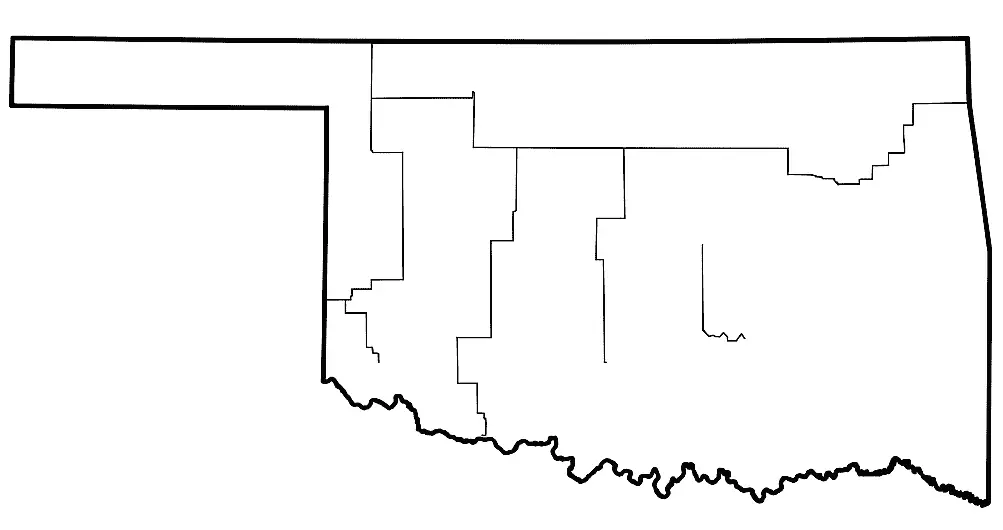
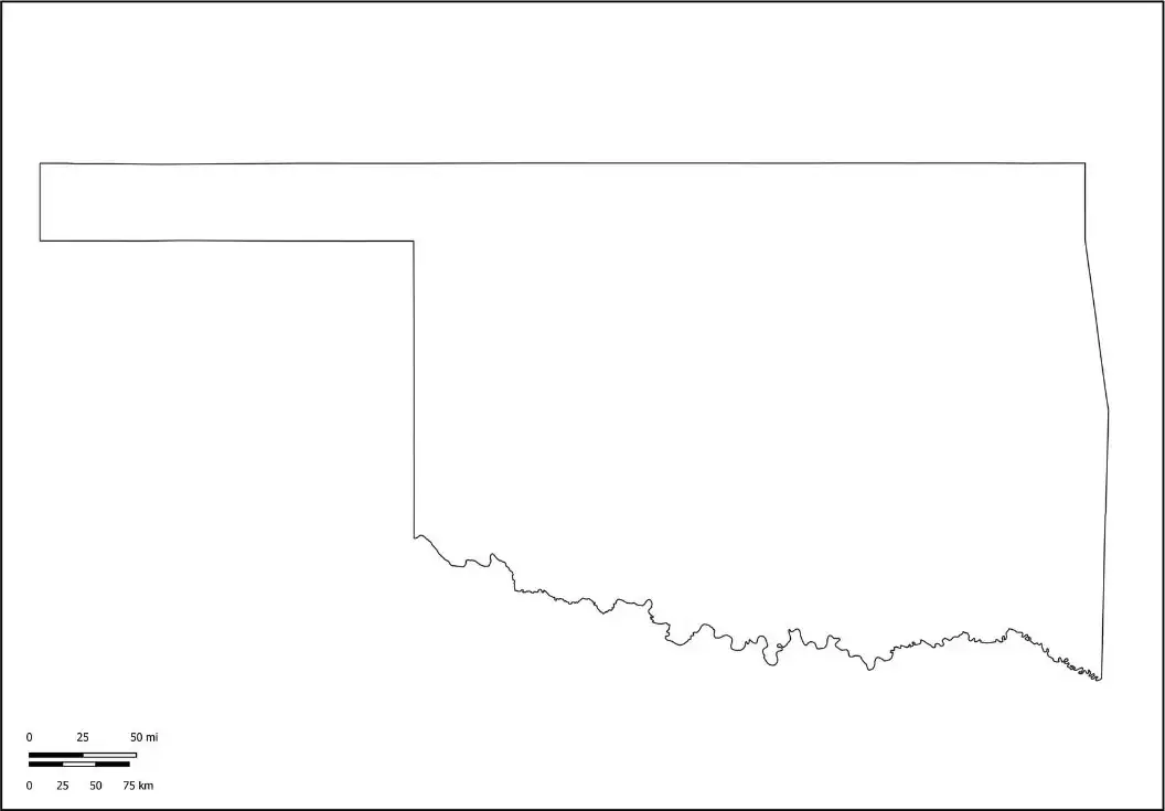
A simple outline map of Oklahoma displays the state's borders and overall shape without additional labels or markings. It is a versatile resource used for education, planning, and creative projects. In classrooms, teachers often use Oklahoma outline maps to support lessons in geography, history, and civics, allowing students to label important cities, rivers, counties, highways, and landmarks. This hands-on approach helps learners develop map-reading skills and gain a better understanding of the state's geographic layout and key features.
The outline map shows Oklahoma’s location within the United States and highlights its borders with Texas, Kansas, Missouri, Arkansas, Colorado, and New Mexico. It provides a clear view of the state's shape and geographic position, making it an excellent resource for educational activities. Whether used for coloring, tracing, labeling, or map-based exercises, an Oklahoma map outline encourages hands-on learning and helps students build a stronger understanding of the state's geography and surrounding regions.

