Johnson County Map Missouri
Johnson County is located in west-central Missouri, where small communities and expansive rural landscapes blend together. The county offers a balance of agricultural traditions and modern development.
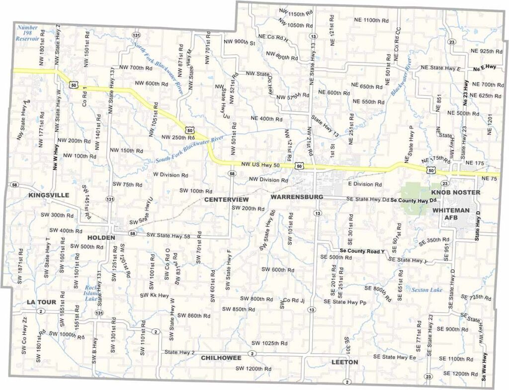
Johnson County is located in west-central Missouri, where small communities and expansive rural landscapes blend together. The county offers a balance of agricultural traditions and modern development.
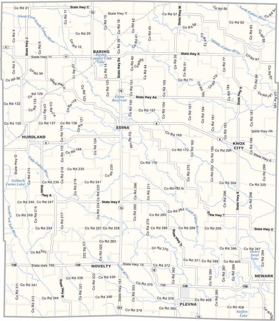
Knox County is located in northeastern Missouri and is characterized by its rural landscapes, agricultural heritage, and small-town charm. The county seat, Edina, sits near the center of the county and is well known for its attractive courthouse square.
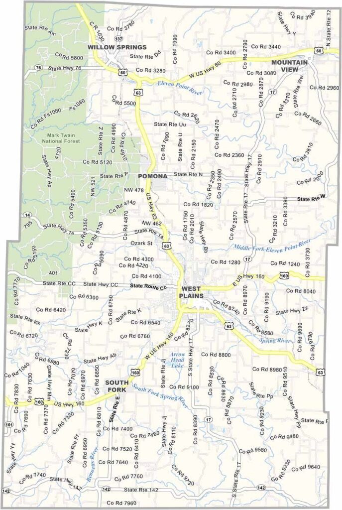
Howell County is located in the Ozarks of southern Missouri and is known for its scenic landscapes, outdoor recreation, and rural charm. The county seat, West Plains, is a historic community that serves as the county’s economic and cultural center.
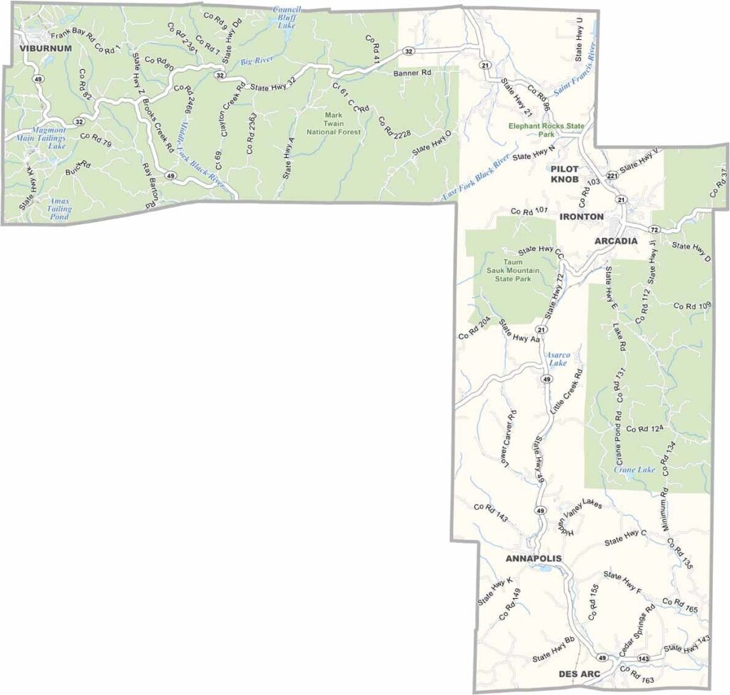
Iron County is located in the heart of Missouri’s Ozark region and is known for its rich mining history. The county takes its name from the iron ore deposits that once made it an important center for iron production.
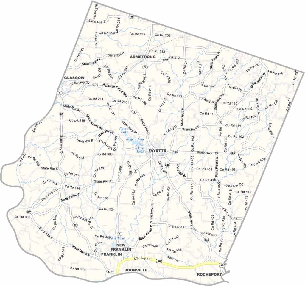
Howard County is located in central Missouri, with the Missouri River forming its southern boundary. The county is known for its rolling hills, fertile farmland, and rich agricultural heritage.
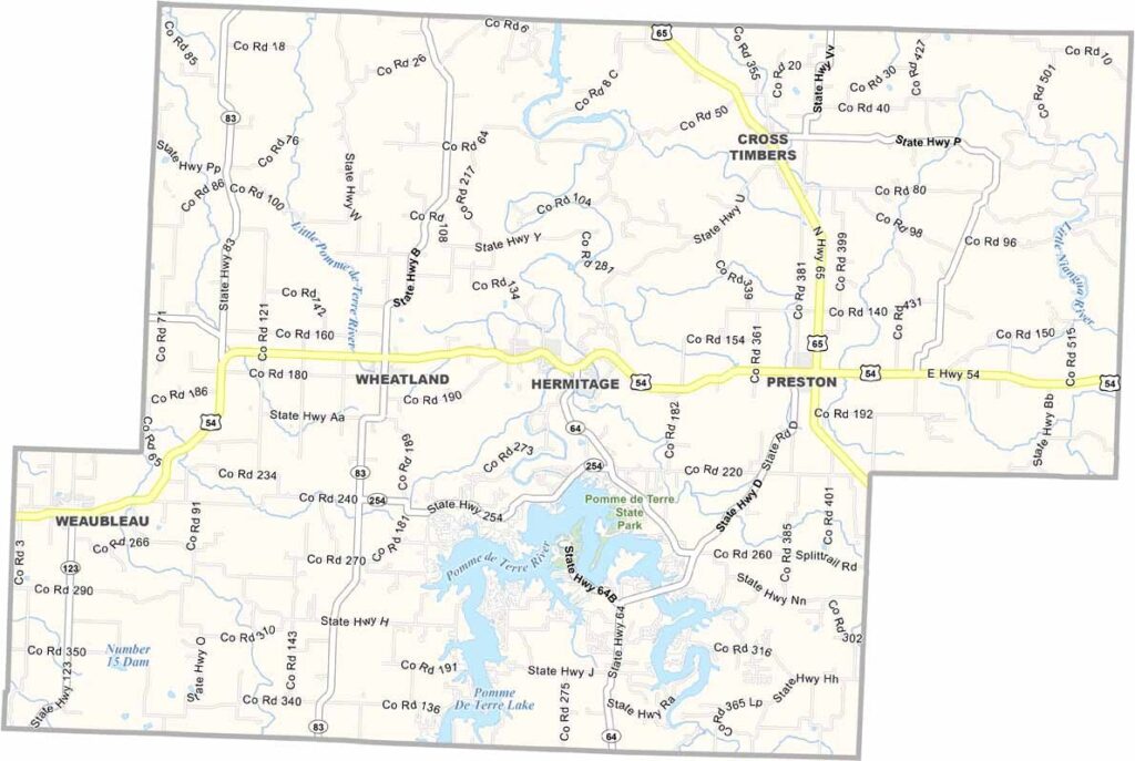
Hickory County is nestled in the heart of Missouri’s Ozark region and is known for its peaceful atmosphere, rolling hills, and heavily forested landscapes. Its quiet rural character is a major part of the county’s appeal.
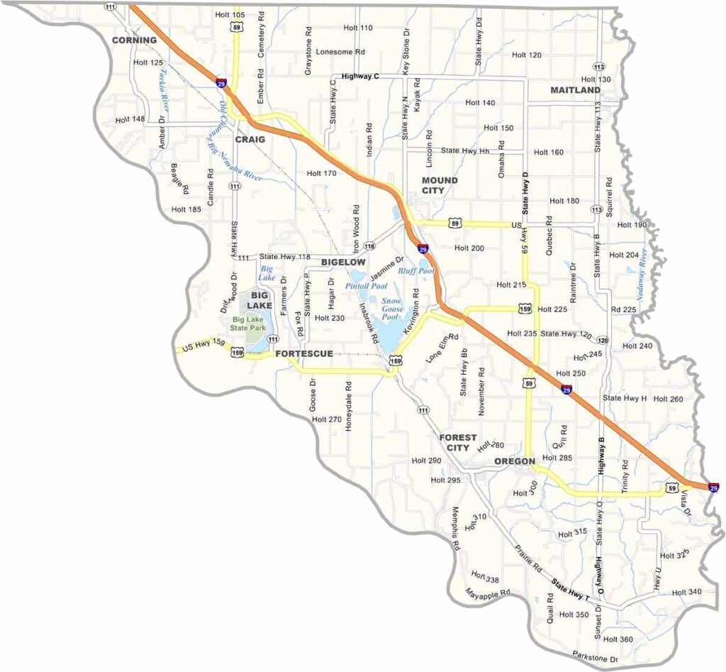
Holt County is located in the northwestern corner of Missouri along the Missouri River. Agriculture plays a central role in the local economy, with corn production being especially important. The county borders Nebraska to the west.
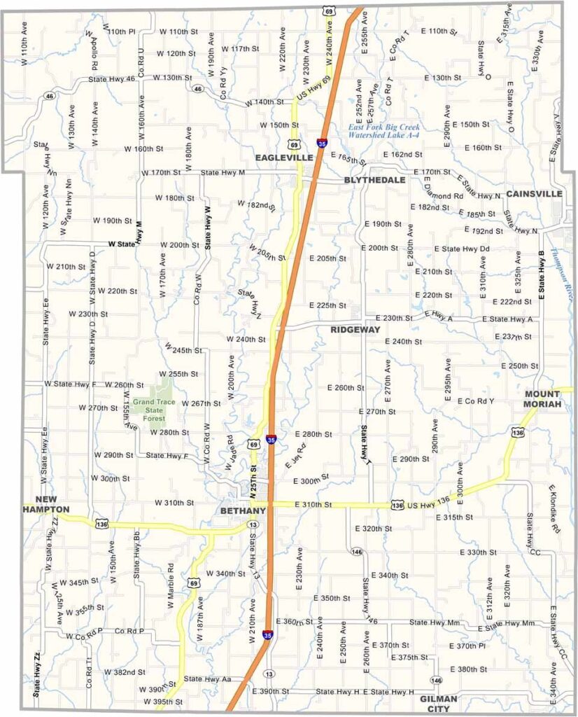
Harrison County is located in northwestern Missouri and is known for its rural character, rolling prairies, and strong agricultural traditions. The county’s largest city, Bethany, features a charming town square that reflects its small-town heritage.
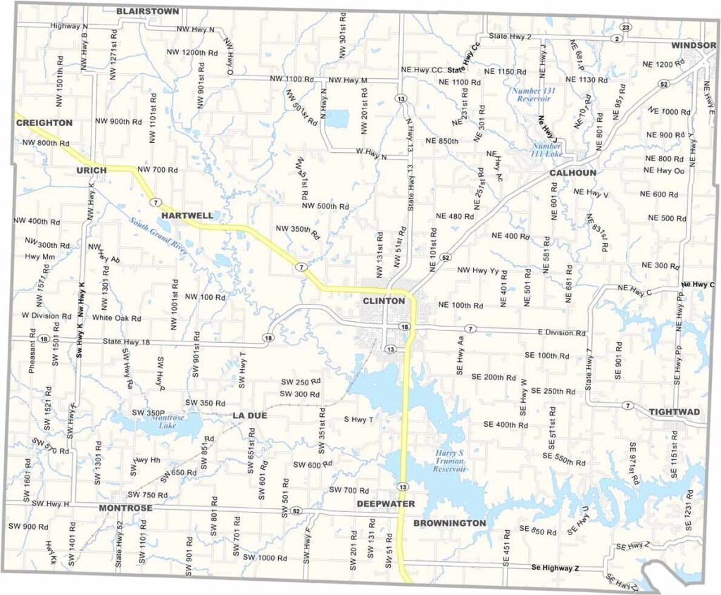
Henry County is located in western Missouri and features a blend of farmland, woodlands, and scenic countryside. A significant portion of the county’s southeastern area is occupied by the Harry S. Truman Dam and Reservoir, which includes Truman Lake, a popular destination for bass fishing and other water activities.
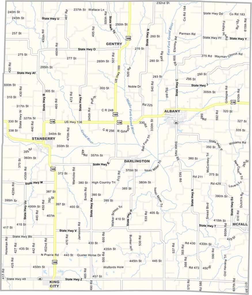
Gentry County is located in northwest Missouri, just south of the Iowa border. Agriculture is the backbone of the local economy, with cornfields, soybean farms, and cattle operations covering much of the countryside. The county is known for its hardworking residents and strong rural traditions.