
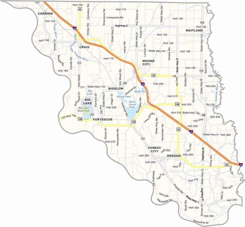
Holt County, Missouri

Holt County is located in the northwestern corner of Missouri along the Missouri River. Agriculture plays a central role in the local economy, with corn production being especially important. The county borders Nebraska to the west.

The county seat, Oregon, is a small community that serves as the center of county government. Along the western edge of the county, the distinctive Loess Hills rise above the landscape. These unique hills were formed by wind-deposited silt thousands of years ago.

Outdoor enthusiasts often visit Big Lake State Park for fishing, birdwatching, and other recreational activities. The county also features sites associated with the historic Lewis and Clark Expedition.
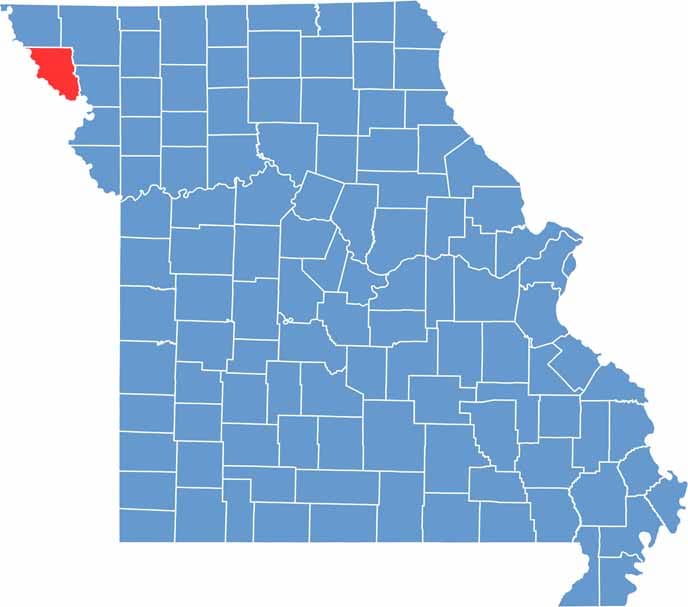

Printable Holt County Missouri location map showing county location and boundaries
Category Details
County Name Holt County
County Seat Oregon
Cities, Towns, and Communities Oregon, Mound City, Craig, Maitland, Big Lake, Corning, Forest City
Interstates and Highways I-29, US 59, MO 111
Population Approximately 4,400
FIPS Code 29-087
Total Area (Land and Water) 469 square miles (Land: 462 sq mi, Water: 7 sq mi)
Time Zone Central Time Zone (CT)
State Missouri
Coordinates 40.1328° N, 95.1287° W
Etymology Named after David Rice Holt, a state legislator
Major Landmarks Squaw Creek National Wildlife Refuge (now Loess Bluffs), Big Lake State Park
Adjacent Counties (and Direction) Atchison County (North), Nodaway County (Northeast), Andrew County (Southeast), Doniphan County, Kansas (South), Brown County, Kansas (Southwest), Richardson County, Nebraska (West), Nemaha County, Nebraska (Northwest)
Scroll to Top


