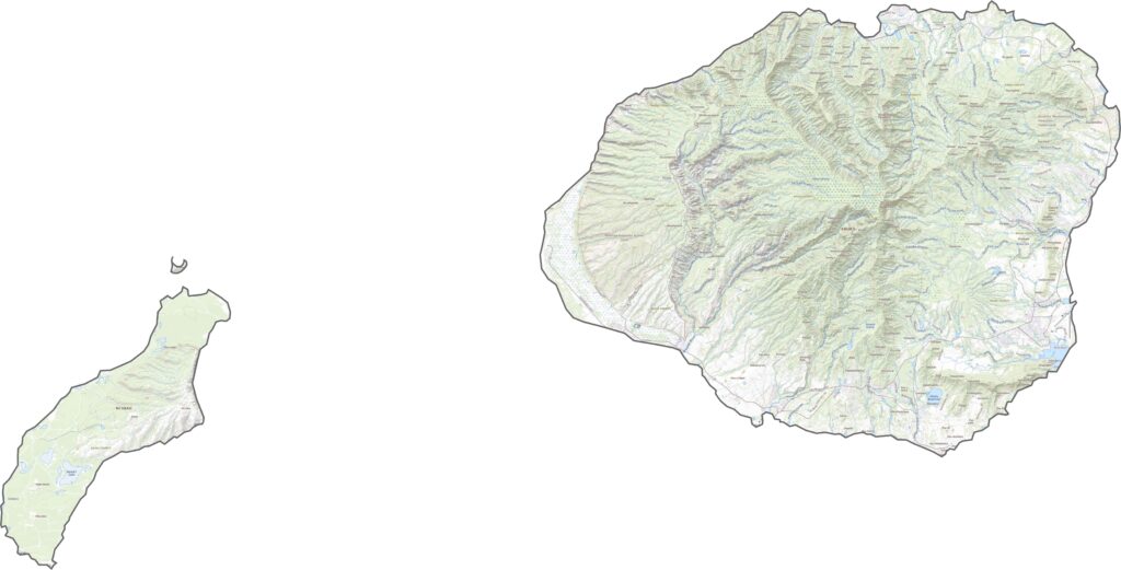
Kauai County encompasses the entire island of Kauai, often called the “Garden Isle” and known as the oldest of Hawaii’s main islands. Renowned for its breathtaking natural beauty, the island features dramatic landscapes such as the Na Pali Coast, famous for its towering sea cliffs and appearances in numerous films.
Waimea Canyon, often referred to as the “Grand Canyon of the Pacific,” stretches deep into the island and offers spectacular views. Much of Kauai is covered in lush tropical forests, nourished by abundant rainfall, particularly along the north shore. This wet climate creates countless waterfalls and keeps the island vibrant and green year-round.
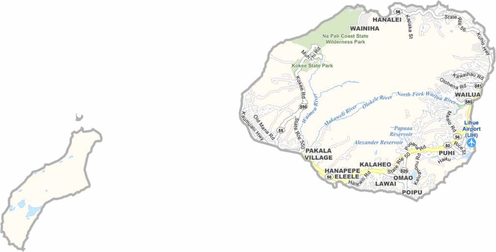
Unlike the busier islands of Oahu and Maui, Kauai maintains a relaxed and peaceful atmosphere. Building heights are limited, preserving the island’s natural charm. Free-roaming chickens are a common sight, adding to its unique character. Hanalei Bay is known for its beautiful beaches and laid-back surf-town feel, while Lihue serves as the island’s main town, home to the airport and county government offices.
Kauai’s topographic landscape is filled with dramatic natural features, including the deep valleys of Waimea Canyon and the rugged cliffs of the Nā Pali Coast. Explore Līhue, the island’s main town, using our zoom tool to discover its key landmarks and surrounding scenery. Be sure to also check out the Wailua River, Hawaii’s only navigable river, which winds through some of the island’s most beautiful tropical landscapes.
From above, Kauai appears incredibly green thanks to its dense forests and lush vegetation that cover much of the island. The vibrant landscape reflects the island’s abundant rainfall and rich natural environment. In contrast, the southern region stands out with its golden beaches, sunny coastline, and drier plains, creating a striking balance between tropical greenery and coastal beauty.
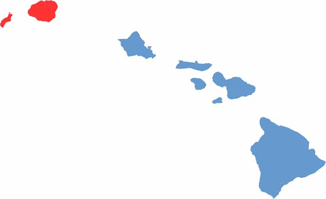
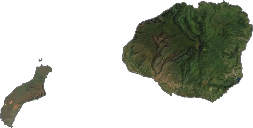
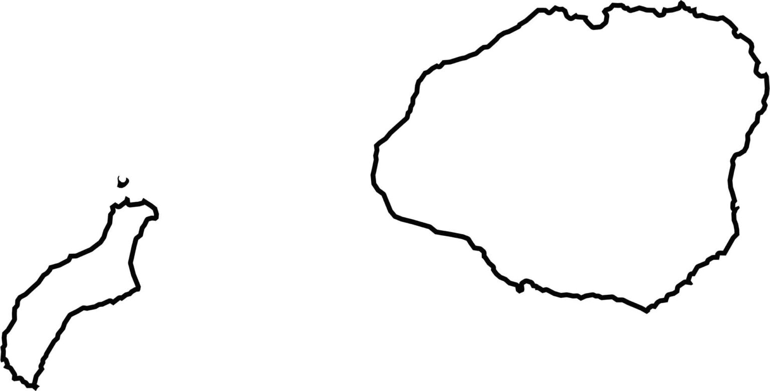
Kauai County includes two main islands: Kauai and Niʻihau. The island of Kauai has a roughly circular shape with a rugged, irregular coastline, particularly along its northern shore. To the west lies Niʻihau, a smaller and more elongated island with a distinct shape that contrasts with Kauai’s broader outline.