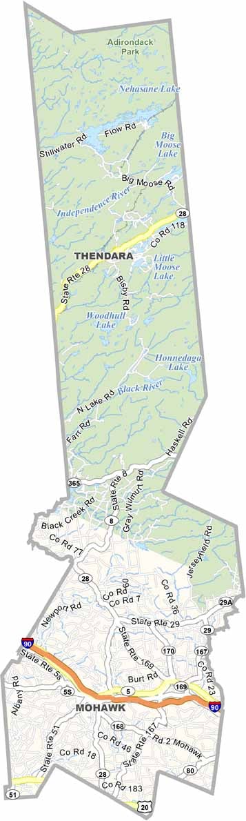
Herkimer County Map, New York

Herkimer County, New York

Herkimer County stretches from the Mohawk Valley to the heart of the Adirondacks in central New York. The county is famous for its Herkimer diamonds, which are actually quartz crystals that you can mine yourself.

Herkimer is the county seat, and you can't miss the Herkimer Home State Historic Site, once the home of Revolutionary War hero General Nicholas Herkimer. The county also has a rich dairy farming tradition.

Visitors come to the southern Adirondacks for scenic trails and views. The Erie Canal runs through the county, showcasing New York's industrial past, and outdoor lovers enjoy camping and fishing in the Fulton Chain of Lakes.
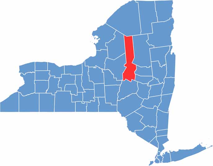

Herkimer County location map of New York
CategoryDetails
County NameHerkimer County
County SeatHerkimer
EtymologyNamed after Nicholas Herkimer, a hero in the American Revolutionary War
Cities, Towns, and CommunitiesHerkimer, Little Falls, Ilion, Frankfort, Dolgeville, Old Forge
Interstates and HighwaysInterstate 90 (New York State Thruway), U.S. Route 20, New York State Route 28, New York State Route 29
FIPS Code36-043
Total Area (Land and Water)1,458 square miles (1,411 sq mi land, 47 sq mi water)
Adjacent Counties (and Direction)St. Lawrence County (North), Hamilton County (Northeast), Fulton County (East), Montgomery County (Southeast), Otsego County (South), Oneida County (West), Lewis County (Northwest)
Time ZoneEastern Time Zone (ET)
StateNew York
Coordinates43.1276° N, 74.9928° W
Major LandmarksHerkimer Diamond Mines, Adirondack Scenic Railroad, Fort Herkimer Church
PopulationApproximately 61,000
Scroll to Top