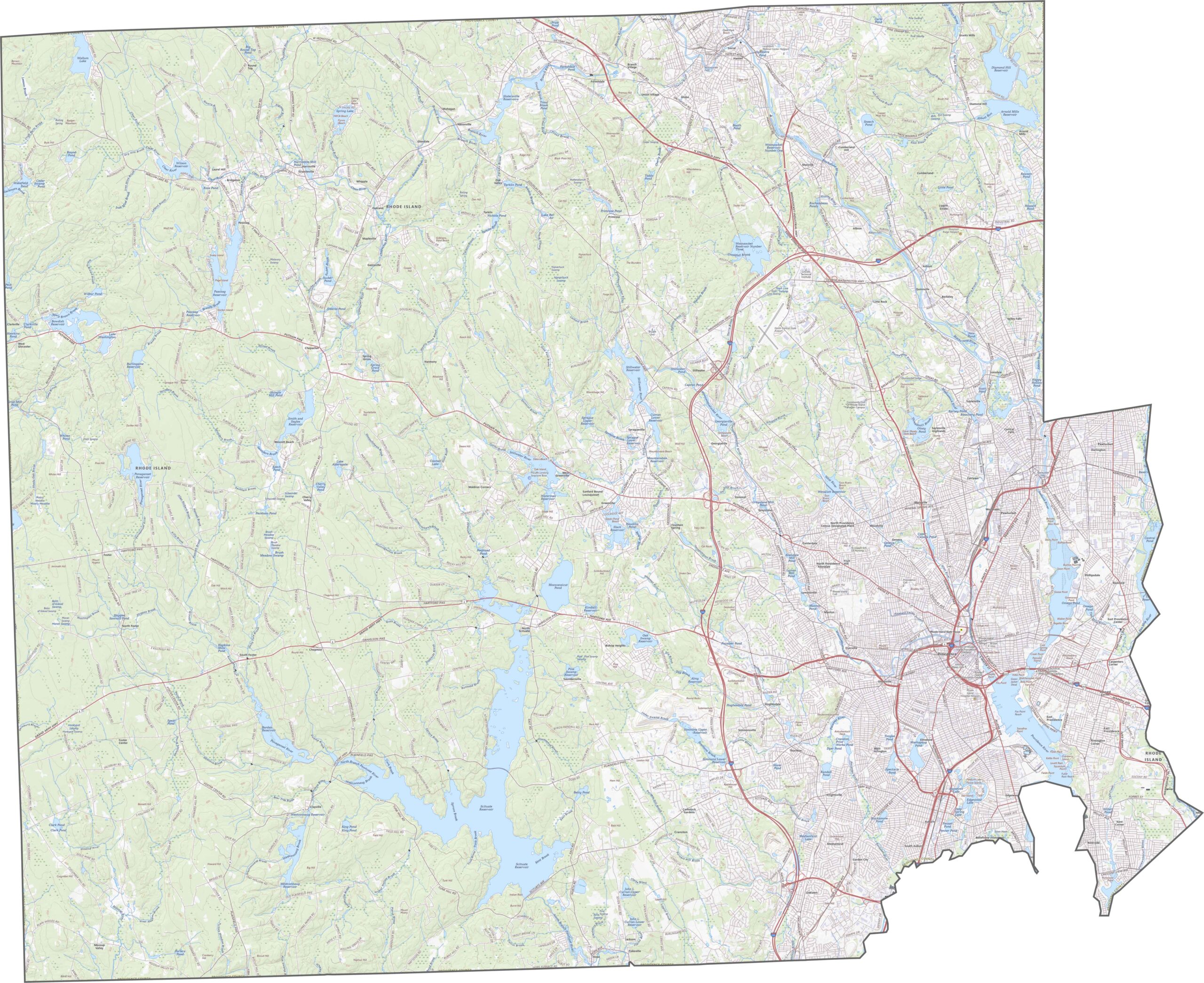
Providence County is the largest and most populous county in Rhode Island, home to more than half of the state's residents. At its center is Providence, the state capital and a major hub for education, culture, and innovation. The county is also home to renowned institutions such as Brown University and Rhode Island School of Design, which contribute to its strong academic reputation.
Stretching north to the Massachusetts border and west toward Connecticut, Providence County includes a mix of historic mill cities and growing suburban communities. Cities such as Pawtucket and Woonsocket reflect the region’s industrial heritage, while towns like Cumberland and Lincoln continue to attract residents with their suburban appeal.
Known for its diversity and resilience, Providence County encompasses urban centers, suburban neighborhoods, and pockets of rural landscape. While it faces many of the challenges common to older industrial regions, it remains the economic, cultural, and educational heart of Rhode Island, playing a vital role in the state's identity and growth.
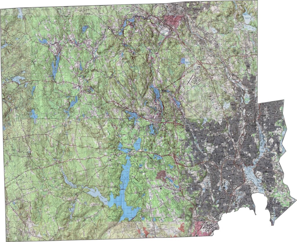
Our Providence County topographic map reveals a landscape that is far more varied than many people expect from southern New England. Rolling hills across the northern portion of the county add noticeable relief to the terrain, while elevations gradually increase farther inland from the coast. Throughout the region, a network of valleys, ridges, and gentle uplands creates subtle but distinctive changes in elevation that shape the county’s natural landscape.
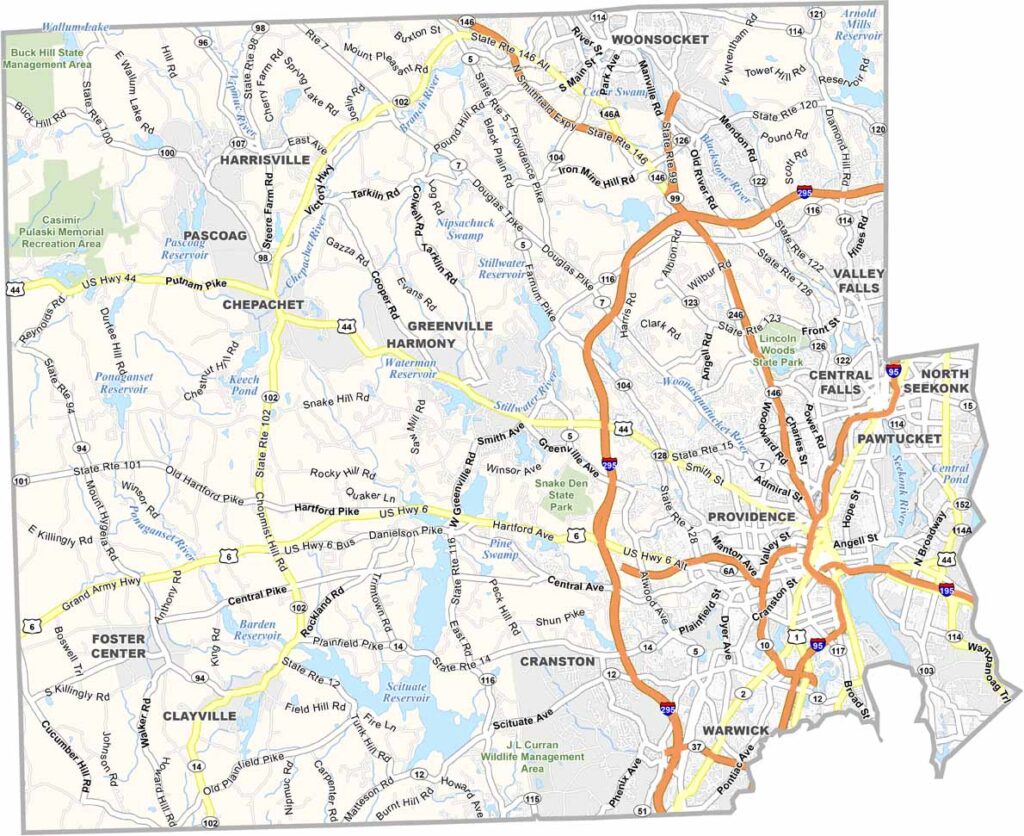
Our Providence County road map highlights Rhode Island’s busiest transportation network, featuring major routes such as Interstate 95, Interstate 195, and Interstate 295. These highways connect the county’s cities, suburbs, and surrounding communities, forming the backbone of regional travel and commerce. Use our zoom tool to explore the road network in greater detail and follow every route across the county.
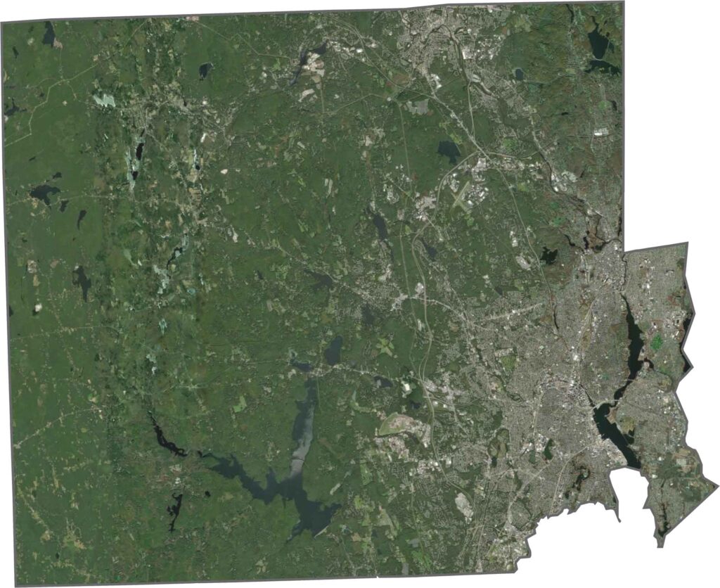
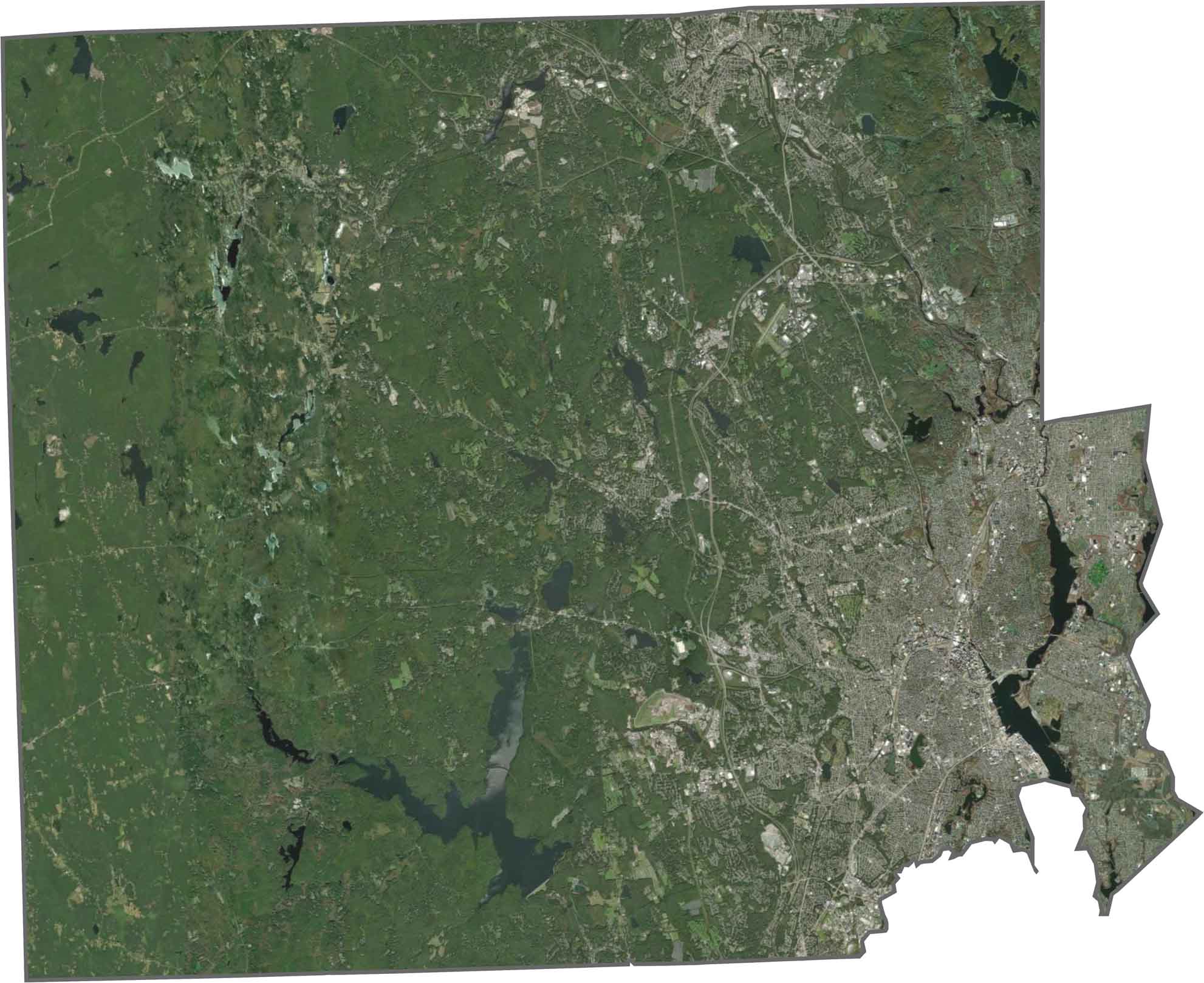
Cities pop out immediately, especially Providence itself, which dominates the eastern side. But west and north? That’s where you’ll find woods, farmland, and lakes. The contrast from city to countryside is sharp and easy to spot.
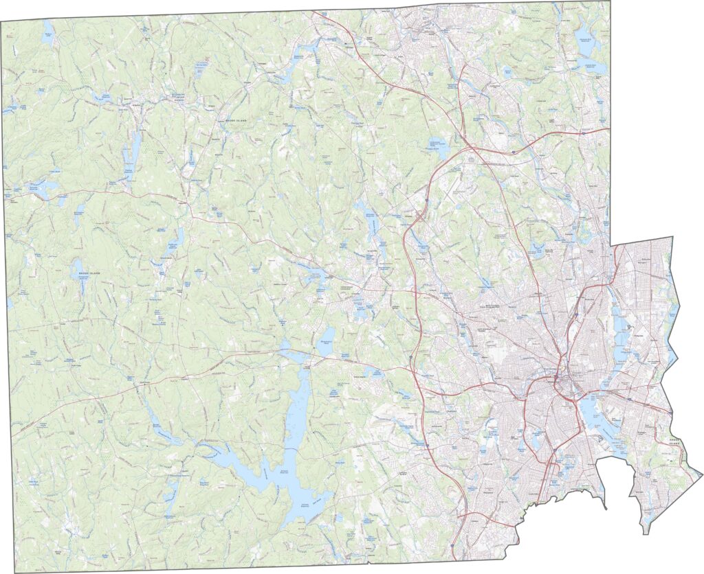
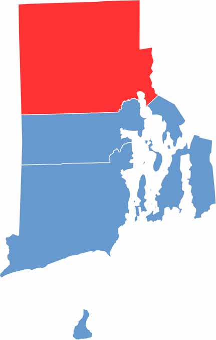
Providence County has a broad, roughly rectangular outline that makes it easy to identify on a map. Its eastern edge is shaped by the waters of Narragansett Bay, giving the county a more irregular coastline. To the north, it shares an extensive border with Massachusetts, while Connecticut lies directly to the west, helping define the county’s overall shape and location within southern New England.


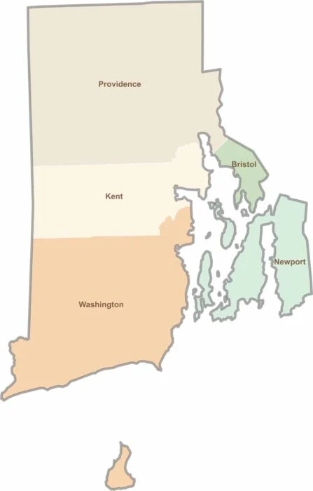
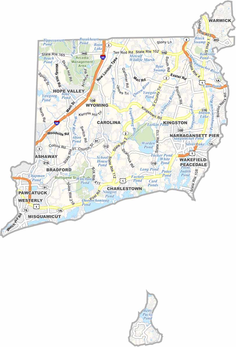
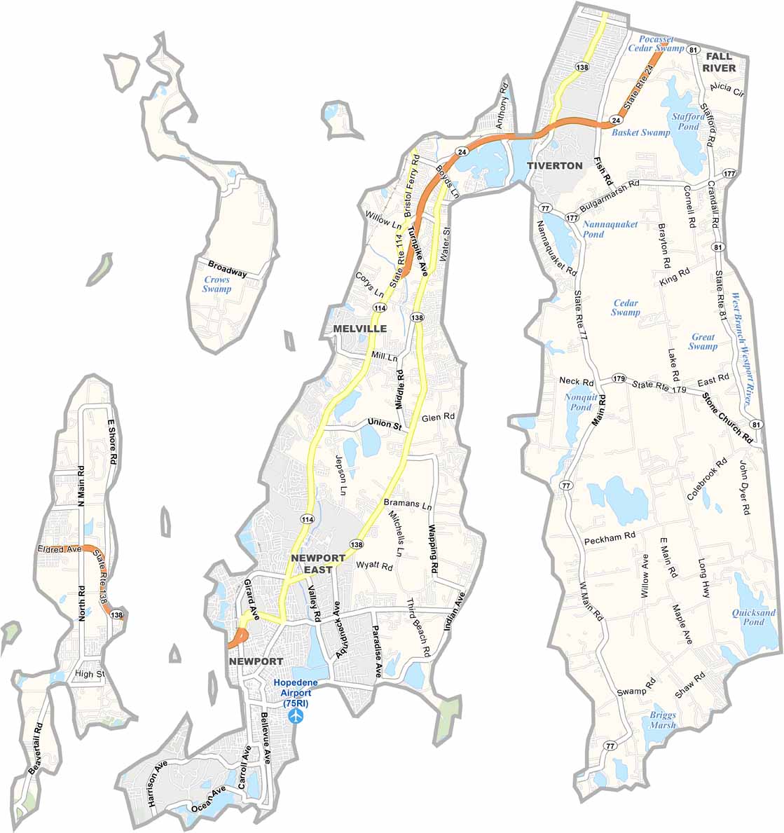
Rhode Island may have only five counties, but each offers its own distinct character. From scenic coastal communities and vibrant college districts to historic towns and peaceful wooded landscapes, the state packs a remarkable variety of places into a small area. Explore them all with our Rhode Island county map collection and discover the unique features that make each county stand out.