Boone County Map Download Missouri – Outline Map and Blank Map
Download Download PDF Stone County, Missouri Located in the heart of the Ozark Mountains in southwestern Missouri, Stone County is […]
Download Download PDF Stone County, Missouri Located in the heart of the Ozark Mountains in southwestern Missouri, Stone County is […]
Download Download PDF Stone County, Missouri Located in the heart of the Ozark Mountains in southwestern Missouri, Stone County is

Download Download PDF Wright County, Missouri Wright County lies in south-central Missouri, with Hartville serving as the county seat near
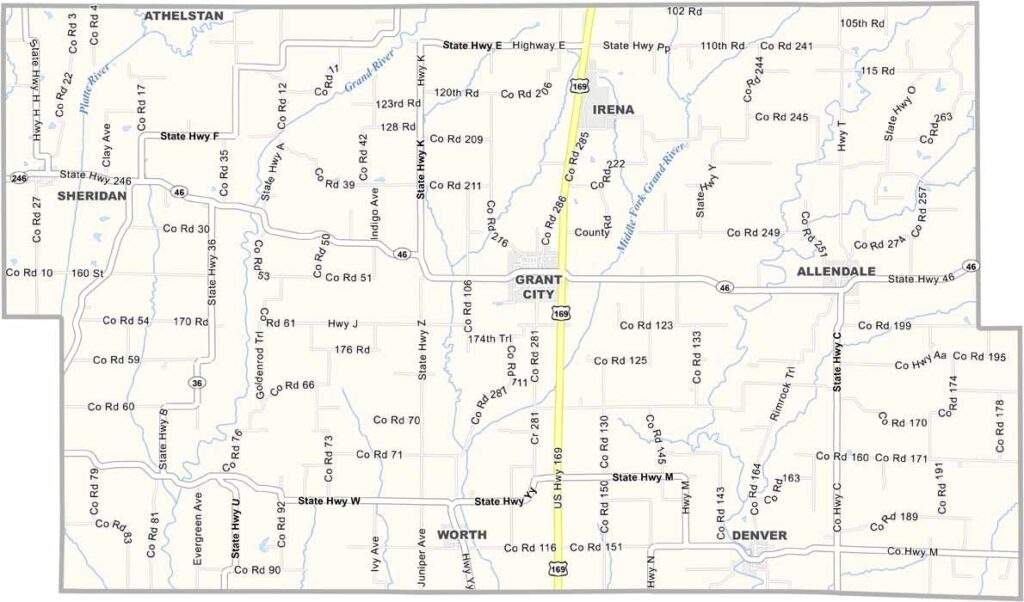
Worth County sits in the far northwestern corner of Missouri, bordering Iowa. Though it’s one of the state’s smaller counties, it offers plenty of rural charm. Grant City serves as the county seat and the community hub.
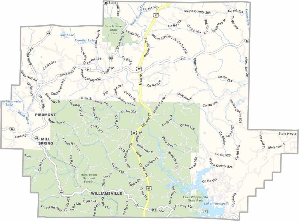
Wayne County is located in southeastern Missouri and is known for its diverse landscape. From rolling hills and fertile farmland to winding rivers and scenic waterways, the county offers a variety of natural attractions.
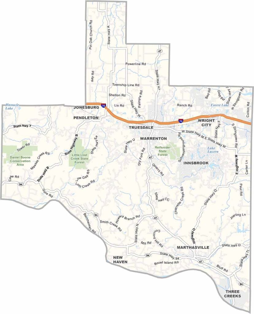
Warren County is located just west of St. Louis, where the urban landscape gradually transitions into rolling hills and picturesque countryside. The Missouri River forms the county’s southern boundary, adding scenic beauty and recreational opportunities to the area.
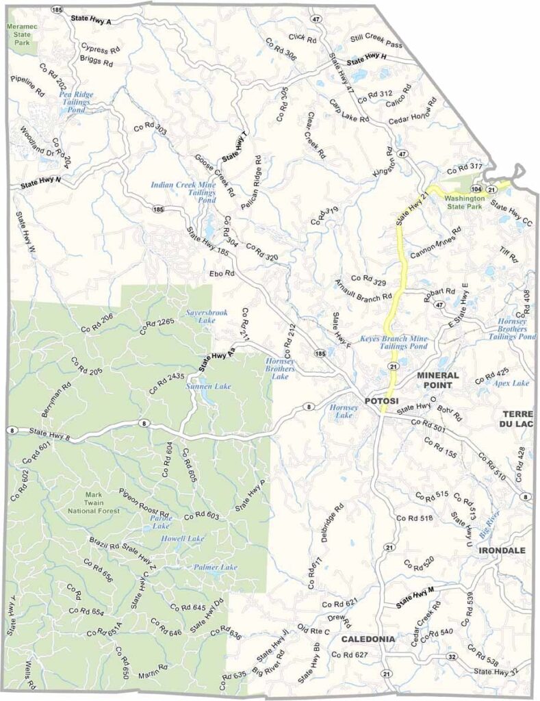
Washington County, located in the eastern region of Missouri, is a picturesque destination known for its rolling hills, sparkling streams, and lush forests that appeal to outdoor enthusiasts and nature lovers alike.
Despite its name, Texas County isn’t located in the Lone Star State—it’s right in the heart of southern Missouri. As the largest county in Missouri by land area, it offers a landscape of rolling Ozark hills, expansive forests, and scenic rivers that showcase the region’s natural beauty.
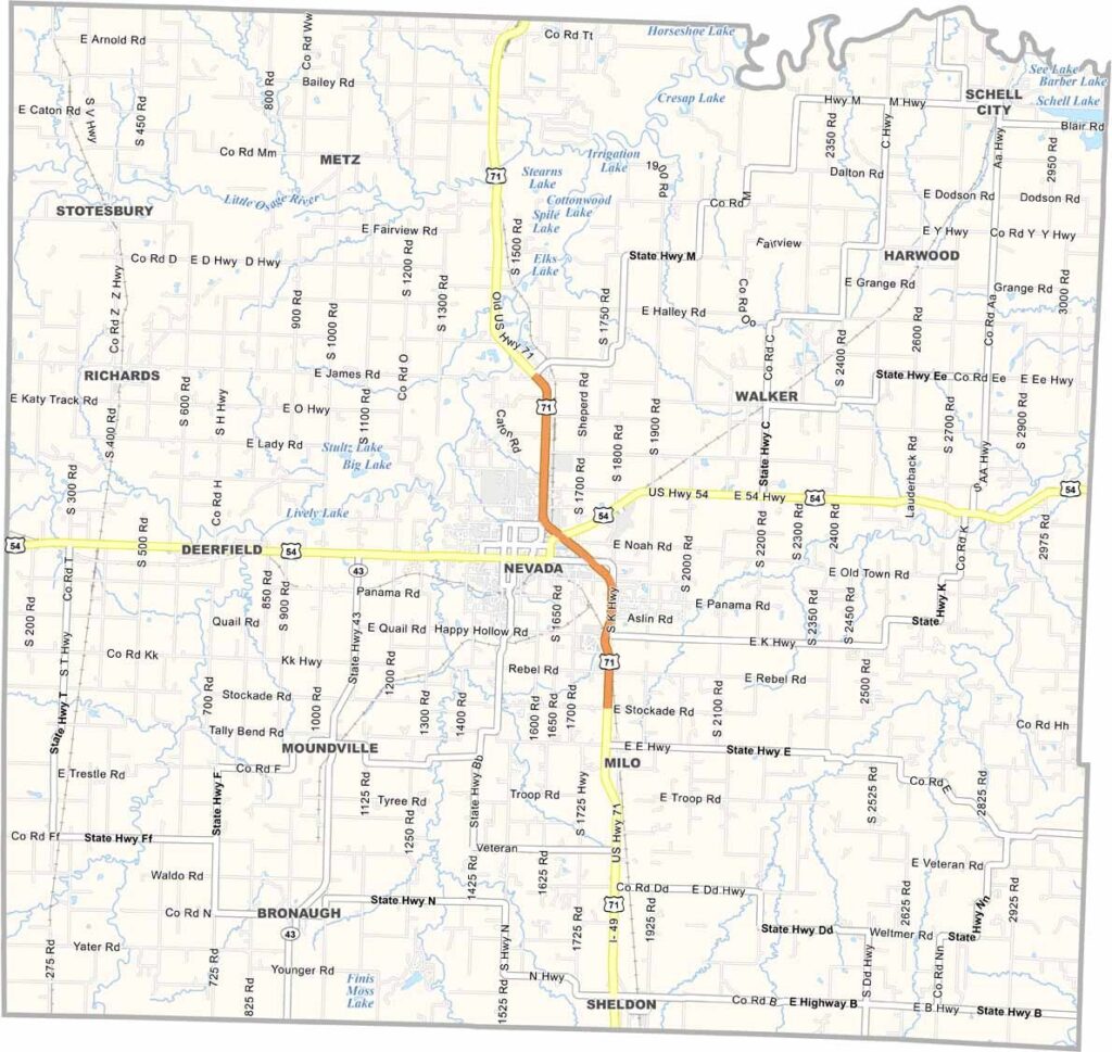
Located in western Missouri, Vernon County captures the charm of small-town America, where the open prairies of Kansas transition into the rolling landscapes of the Show-Me State. Its scenic countryside and rich history make it a fascinating destination for visitors and residents alike.
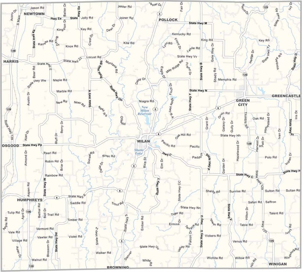
Sullivan County sits in northern Missouri, where green pastures and grazing cattle define the landscape. It’s classic farm country through and through.