Taney County Map Missouri
Download Download PDF Taney County, Missouri Taney County is a highlight of southern Missouri’s Ozarks, combining stunning natural scenery with […]
Download Download PDF Taney County, Missouri Taney County is a highlight of southern Missouri’s Ozarks, combining stunning natural scenery with […]
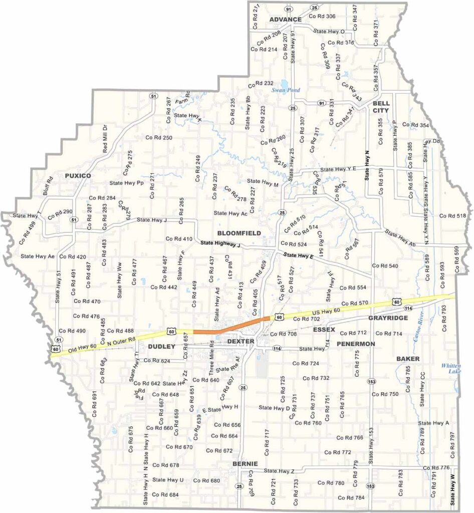
Located in Missouri’s Bootheel region, Stoddard County is a vibrant area known for its agricultural roots, natural beauty, and historical attractions. While Dexter is the county’s largest city and serves as a major commercial hub, Bloomfield holds the distinction of being the county seat.
Located in the heart of the Ozark Mountains in southwestern Missouri, Stone County is a scenic destination known for its natural beauty and outdoor recreation. Bordering Arkansas, the county offers breathtaking landscapes that attract visitors seeking relaxation and adventure alike.
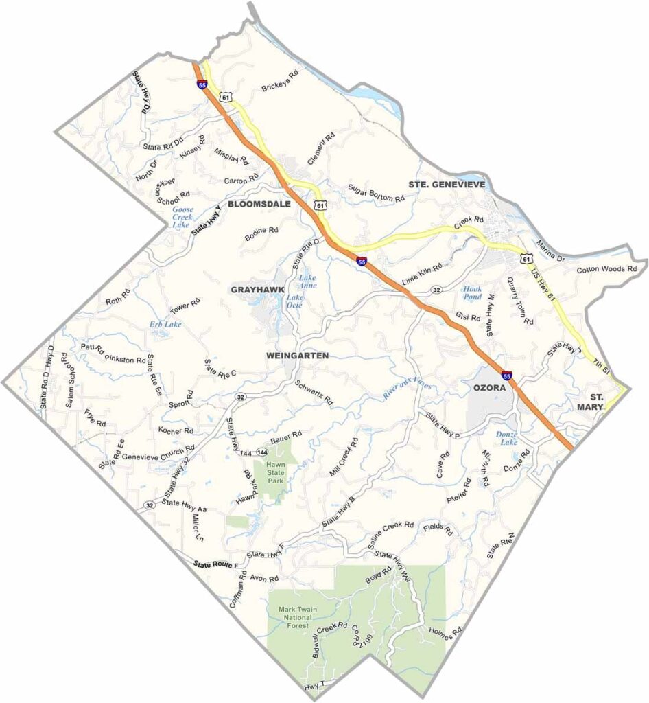
Located along the Mississippi River in eastern Missouri, Ste. Genevieve County is a destination rich in history, culture, and natural beauty. The county is especially known for its well-preserved French colonial heritage, with historic architecture that reflects its early European roots.
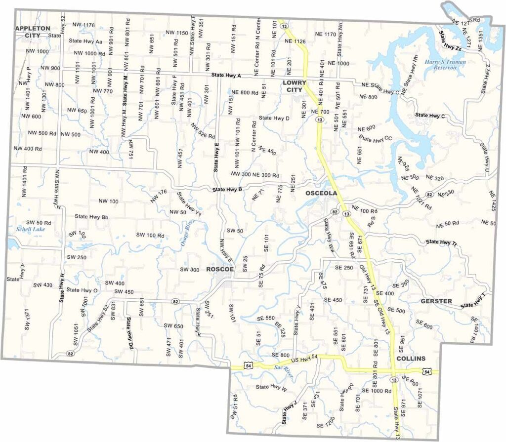
Located in west-central Missouri, St. Clair County offers a peaceful rural setting between Kansas City and the Lake of the Ozarks, making it an appealing destination for travelers seeking relaxation and small-town charm.
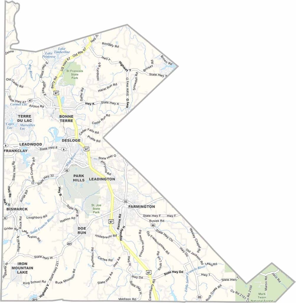
Located in southeastern Missouri, St. Francois County sits in the heart of the historic Lead Belt region, approximately an hour south of St. Louis. The county combines a rich industrial heritage with scenic landscapes and abundant outdoor recreation opportunities.
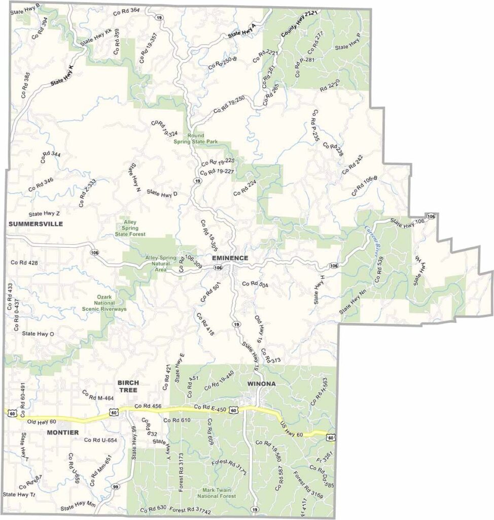
Nestled in the heart of the Ozarks, Shannon County is renowned for its breathtaking natural beauty and abundant outdoor recreation opportunities. The county is home to some of Missouri’s most scenic landscapes, including the pristine Current and Jacks Fork rivers, which attract visitors from across the region.
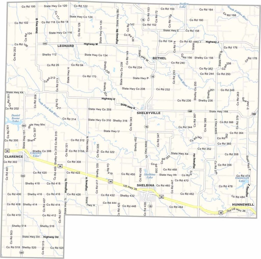
Located in northeastern Missouri, Shelby County is characterized by its rolling hills, expansive farmland, and welcoming rural communities. Agriculture plays a vital role in the local economy and continues to shape the county’s identity and way of life.
Scotland County is a rural community known for its agricultural heritage, scenic countryside, and strong small-town values. Despite its name, the county reflects the character of the American Midwest, with rolling farmland and close-knit communities defining the landscape.
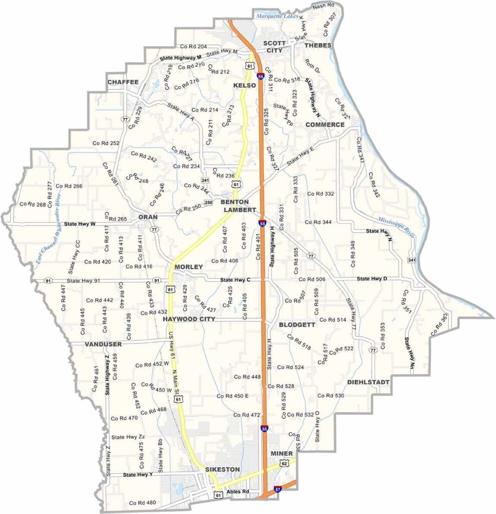
Located in Missouri’s southeastern Bootheel region, Scott County is shaped by the mighty Mississippi River, which forms its eastern border with Illinois. The river has played a significant role in the county’s development, influencing its economy, culture, and landscape for generations.