Dearborn County, Indiana

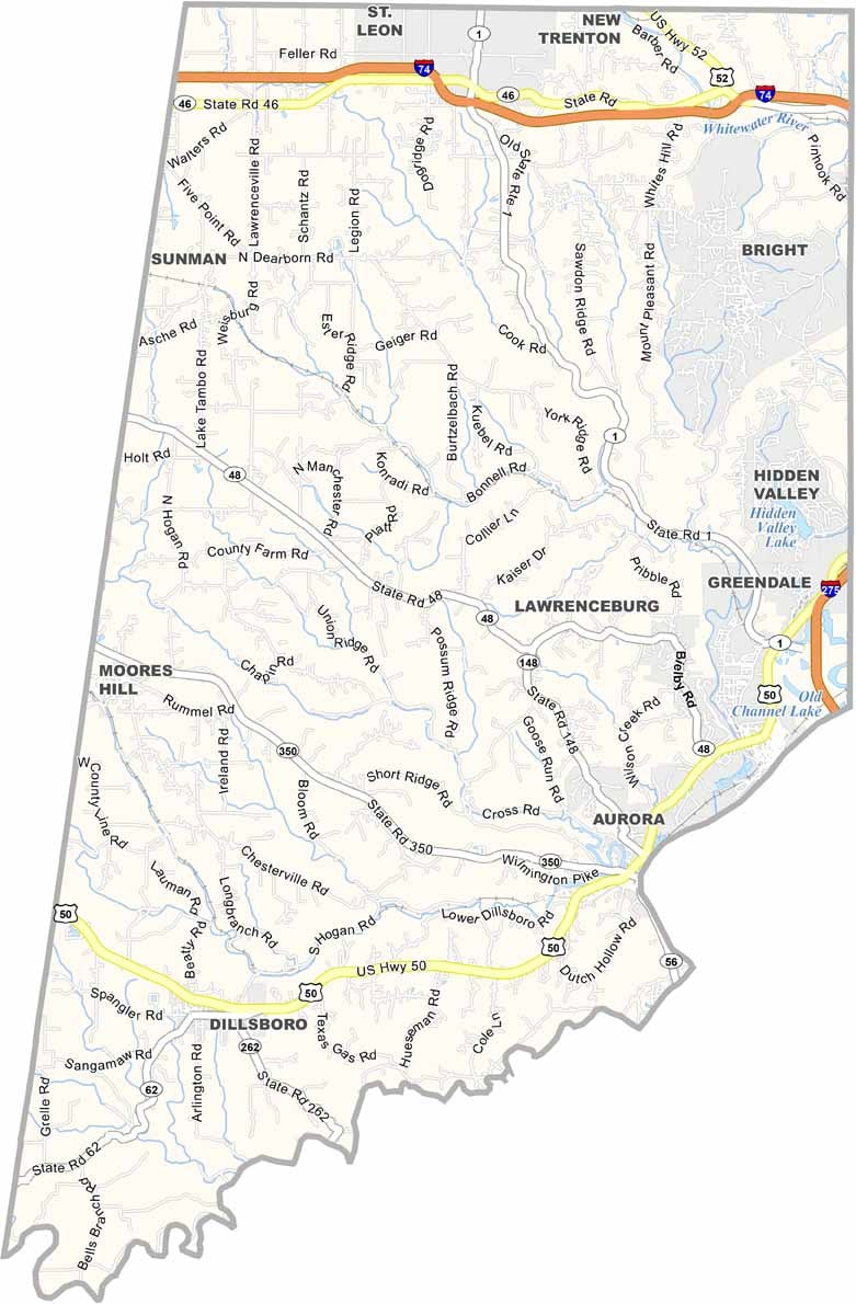
Dearborn County hugs the Ohio River in southeastern Indiana along the Ohio border. Its location provides easy access to Cincinnati for day trips while allowing the county to maintain its own small-town identity and character.

Lawrenceburg, the county seat, has a history connected to whiskey distilleries and is now known for its popular casino. Nearby Aurora is another historic river community, featuring impressive historic architecture and scenic views along the Ohio River.

The Ohio River Valley helps give Dearborn County milder winters compared with northern Indiana. During snowy months, Perfect North Slopes attracts visitors for skiing and other winter activities. The county’s location and history have created a distinctive blend of Midwestern and Appalachian culture.


Printable Stone County Missouri location map showing county location and boundaries
CategoryDetails
County NameDearborn County
County SeatLawrenceburg
EtymologyNamed after Henry Dearborn, U.S. Secretary of War
Cities, Towns, and CommunitiesLawrenceburg, Aurora, Greendale, Dillsboro, Moores Hill, St. Leon, Bright, West Harrison
Interstates and HighwaysI-74, US-50, US-52, IN-1, IN-46, IN-48, IN-56
FIPS Code18-029
Total Area (Land and Water)307 square miles (Land: 305 sq mi, Water: 2 sq mi)
Adjacent Counties (and Direction)Franklin County (North), Butler County, Ohio (Northeast), Hamilton County, Ohio (East), Boone County, Kentucky (Southeast), Ohio County (South), Ripley County (West)
Time ZoneEastern Time Zone (ET)
StateIndiana
Coordinates39.1295° N, 84.9299° W
Major LandmarksPerfect North Slopes, Hillforest Mansion, Lawrenceburg Speedway, Dearborn County Historical Society
Population50,000 (estimated)
Scroll to Top