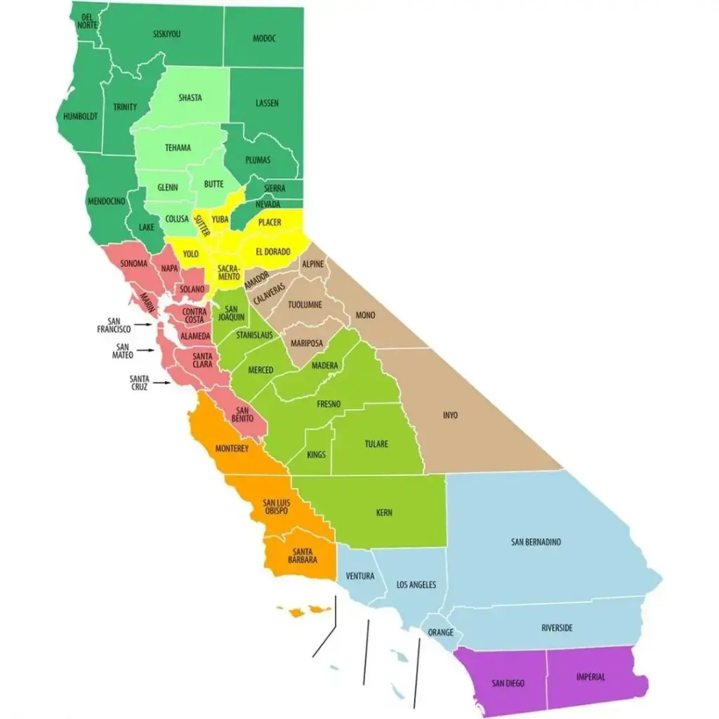
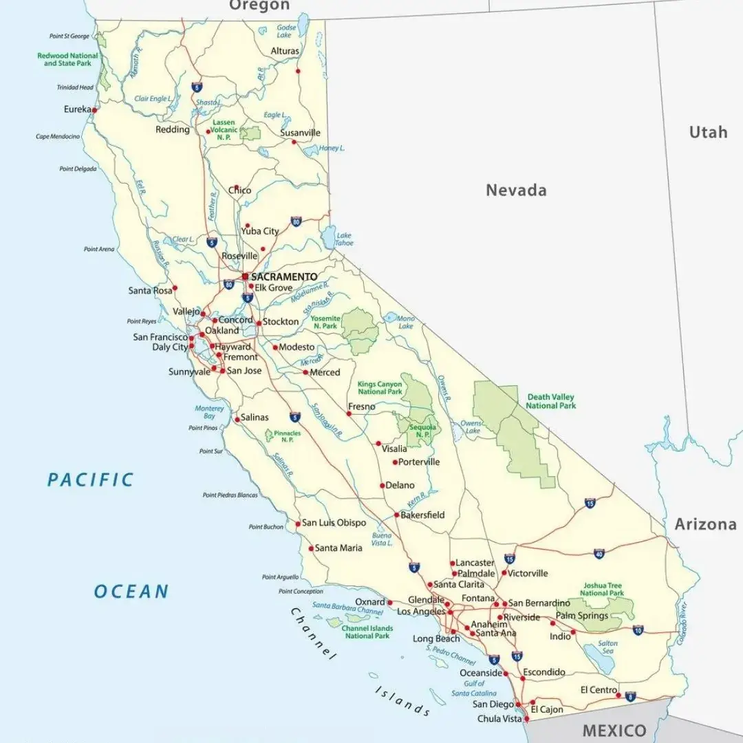
A Labeled California County Map provides a detailed view of the Golden State’s geography, including its counties, major cities, highways, national parks, and important geographic features. This type of map is a valuable resource for students, teachers, travelers, and researchers who need a clear understanding of California’s layout and infrastructure. It highlights key locations across the state, from the Pacific coastline to the Sierra Nevada mountain range, making it easy to identify different regions and counties. Major cities such as Los Angeles, San Francisco, San Diego, and Sacramento are clearly marked, helping users explore and understand California’s diverse landscapes and population centers.

Beyond major cities, a labeled California map often highlights important natural features such as rivers, mountain ranges, deserts, and renowned wine-producing valleys, offering a comprehensive view of the state's diverse landscape. These maps may also display political boundaries, county divisions, major highways, interstate routes, and rail networks, making them valuable for understanding California’s transportation infrastructure. Whether used in classrooms, for travel planning, or to enhance geographic knowledge, a labeled California map serves as an informative and practical resource. Its clear labels and organized layout make it easy to explore the state's unique blend of natural beauty, urban development, and regional diversity. Overall, it is a versatile tool suitable for educational, professional, and personal use.
California is a state located on the West Coast of the United States and is the most populous state in the country. Known for its diverse geography, California features stunning beaches, vast deserts, lush forests, and towering mountain ranges. The state is also home to some of the nation's most influential cities, including Los Angeles, San Francisco, and San Diego, which are recognized for their contributions to entertainment, technology, culture, and innovation. This unique combination of natural beauty and urban development makes California one of the most dynamic and visited states in the United States.

California is a global leader in technology, agriculture, and entertainment, serving as the home of Silicon Valley and Hollywood. The state’s world-renowned national parks, including Yosemite National Park and Sequoia National Park, attract millions of visitors each year. With its rich history, cultural diversity, and breathtaking natural landscapes, California offers a unique blend of innovation, tradition, and scenic beauty. As one of the most influential states in the nation, it continues to evolve while playing a vital role in the economic, cultural, and environmental development of the United States.
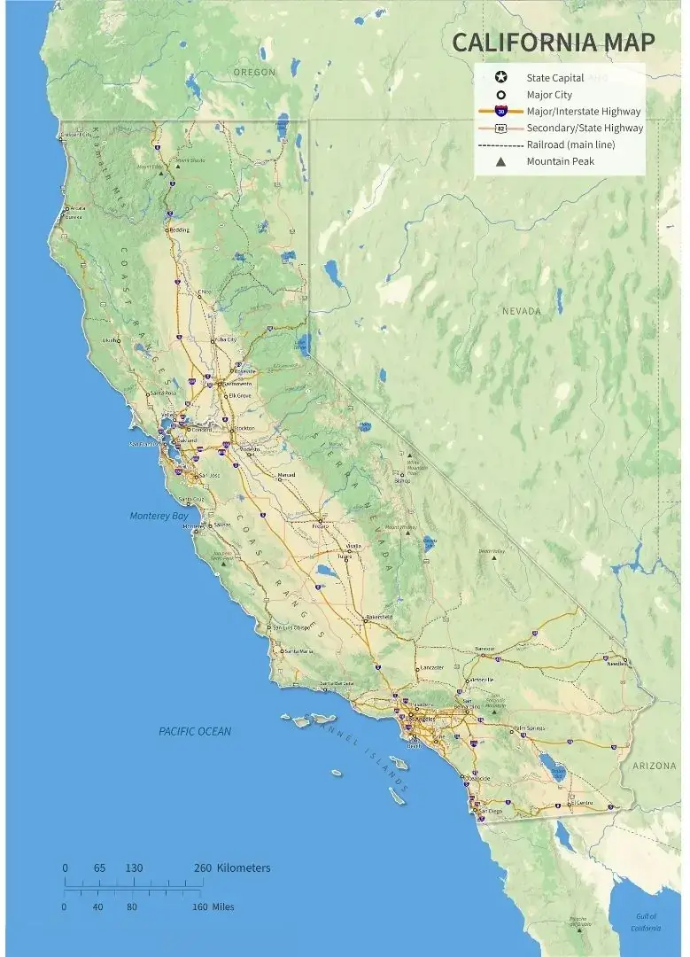
A Labeled California Map with Cities provides a detailed view of the state by clearly marking the locations of major and minor cities. From Los Angeles and San Francisco to Sacramento, San Diego, Fresno, and many smaller communities, this map helps users easily identify where each city is situated within California.
This type of map is an excellent resource for education, travel planning, and general geographic reference. In addition to city names and locations, it often includes major highways, county boundaries, and important natural landmarks. By showing how cities are distributed across California’s diverse landscapes, a labeled city map helps users better understand the state's geography, transportation networks, and regional development. Whether used in the classroom or for personal exploration, it serves as a practical and informative guide to California’s urban and geographic features.
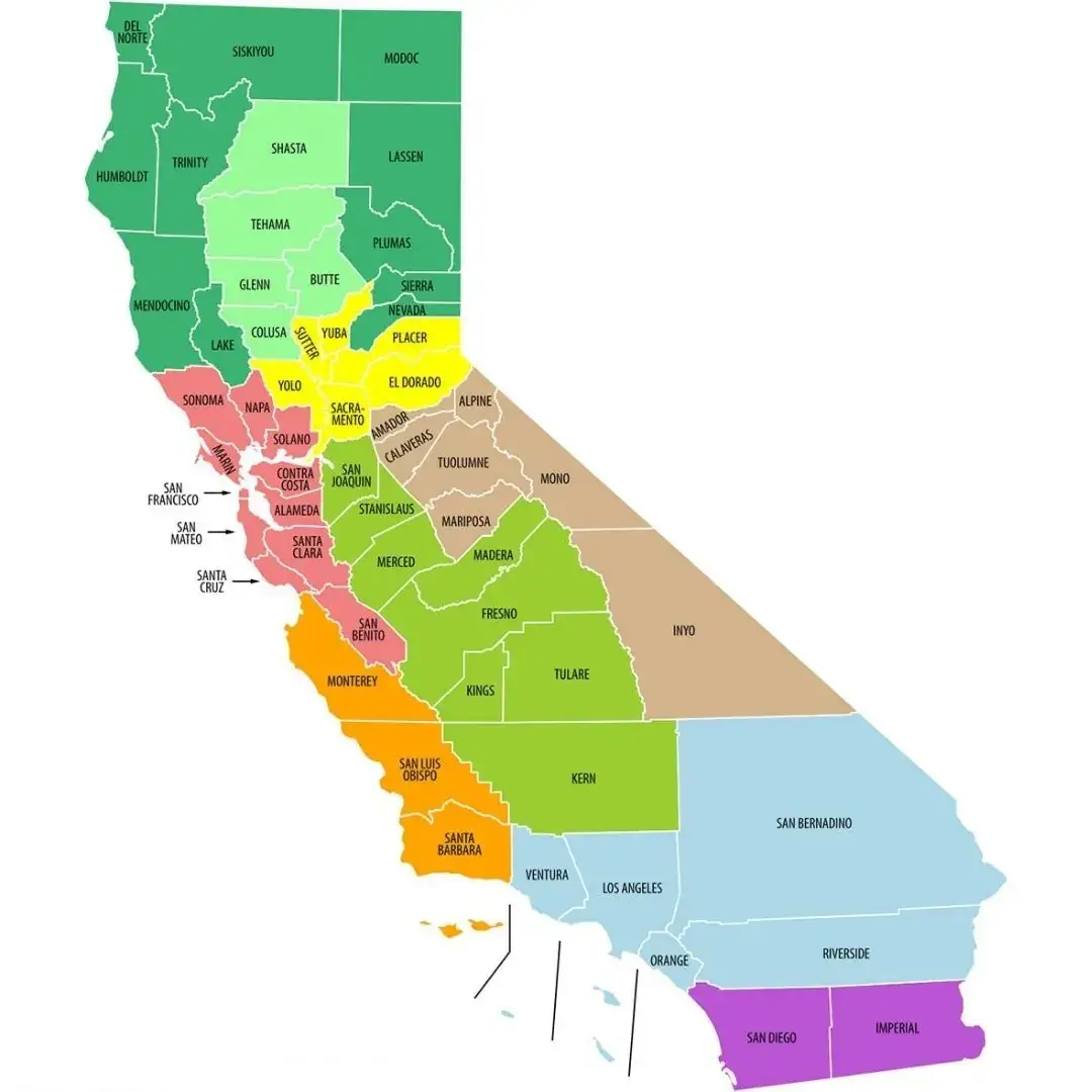
The Labeled California Map Outline offers a clear and easy-to-understand representation of the state's boundaries, major geographic features, and key locations. This type of map typically includes labels for important cities, rivers, mountain ranges, and state borders, helping users gain a better understanding of California’s geography. It may also identify neighboring states such as Oregon to the north, Nevada to the east, and Arizona to the southeast. With its simple yet informative design, a labeled California outline map is a valuable resource for education, research, travel planning, and geographic reference.
California outline maps are often labeled with major cities and important geographic features, making them an excellent resource for students, teachers, travelers, and anyone interested in understanding the state's layout. These maps provide a clear overview of California’s geography without overwhelming users with excessive detail. They highlight the state's vast size, coastal regions, major geographic divisions, and county boundaries while maintaining a simple and easy-to-read design. As a result, labeled California outline maps are widely used for educational activities, travel planning, research, and general geographic reference.