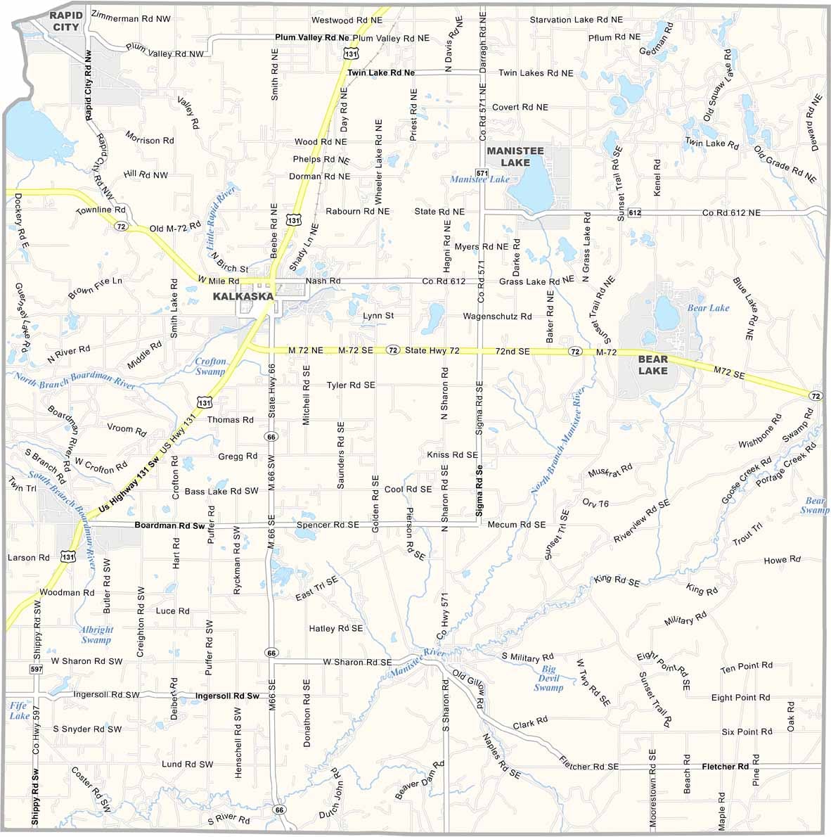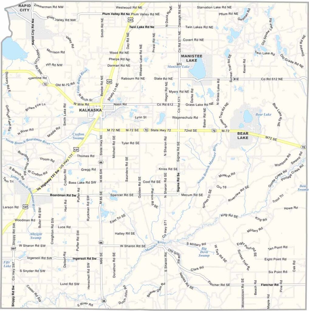
Kalkaska County Map, Michigan

Kalkaska County, Michigan

Kalkaska County is located in the northern Lower Peninsula of Michigan, about 30 miles east of Traverse City. Surrounded by lush forests, rivers, and pristine waterways, the county offers a scenic setting for outdoor recreation throughout the year.

The county is known for its extensive forests and wilderness areas, where visitors can enjoy hiking, camping, and other outdoor activities. Fishing is another major attraction, with the Boardman River and Manistee River offering excellent opportunities for trout fishing and other angling adventures.

Kalkaska, the county seat, hosts the annual National Trout Festival each April, a popular local celebration centered around the area’s fishing heritage. Logging and agriculture also remain important parts of the local economy, reflecting the county’s strong connection to its natural resources and rural landscape.
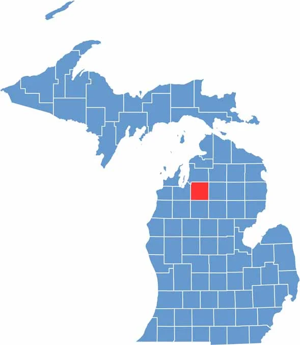

Kalkaska County location map of Michigan
CategoryDetails
County NameKalkaska County
County SeatKalkaska
EtymologyBelieved to be derived from a Native American word, though the exact meaning is uncertain
Cities, Towns, and CommunitiesKalkaska, Rapid City, South Boardman, Fife Lake, Bear Lake
Interstates and HighwaysUS 131, M-66, M-72
FIPS Code26-079
Total Area (Land and Water)571 square miles (Land: 560 sq mi, Water: 11 sq mi)
Adjacent Counties (and Direction)Antrim County (North), Otsego County (Northeast), Crawford County (East), Roscommon County (Southeast), Missaukee County (South), Wexford County (Southwest), Grand Traverse County (West)
Time ZoneEastern Time Zone (ET)
StateMichigan
Coordinates44.6971° N, 85.0901° W
Major LandmarksTorch Lake, Manistee River, Kalkaska County Sand Dunes, Rapid River
PopulationApproximately 18,000
Scroll to Top