
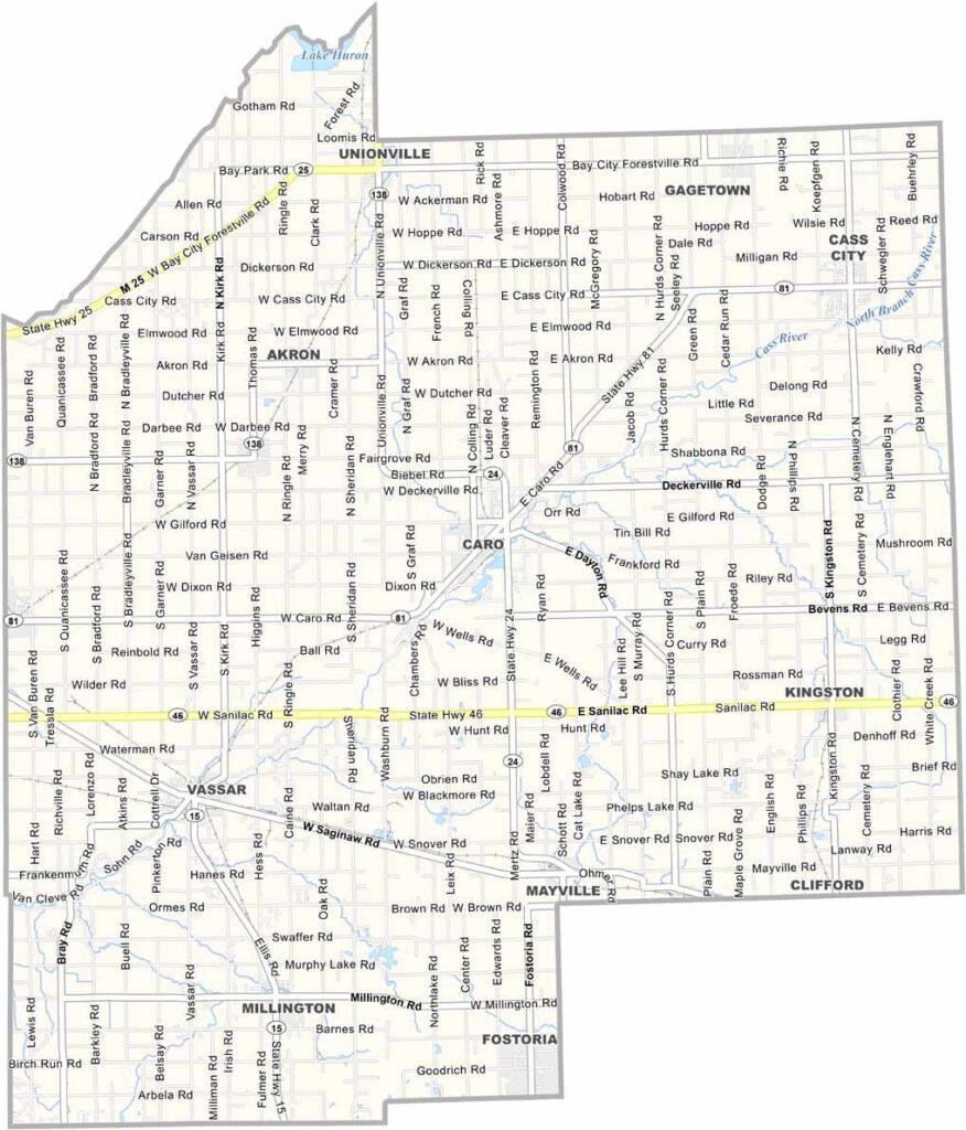
Tuscola County Map, Michigan

Tuscola County, Michigan

Tuscola County is located just south of Saginaw Bay, with rolling farmland stretching across the countryside and access to the nearby Lake Huron shoreline. Caro, the county seat, is known for its annual pumpkin festival, which brings thousands of visitors and residents together each fall.

Sugar beets are an important local crop, while the Cass River winds through the county’s rural landscape. Outdoor enthusiasts can explore the Tuscola State Game Area, which offers opportunities for hunting, hiking, and enjoying the natural surroundings.

Small communities such as Mayville and Millington offer friendly local character, independent shops, and a classic small-town atmosphere. With its rich agricultural soil, Tuscola County produces a variety of crops, including corn and Christmas trees.
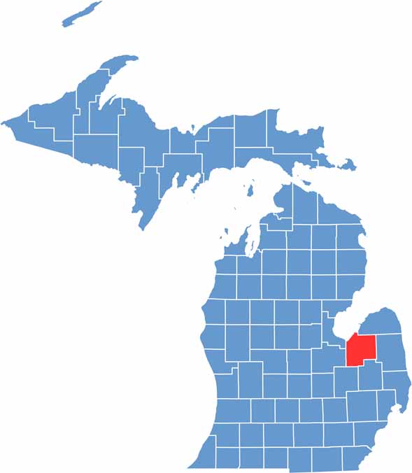

Tuscola County location map of Michigan
CategoryDetails
County NameTuscola County
County SeatCaro
EtymologyA made-up word by Henry Schoolcraft, intended to sound like a Native American name
Cities, Towns, and CommunitiesCaro, Vassar, Cass City, Millington, Reese, Akron, Fairgrove, Unionville
Interstates and HighwaysM-15, M-24, M-25, M-46, M-81
FIPS Code26-157
Total Area (Land and Water)914 square miles (Land: 803 sq mi, Water: 111 sq mi)
Adjacent Counties (and Direction)Huron County (North), Sanilac County (East), Saginaw County (West), Lapeer County (Southeast), Genesee County (Southwest), Bay County (West)
Time ZoneEastern Time Zone (ET)
StateMichigan
Coordinates43.4831° N, 83.4218° W
Major LandmarksCass River, Thumb Octagon Barn, Tuscola County Pumpkin Festival, Frankenmuth Aerial Park
PopulationApproximately 52,000
Scroll to Top





