A Blank Arizona Map is a valuable resource for anyone looking to explore or better understand the geography of Arizona. Known for its stunning desert landscapes, majestic mountain ranges, and iconic landmarks such as the Grand Canyon, Arizona offers a diverse and fascinating natural environment. An unlabeled map of the state allows users to identify and study major cities, including Phoenix, Tucson, and Flagstaff, while also learning about important geographic features. It is especially useful for students, educators, and travelers who want to explore Arizona’s natural attractions, such as the Colorado River, the Sonoran Desert, and the state's many national parks and monuments. Whether for educational purposes, travel planning, or geographic study, a Blank Arizona Map provides an excellent foundation for learning about the Grand Canyon State.
Blank Arizona Maps are widely used in classrooms to help students develop map-reading skills and gain a better understanding of the geography of the United States. Teachers often incorporate them into geography lessons, worksheets, and educational activities, allowing learners to label cities, counties, rivers, mountains, and other natural features. This hands-on approach helps students build a deeper understanding of Arizona’s physical landscape and political boundaries.Beyond the classroom, a Blank Arizona Map is a valuable resource for travelers, researchers, and anyone interested in exploring the state. It can be used for educational projects, travel planning, geographic studies, and personal exploration. By providing a customizable and interactive learning tool, a Blank Arizona Map encourages users to engage with Arizona’s diverse geography in a meaningful way. Whether for academic purposes or general reference, it serves as an essential resource for learning about and discovering the unique characteristics of the Grand Canyon State.
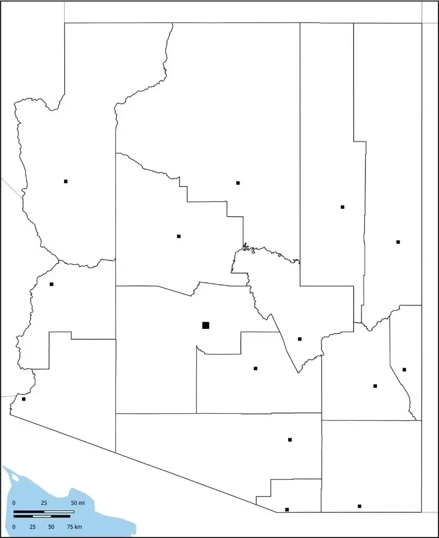
Arizona, located in the southwestern United States, is renowned for its stunning desert landscapes and world-famous natural attractions, including the Grand Canyon—one of the most iconic natural wonders on Earth. The state's diverse geography ranges from vast deserts and rugged canyons to forested mountains and high plateaus. Major cities include Phoenix, the state capital and largest city, as well as Tucson and Flagstaff.Arizona is rich in Native American history and culture, with numerous tribal nations, reservations, and historic sites that contribute to the state's unique heritage. The state also plays a significant role in the U.S. economy through industries such as mining, tourism, and outdoor recreation. Known as one of the nation's leading copper producers, Arizona attracts millions of visitors each year who come to experience its breathtaking scenery, cultural landmarks, and recreational opportunities.
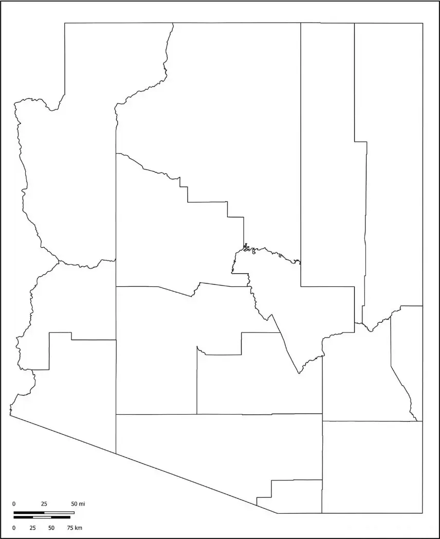
An Arizona Map Worksheet is an educational tool designed to help students learn about the geography of Arizona in an interactive and engaging way. These worksheets typically feature a blank or partially labeled map that allows learners to identify and label major cities such as Phoenix, Tucson, and Flagstaff. Students may also be asked to locate important natural landmarks and geographic features, including the Grand Canyon, the Colorado River, and the Sonoran Desert.By completing these activities, students can strengthen their map-reading skills, improve their understanding of Arizona’s geography, and gain a deeper appreciation for the state's diverse landscapes. Arizona Map Worksheets are widely used in classrooms, homeschooling programs, and educational projects as an effective way to support geographic learning.
These worksheets help teachers create interactive and engaging lessons that allow students to develop essential map-reading skills, spatial awareness, and geographic knowledge. By identifying locations, labeling features, and exploring Arizona’s physical and political geography, students gain a deeper understanding of the state's layout and natural environment. Arizona Map Worksheets encourage active learning and critical thinking, making them an excellent resource for classroom activities, independent study, and homework assignments. Their hands-on approach helps learners better understand and retain important geographic concepts.
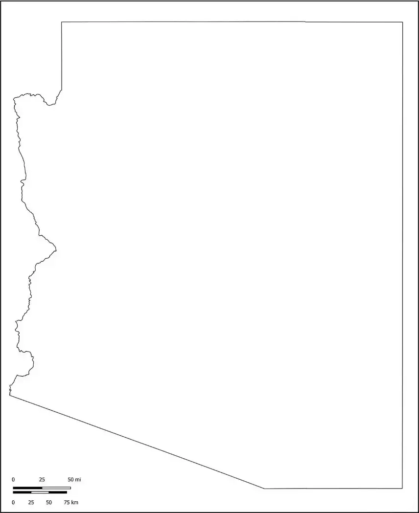
You can also download a blank Arizona map that displays only the state's outline and borders. This unlabeled map provides an excellent learning resource for students, educators, and geography enthusiasts. Users can label major cities such as Phoenix, Tucson, and Flagstaff, as well as important geographic landmarks including the Grand Canyon and the Colorado River. Ideal for classroom activities, educational projects, and personal study, a blank Arizona map helps improve map-reading skills and encourages a deeper understanding of the state's geography.
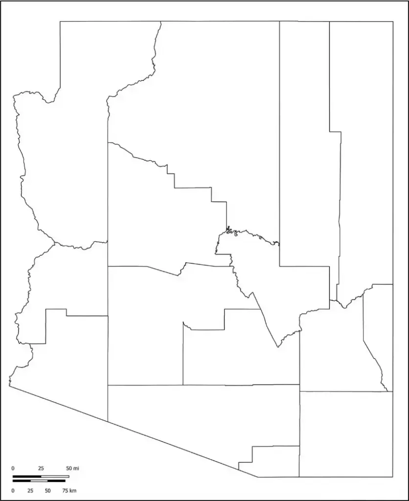
Many teachers use a Blank Arizona Map Outline to help students identify counties, state boundaries, and important natural landmarks. It is also a valuable resource for U.S. geography projects, classroom activities, and educational quizzes. By labeling locations and geographic features, students can strengthen their map-reading skills and develop a better understanding of Arizona’s physical and political geography. Whether used in the classroom or at home, a Blank Arizona Map Outline provides an engaging and effective way to explore the state's unique and diverse landscape.

