

Burleigh County is located in the heart of North Dakota and is home to Bismarck, the state capital. As a center for government, business, and economic activity, the county combines the energy of urban life with the charm of surrounding rural communities.
History and culture are an important part of the region. The North Dakota Heritage Center & State Museum showcases the state's rich history, while Fort Abraham Lincoln State Park offers visitors a fascinating look at North Dakota's frontier past. The county also features a growing arts and cultural scene, along with numerous parks, trails, and opportunities for outdoor recreation.
The Missouri River forms much of Burleigh County's western boundary, adding scenic beauty and recreational opportunities to the area. With its strong economy, diverse communities, outdoor attractions, and high quality of life, Burleigh County continues to attract new residents and visitors looking to experience the best of North Dakota.

Burleigh County lies in the transition zone where the Great Plains begin to develop more varied terrain. The eastern part of the county is relatively flat, while the landscape becomes more diverse as you approach the Missouri River. Here, you’ll find gentle ridges, small valleys, and scenic bluffs that add character to the terrain. Although Burleigh County is not mountainous, the land becomes noticeably more rugged near the river. Even Bismarck, the county seat and state capital, sits on gently sloping terrain that gradually descends toward the Missouri River.

Burleigh County lies in the transition zone where the Great Plains begin to develop more varied terrain. The eastern part of the county is relatively flat, while the landscape becomes more diverse as you approach the Missouri River. Here, you’ll find gentle ridges, small valleys, and scenic bluffs that add character to the terrain. Although Burleigh County is not mountainous, the land becomes noticeably more rugged near the river. Even Bismarck, the county seat and state capital, sits on gently sloping terrain that gradually descends toward the Missouri River.

The Burleigh County satellite map offers a fascinating view of the region’s diverse landscape. Bismarck stands out in the western part of the county, with its broad streets, developed neighborhoods, buildings, and bridges. The Missouri River is one of the most prominent natural features, winding through the landscape with wide bends and lush green riverbanks.

The Burleigh County outline map reveals a distinctive shape influenced by the natural course of the Missouri River. While most of the county’s boundaries follow straight lines, the river curves along the southwestern edge, creating an irregular border that sets the county apart. Burleigh County is located entirely within North Dakota and does not share a border with any other state.









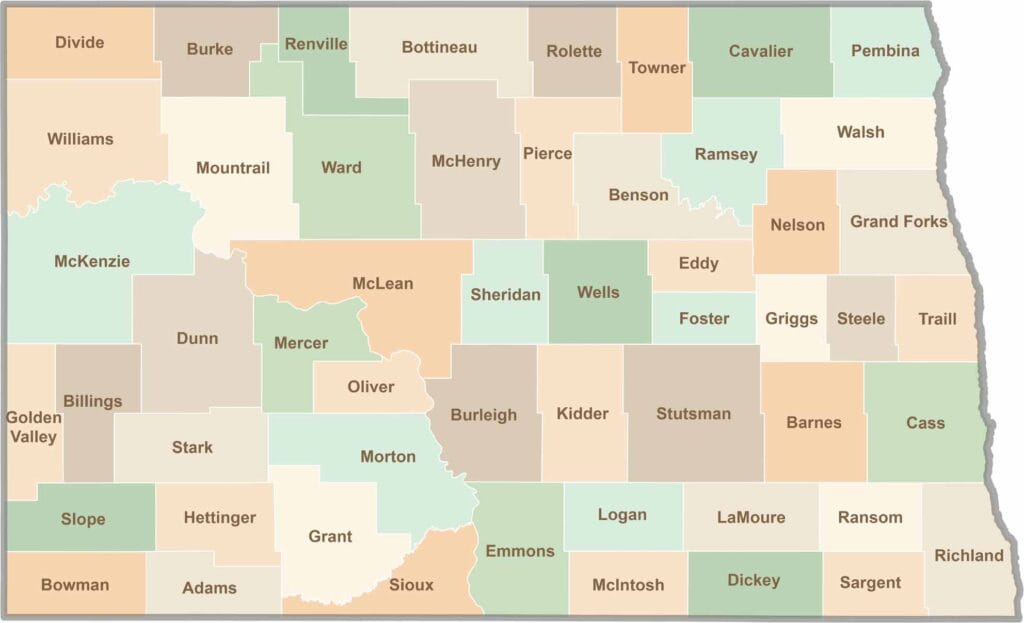
With 53 counties spread across North Dakota, the state offers far more variety than most people expect, from sleepy prairie towns to busy oil hubs. In one county, the scenery may be nothing but wheat fields and peaceful back roads, while the next boasts rodeos, wind turbines, and a giant buffalo statue as big as a house.