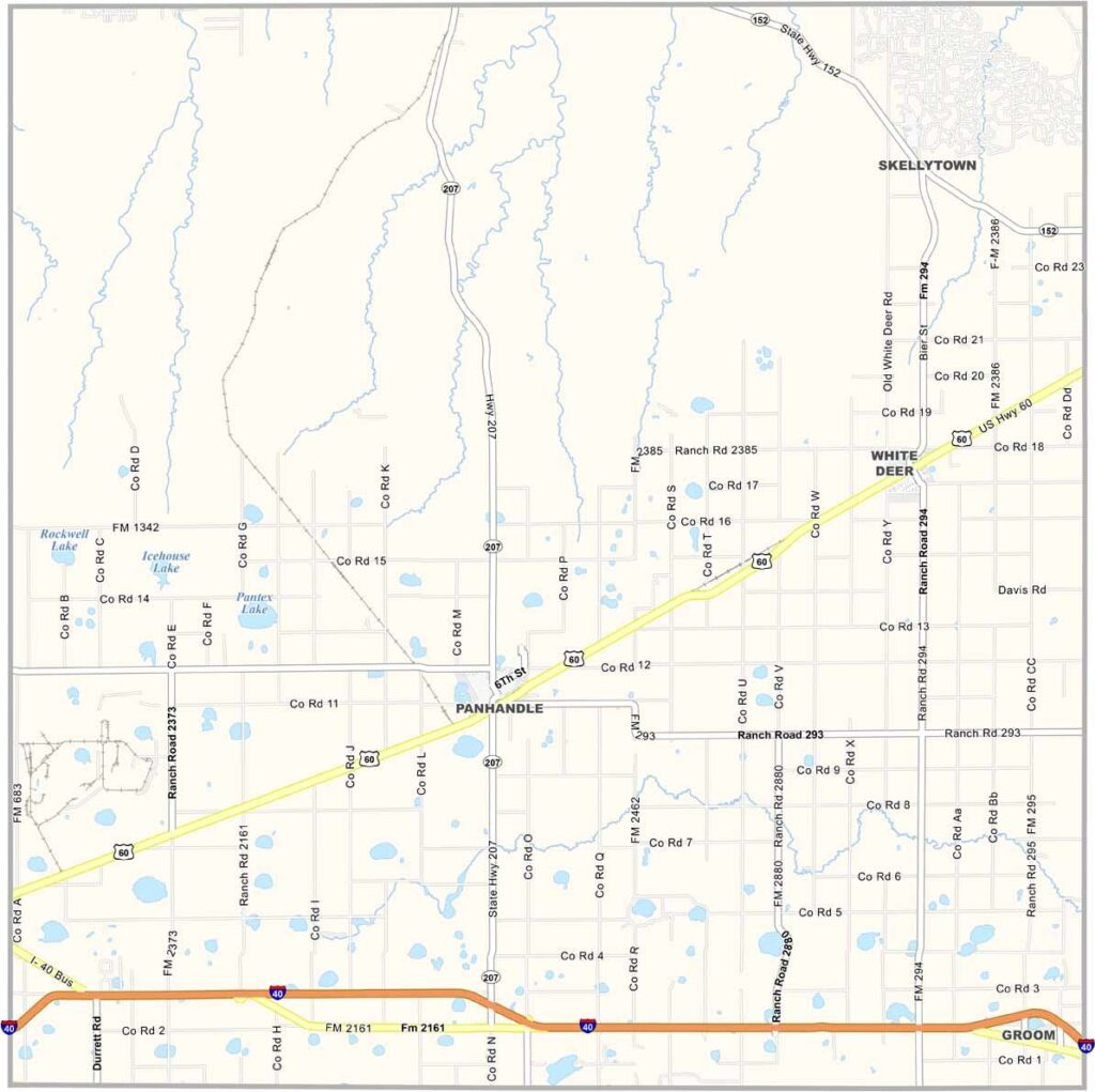
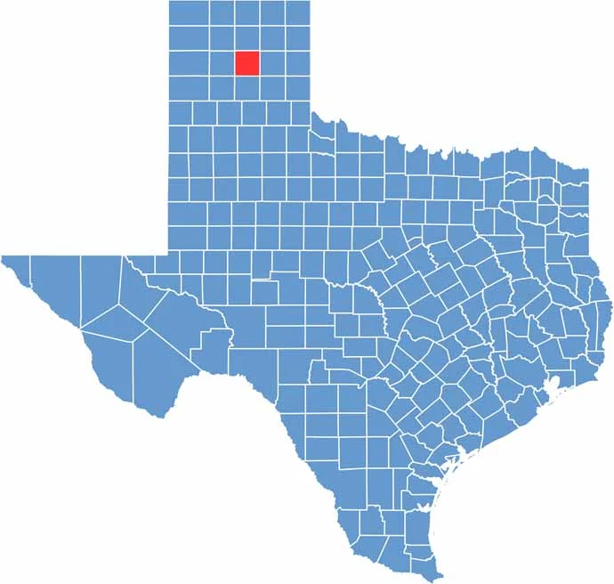
Carson County, Texas

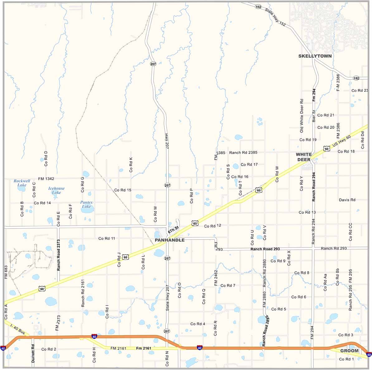
Carson County is located in the heart of the Texas Panhandle, where vast open spaces, flat plains, and endless skies define the landscape. The wind is a constant presence, adding to the rugged character of the region. Panhandle, which shares its name with the county, serves as the county seat.

Ranching and farming are important parts of the local economy, while oil production also contributes significantly to the area. Visitors can explore the Square House Museum in Panhandle, a great place to discover the history and heritage of the region.

A section of historic Route 66 also passes through Carson County, offering a glimpse into the golden age of American road travel. Life here is peaceful and unhurried, and the quiet surroundings are part of what makes Carson County special.
CategoryDetails
County NameCarson County
County SeatPanhandle
PopulationApproximately 6,000
Cities, Towns, and CommunitiesPanhandle, White Deer, Groom, Skellytown
Interstates and HighwaysInterstate 40, U.S. Highway 60
FIPS Code48-065
Total Area (Land and Water)924 square miles (920 sq mi land, 4 sq mi water)
Adjacent Counties (and Direction)Hutchinson County (North), Roberts County (Northeast), Gray County (East), Donley County (Southeast), Armstrong County (South), Randall County (Southwest), Potter County (West), Moore County (Northwest)
Time ZoneCentral Time Zone (CST)
StateTexas
Coordinates35°24’N, 101°21’W
EtymologyNamed after Samuel Price Carson, the first secretary of state for the Republic of Texas
Major LandmarksGroom Cross, Pantex Plant, Panhandle-Plains Historical Museum
Scroll to Top