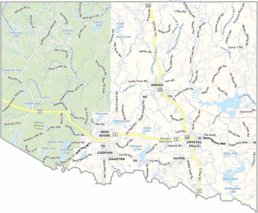
Iron County Map, Michigan

Iron County, Michigan

Iron County sits right on the Wisconsin border, about as far west as you can go before leaving the state. This place is all about the outdoors, with lakes, rivers, and forests everywhere you look.

Iron County got its name from the iron ore mining that was once big business here. These days, though, the focus is more on tourism and timber. Yep, Ottawa National Forest covers pretty much the western half.

Winters are long and snowy, perfect for snowmobiling and skiing. Summers are short but sweet, with hiking, fishing, and camping on the menu. The people here are tough and friendly, accustomed to harsh weather and hard work.
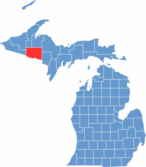

Iron County location map of Michigan
CategoryDetails
County NameIron County
County SeatCrystal Falls
Cities, Towns, and CommunitiesIron River, Crystal Falls, Caspian, Gaastra, Amasa, Alpha
Interstates and HighwaysUS 2, US 141, M-69, M-189
FIPS Code26-071
Total Area (Land and Water)1,211 square miles (Land: 1,166 sq mi, Water: 45 sq mi)
Adjacent Counties (and Direction)Houghton County (North), Baraga County (North), Marquette County (Northeast), Dickinson County (East), Florence County, Wisconsin (Southeast), Forest County, Wisconsin (South), Vilas County, Wisconsin (Southwest), Gogebic County (West), Ontonagon County (Northwest)
Time ZoneCentral Time Zone (CT)
StateMichigan
Coordinates46.0972° N, 88.4441° W
EtymologyNamed for the abundant iron ore deposits in the area
Major LandmarksOttawa National Forest, Pentoga Park, Iron River National Fish Hatchery, Ski Brule
PopulationApproximately 11,000
Scroll to Top