Kidder County Map, North Dakota

Kidder County, North Dakota

Kidder County lies in the middle of North Dakota, where wide open spaces define the landscape. Steele, the county seat, is a tiny town where locals gather to swap stories over coffee.

The county has deep roots in agriculture, and wheat fields shimmer golden in the summer sun. Lakes are plentiful here, and any one of them is a great spot to hook walleye or northern pike.

It's quiet out here, with just 2,800 people living in the entire county. Yep, it's that peaceful. Stargazing is spectacular on clear nights, and the county fair each July is not to be missed.
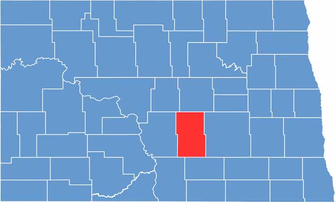
Kidder County location map of North Dakota
CategoryDetails
County NameKidder County
County SeatSteele
EtymologyNamed after Jefferson Parrish Kidder
Cities, Towns, and CommunitiesSteele, Tuttle, Robinson, Braddock
Interstates and HighwaysNorth Dakota Highway 10, North Dakota Highway 34
FIPS Code38-043
Total Area (Land and Water)1,868 square miles (land and water)
Adjacent Counties (and Direction)Wells County (North), Stutsman County (East), Logan County (South), Emmons County (Southwest), Burleigh County (West), Sheridan County (Northwest)
Time ZoneCentral Time Zone
StateNorth Dakota
Coordinates46.8044° N, 99.5381° W
Major LandmarksKidder County Museum, Lake Isabel
PopulationApproximately 2,800
Scroll to Top