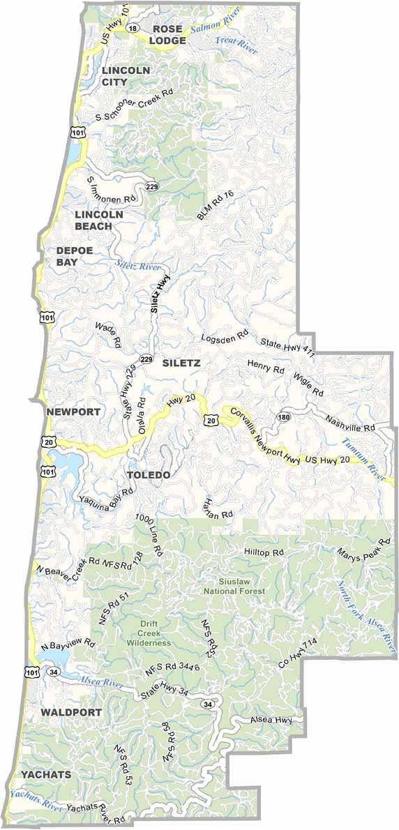
Lincoln County Map, Oregon

Lincoln County, Oregon

Lincoln County sits on the central coast of Oregon, where the forest meets the sea, quite literally. Newport, the county seat, is famous for its working waterfront and the Oregon Coast Aquarium.

Depoe Bay claims to have the world's smallest navigable harbor, and it is also a prime spot for whale watching. Inland, the Siuslaw National Forest occupies the southeast, with hiking trails and campgrounds galore.

Pack a raincoat, because the weather is wet, but when the sun breaks through, it is pure magic. From lighthouses to tide pools, Lincoln County serves up classic Oregon coast vibes with a side of small-town charm.
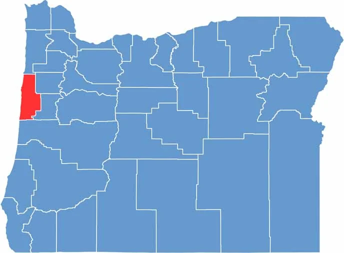

Location map of Lincoln County, Oregon
CategoryDetails
County NameLincoln County
County SeatNewport
EtymologyNamed after President Abraham Lincoln
Cities, Towns, and CommunitiesNewport, Lincoln City, Waldport, Yachats, Toledo, Depoe Bay, Siletz
Interstates and HighwaysU.S. Highway 101, State Highway 18, State Highway 20
FIPS Code41-041
Total Area (Land and Water)1,194 square miles (980 sq mi land, 214 sq mi water)
Adjacent Counties (and Direction)Tillamook County (North), Polk County (East), Benton County (East), Lane County (South)
Time ZonePacific Time Zone (PST)
StateOregon
Coordinates44°38’N, 123°55’W
Major LandmarksYaquina Head Lighthouse, Oregon Coast Aquarium, Devils Punch Bowl State Natural Area
PopulationApproximately 50,000
Scroll to Top