
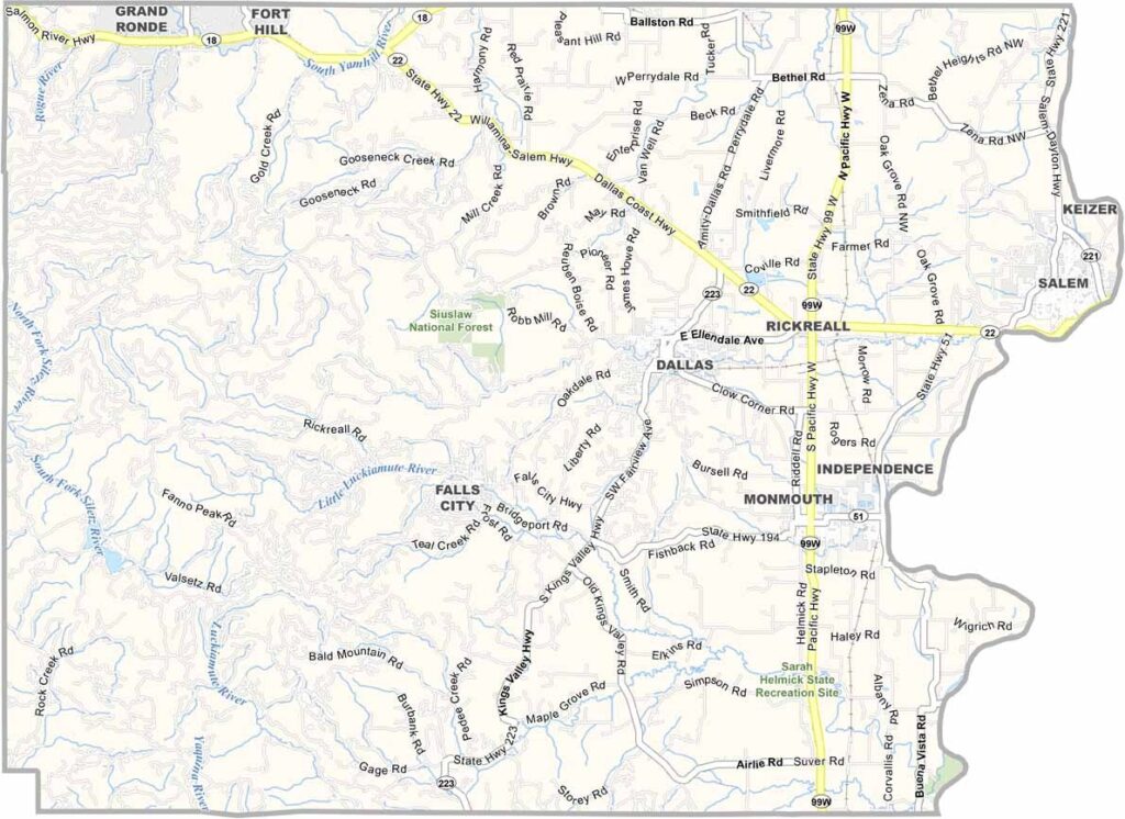
Polk County Map, Oregon

Polk County, Oregon

Polk County stretches across Oregon's Willamette Valley, west of Salem, where city meets country. Western Oregon University calls Monmouth home.

Dallas is the county seat, and just a few miles in any direction you are surrounded by vineyards. Wine country, anyone? The county is known for its Pinot Noir and is also big on Christmas trees.

Baskett Slough Wildlife Refuge is a bird-watcher's paradise, and the Willamette River forms the eastern border. Rolling hills and fertile soil define the county, which is named after James K. Polk, the 11th U.S. president.
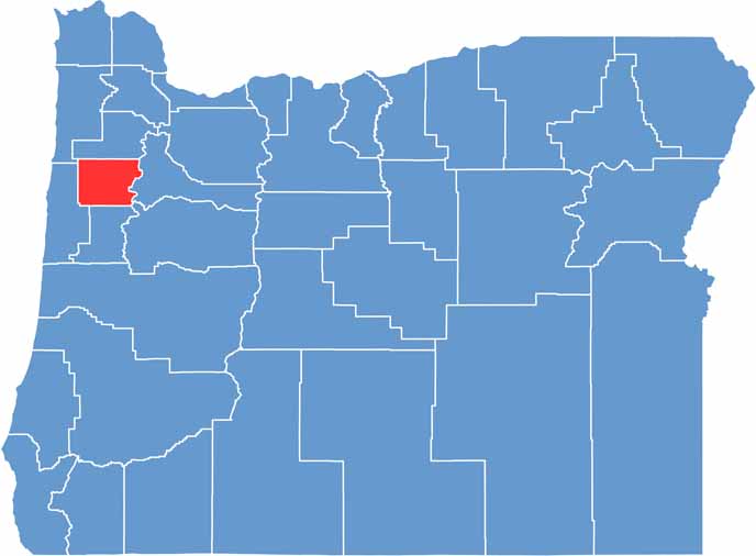

Location map of Polk County, Oregon
CategoryDetails
County NamePolk County
County SeatDallas
EtymologyNamed after President James K. Polk
Cities, Towns, and CommunitiesDallas, Monmouth, Independence, Falls City, Rickreall
Interstates and HighwaysState Highway 22, State Highway 99W, State Highway 51
FIPS Code41-053
Total Area (Land and Water)744 square miles (741 sq mi land, 3 sq mi water)
Adjacent Counties (and Direction)Tillamook County (Northwest), Yamhill County (North), Marion County (East), Linn County (Southeast), Benton County (South), Lincoln County (West)
Time ZonePacific Time Zone (PST)
StateOregon
Coordinates44°54’N, 123°23’W
Major LandmarksBaskett Slough National Wildlife Refuge, Fort Yamhill State Heritage Area, Western Oregon University
PopulationApproximately 89,000
Scroll to Top




