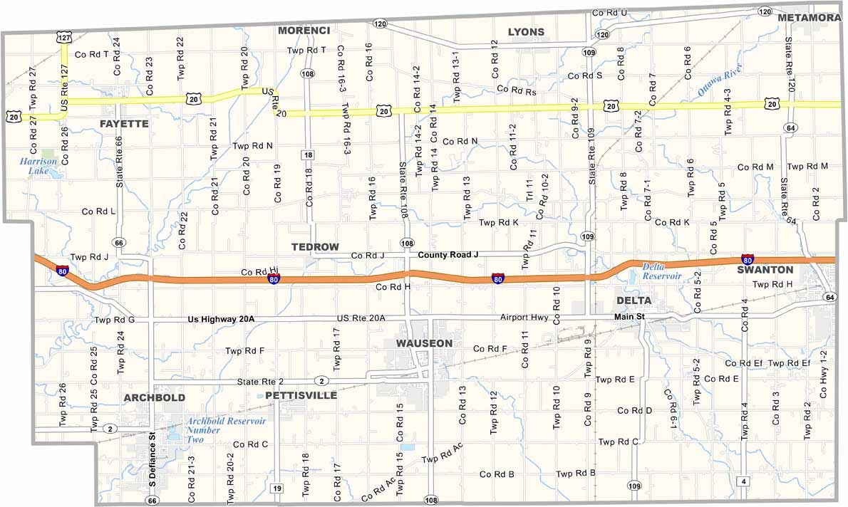
Fulton County Map, Ohio

Fulton County, Ohio

Fulton County is a slice of rural Americana tucked away in the northwest corner of Ohio, bordering Michigan to the north. Its proximity to Toledo means big-city amenities are just a short drive away.

Agriculture is the backbone of the local economy, with corn and soybean fields stretching as far as the eye can see. The Fulton County Fair is a big deal around here, and it’s one of the largest county fairs in Ohio.

Visitors will enjoy the Fulton County Museum, packed with interesting local artifacts. The county is also home to several beautiful parks, perfect for picnics and nature walks. Sauder Village, a living history museum, is in Archbold.
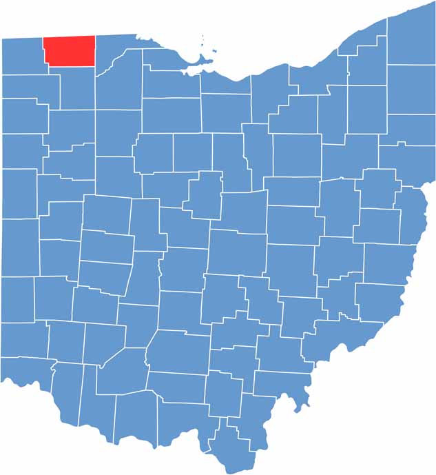

Fulton County location map of Ohio
CategoryDetails
County NameFulton County
County SeatWauseon
EtymologyNamed after Robert Fulton, inventor of the steamboat
Cities, Towns, and CommunitiesWauseon, Swanton, Delta, Lyons
Interstates and HighwaysU.S. Highway 20, U.S. Highway 24, State Route 108
FIPS Code39-051
Total Area408 square miles (land and water)
Adjacent CountiesLenawee County, Michigan (North), Lucas County (East), Henry County (South), Williams County (West), Hillsdale County, Michigan (Northwest)
Time ZoneEastern Time Zone
StateOhio
Coordinates41.5496° N, 84.1392° W
Major LandmarksFulton County Historical Museum, Harrison Lake State Park
PopulationApproximately 42,000
Scroll to Top