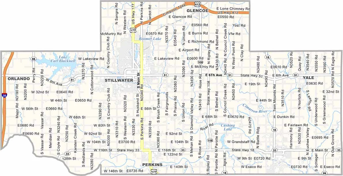
Payne County Map, Oklahoma

Payne County, Oklahoma

Payne County is located in north-central Oklahoma. It’s home to Oklahoma State University (OSU) in Stillwater, so there’s always plenty happening around campus.

Agriculture is important here, but technology is growing too. The county is becoming known as a hub for unmanned aerial systems.

Locals enjoy spending time at Lake Carl Blackwell in the northwest, where fishing and boating are popular. Stillwater is also home to the National Wrestling Hall of Fame. Not WWE, but it’s still a must-see for sports fans.
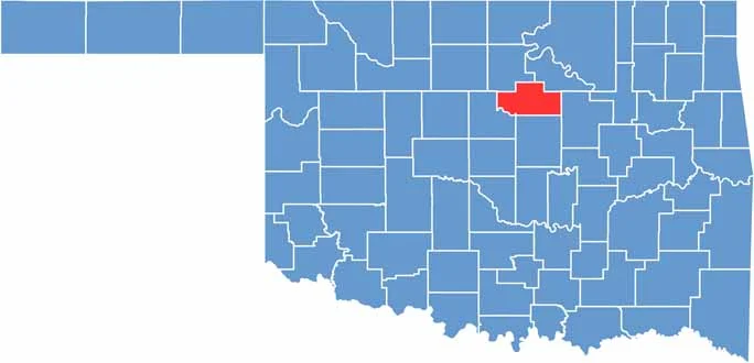

Location map of Payne County, Oklahoma
CategoryDetails
County NamePayne County
County SeatStillwater
EtymologyNamed after David L. Payne, a leader advocating for the opening of Oklahoma lands for settlement
Cities, Towns, and CommunitiesStillwater, Cushing, Perkins, Yale, Glencoe, Ripley, Quay, Ingalls
Interstates and HighwaysU.S. Highway 177, U.S. Highway 412, State Highway 33, State Highway 51
FIPS Code40-119
Total Area (Land and Water)697 square miles (685 sq mi land, 12 sq mi water)
Adjacent Counties (and Direction)Noble County (Northwest), Pawnee County (Northeast), Creek County (East), Lincoln County (South), Logan County (Southwest)
Time ZoneCentral Time Zone (CST)
StateOklahoma
Coordinates36°06’N, 96°56’W
Major LandmarksOklahoma State University, Boomer Lake Park, Lake McMurtry, National Wrestling Hall of Fame
PopulationApproximately 85,000
Scroll to Top