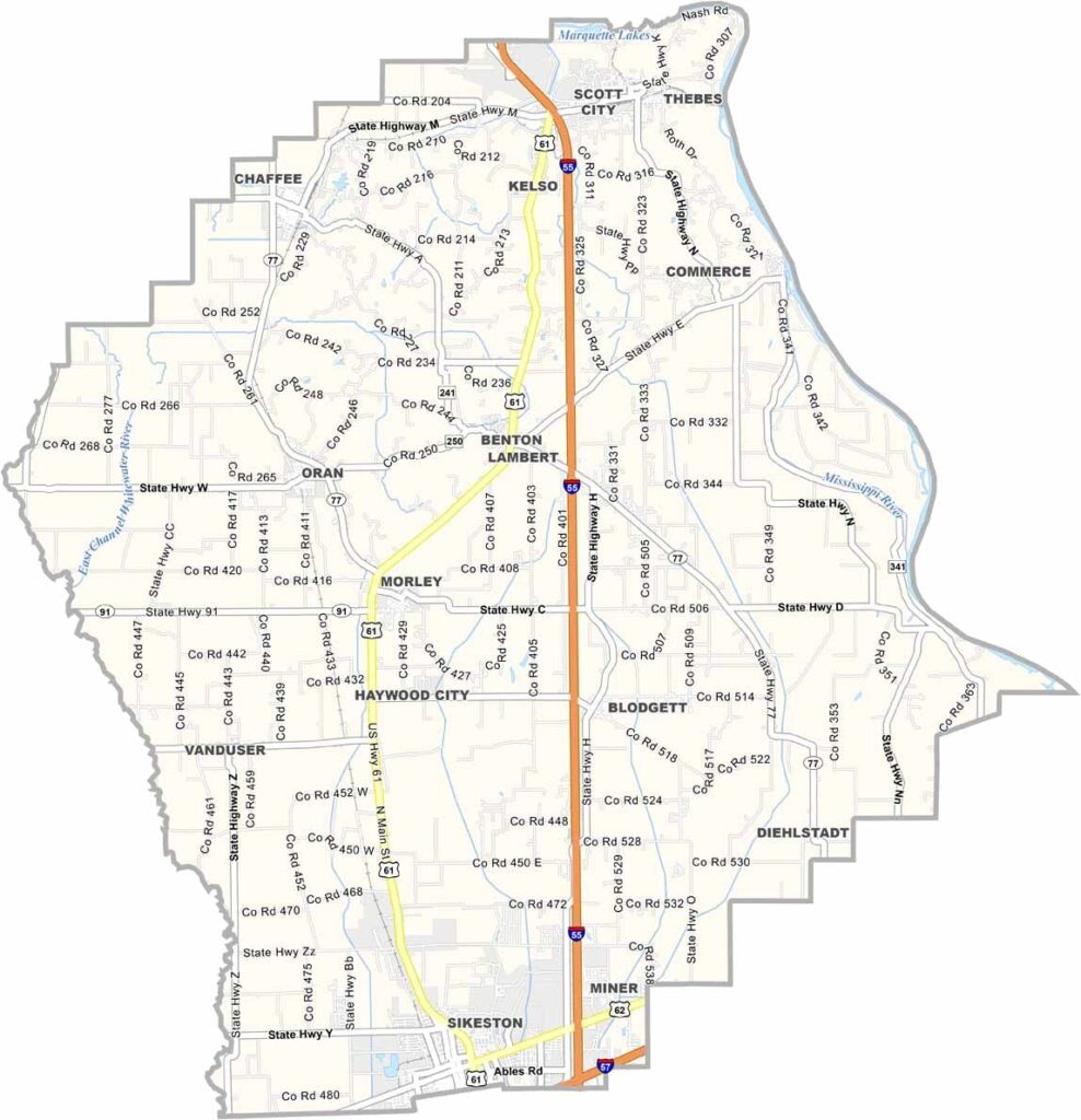
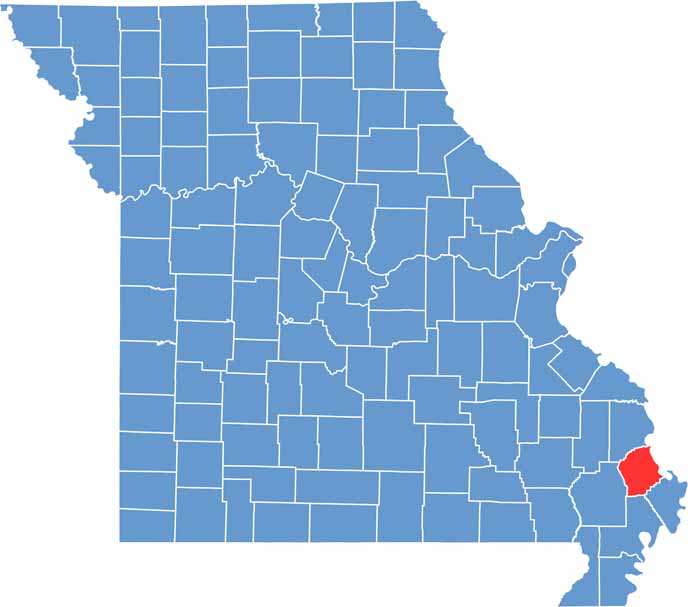
Located in Missouri’s southeastern Bootheel region, Scott County is shaped by the mighty Mississippi River, which forms its eastern border with Illinois. The river has played a significant role in the county’s development, influencing its economy, culture, and landscape for generations.
Nature enthusiasts will find plenty to enjoy throughout Scott County. Parks, walking trails, waterways, and outdoor recreation areas provide opportunities for hiking, wildlife viewing, fishing, and exploring the region’s natural beauty.
Sikeston, the county’s largest city, serves as a major commercial hub and is strategically located near the intersection of Interstate 55 and Interstate 57. Despite its growth and convenient transportation connections, Scott County continues to maintain a strong sense of community.

Wright County Map Missouri

Worth County Map Missouri
Wayne County Map Missouri
Warren County Map Missouri
Washington County Map Missouri
