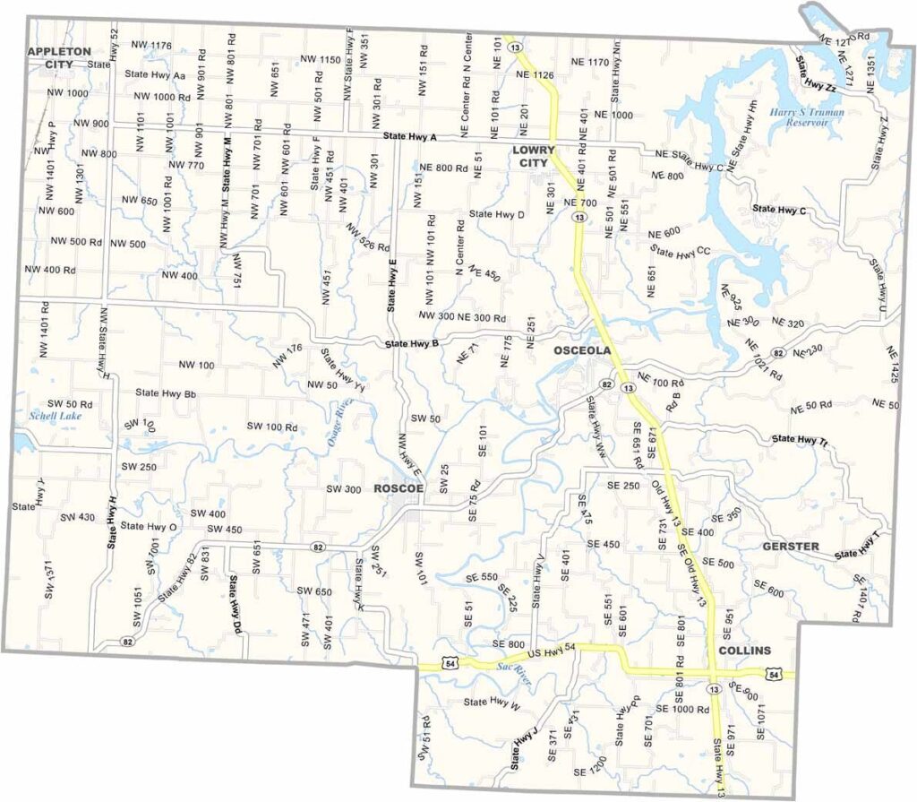
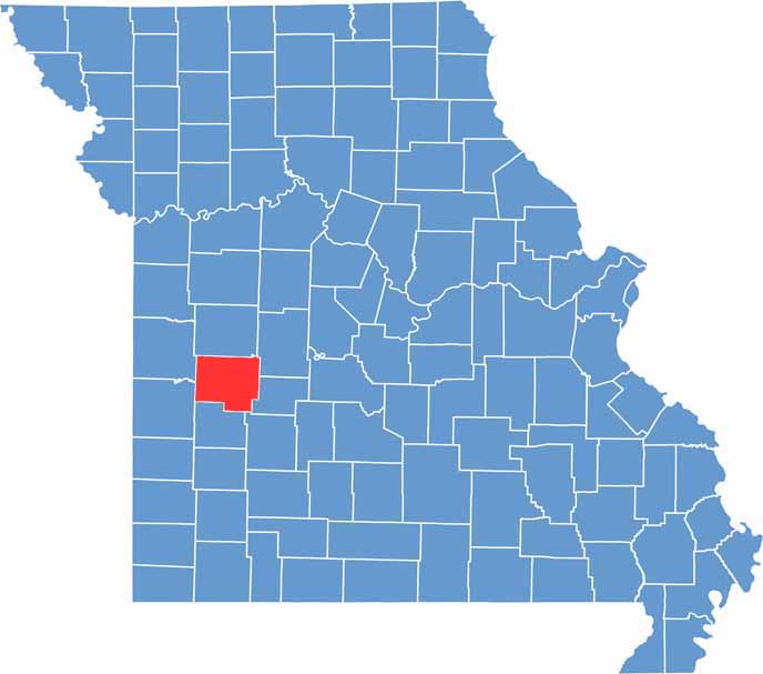
Located in west-central Missouri, St. Clair County offers a peaceful rural setting between Kansas City and the Lake of the Ozarks, making it an appealing destination for travelers seeking relaxation and small-town charm.
Appleton City, the county’s largest community, is known for its welcoming atmosphere and close-knit spirit. Throughout the year, local events and community gatherings bring residents together and highlight the county’s strong sense of tradition and hospitality.
The Osage River winds through the region, providing excellent opportunities for fishing, boating, and other outdoor recreation. Agriculture remains an important part of life in St. Clair County, with many farms continuing a legacy that spans generations.

Missouri
Wright County Map Missouri

Missouri
Worth County Map Missouri
Missouri
Wayne County Map Missouri
Missouri
Warren County Map Missouri
Missouri
Washington County Map Missouri

Missouri