
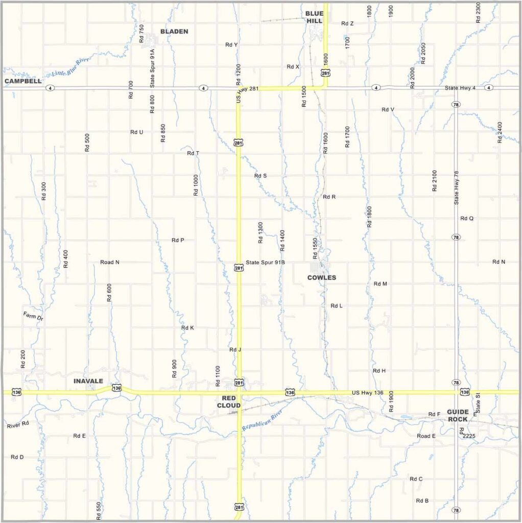
Webster County Map, Nebraska

Webster County, Nebraska

Webster County lies in south-central Nebraska, along the Kansas border. Red Cloud, the county seat, is famous as the childhood home of Willa Cather. The author, you know?

The Republican River runs through the county, creating some nice scenery, but there's something special about this place.

Maybe it's the literary history, or maybe it's the way folks look out for each other. Either way, you can feel the history here, in the old buildings and in the stories people tell.
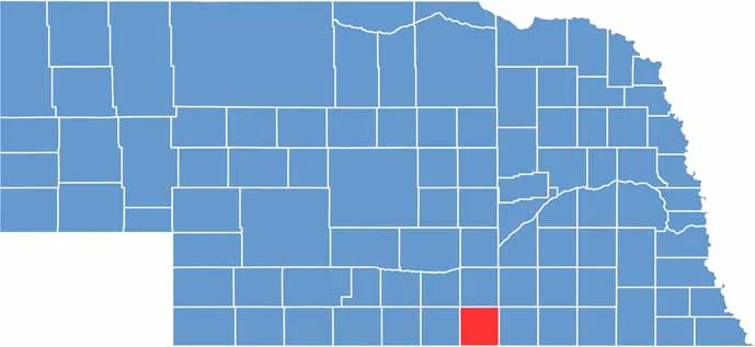

Webster County location map of Nebraska
CategoryDetails
County NameWebster County
County SeatRed Cloud
EtymologyNamed after Daniel Webster, an American statesman and orator
Cities, Towns, and CommunitiesRed Cloud, Blue Hill, Guide Rock, Cowles
Interstates and HighwaysU.S. Highway 136, Nebraska Highway 4, Nebraska Highway 78
FIPS Code31-181
Total Area (Land and Water)575 square miles (573 sq mi land, 2 sq mi water)
Adjacent Counties (and Direction)Adams County (North), Clay County (Northeast), Nuckolls County (East), Jewell County, Kansas (Southeast), Smith County, Kansas (Southwest), Franklin County (West), Kearney County (Northwest)
Time ZoneCentral Time Zone (CT)
StateNebraska
Coordinates40.1839° N, 98.5133° W
Major LandmarksWilla Cather State Historic Site, Red Cloud Opera House
PopulationApproximately 3,400
Scroll to Top





