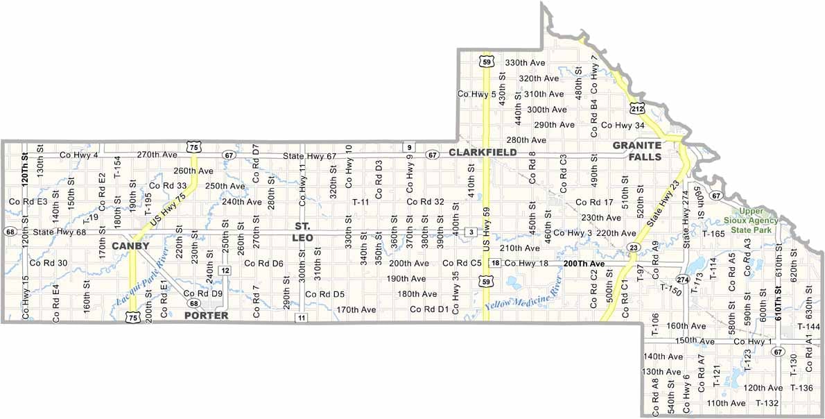
Yellow Medicine County Map, Minnesota

Yellow Medicine County, Minnesota

Southwest Minnesota is home to Yellow Medicine County. It's named after the Yellow Medicine River, which flows through the area. Agriculture is key here. Corn and soybeans dominate the landscape, with a few cattle farms thrown in for good measure.

Granite Falls is the county seat, which sits on the Minnesota River and has some pretty cool old buildings. The county's got a strong Dakota heritage. You can learn about it at Upper Sioux Agency State Park.

If you're into birding, head to the river valleys in spring and fall to catch the migration. Wood Lake is a tiny town in the county, which was the site of a major battle in the U.S.-Dakota War of 1862.
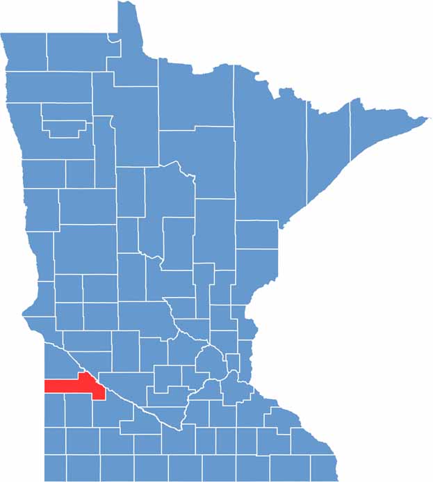

Yellow Medicine County location map of Minnesota
CategoryDetails
County NameYellow Medicine County
County SeatGranite Falls
PopulationApproximately 9,700
Cities, Towns, and CommunitiesGranite Falls, Clarkfield, Canby, Wood Lake, Hanley Falls, Echo, Hazel Run, St. Leo
Interstates and HighwaysUS 59, MN 23, MN 67, MN 274
FIPS Code27-173
Total Area (Land and Water)763 square miles (Land: 759 sq mi, Water: 4 sq mi)
Adjacent Counties (and Direction)Lac qui Parle County (North), Chippewa County (Northeast), Renville County (East), Redwood County (Southeast), Lyon County (South), Lincoln County (Southwest), Deuel County, South Dakota (West)
Time ZoneCentral Time Zone (CT)
StateMinnesota
Coordinates44.7453° N, 95.8650° W
EtymologyNamed after the Yellow Medicine River, which was named for the yellow root used by Dakota Sioux for medicine
Major LandmarksUpper Sioux Agency State Park, Minnesota’s Machinery Museum, Prairie’s Edge Casino Resort
Scroll to Top