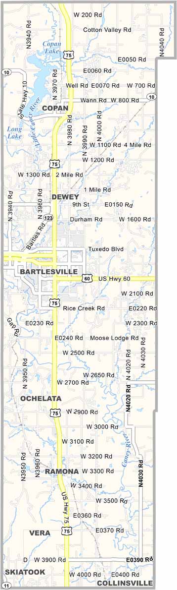
Washington County Map, Oklahoma

Washington County, Oklahoma

Washington County occupies a slice of northeastern Oklahoma along the Kansas border. The Caney River winds through the county, and rolling hills give way to tallgrass prairie.

Oil wealth shaped this area. Bartlesville, the county seat, covers a large share of the county and is where Phillips Petroleum got its start. Price Tower, the only skyscraper designed by Frank Lloyd Wright, rises over downtown.

Woolaroc, the ranch retreat of Frank Phillips, is a must-see attraction with a mix of art and artifacts. Outdoor recreation is popular throughout Washington County, and the area's natural beauty draws visitors all year.
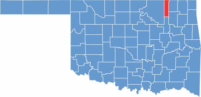

Location map of Washington County, Oklahoma
CategoryDetails
County NameWashington County
County SeatBartlesville
EtymologyNamed after President George Washington
Cities, Towns, and CommunitiesBartlesville, Dewey, Copan, Ramona, Ochelata, Vera
Interstates and HighwaysU.S. Highway 60, U.S. Highway 75, State Highway 123
FIPS Code40-147
Total Area (Land and Water)424 square miles (417 sq mi land, 7 sq mi water)
Adjacent Counties (and Direction)Montgomery County, Kansas (North), Nowata County (East), Rogers County (Southeast), Tulsa County (South), Osage County (West), Chautauqua County, Kansas (Northwest)
Time ZoneCentral Time Zone (CST)
StateOklahoma
Coordinates36°45’N, 95°93’W
Major LandmarksWoolaroc Museum & Wildlife Preserve, Price Tower, Bartlesville Community Center
PopulationApproximately 55,000
Scroll to Top