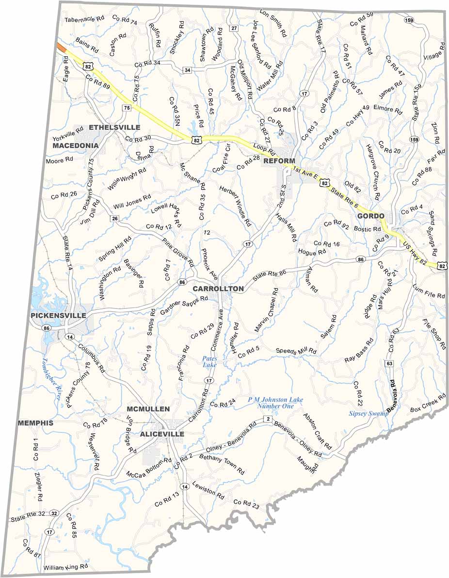
Pickens County, Alabama

Pickens County is located along the Mississippi border in western Alabama. Its county seat is Carrollton, and the county has a population of around 20,000 people.

The Tombigbee and Sipsey Rivers form the county’s southeastern boundary, adding to its natural landscape. U.S. Highway 82 runs through the area, making it accessible while still maintaining a quiet, rural character.

The local economy is largely based on agriculture, particularly cattle farming and timber production. The county is named after General Andrew Pickens, a Revolutionary War hero from South Carolina.
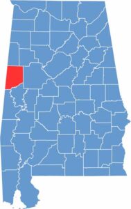

Pickens County location map showing its position in Alabama.
Category Details
County Name Pickens County
County Seat Carrollton
Cities, Towns, and Communities Aliceville, Carrollton, Gordo, Reform, McMullen, Ethelsville, Pickensville, Macedonia
Interstates and Highways U.S. Highway 82, State Route 14, State Route 17, State Route 86, State Route 159
Etymology Named after General Andrew Pickens
FIPS Code 01-107
Total Area (Land and Water) 890 square miles (Land: 881 sq mi, Water: 9 sq mi)
Time Zone Central Time Zone (CT)
State Alabama
Coordinates 33.2619° N, 88.2653° W
Major Landmarks Aliceville Museum, Pickens County Courthouse, Tom Bevill Lock and Dam, Lake Lurleen State Park (partly in Pickens County)
Adjacent Counties (and Direction) Lamar County (North), Fayette County (Northeast), Tuscaloosa County (East), Greene County (Southeast), Sumter County (South), Noxubee County, Mississippi (Southwest), Lowndes County, Mississippi (West)
Population Approximately 20,000
Scroll to Top