Putnam County, Missouri
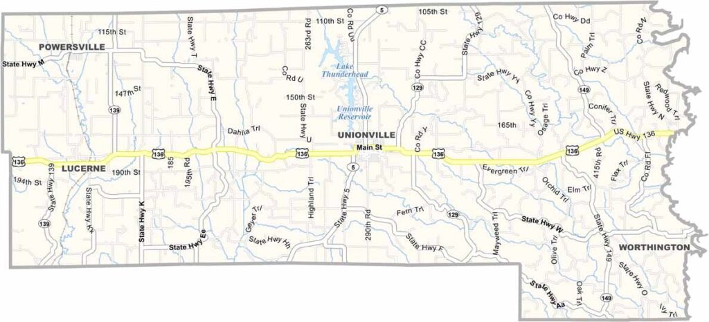
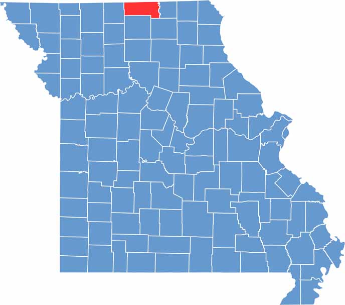
Putnam County is located in north-central Missouri along the Iowa border. It’s known for its rolling hills, productive farmland, and strong agricultural traditions that have shaped the area for generations.
Unionville serves as the county seat and offers the classic charm of a small Midwestern town. Residents take great pride in their community and local heritage. The county itself is named after Revolutionary War General Israel Putnam, whose legacy lives on through its name.
Outdoor recreation is a major draw in Putnam County. Fishing and hunting are popular activities throughout the region, attracting both locals and visitors.
| Category | Details |
|---|---|
| County Name | Putnam County |
| County Seat | Unionville |
| Cities, Towns, and Communities | Unionville, Livonia, Worthington, Lucerne, Powersville, Omaha, Lemons |
| Interstates and Highways | US 136, MO 5, MO 129 |
| Population | Approximately 4,500 |
| FIPS Code | 29-171 |
| Total Area (Land and Water) | 518 square miles (Land: 517 sq mi, Water: 1 sq mi) |
| Time Zone | Central Time Zone (CT) |
| State | Missouri |
| Coordinates | 40.4853° N, 93.0157° W |
| Etymology | Named after Israel Putnam, a general in the American Revolutionary War |
| Major Landmarks | Lake Thunderhead, Unionville City Park, Mineral Hills Conservation Area |
| Adjacent Counties (and Direction) | Wayne County, Iowa (Northwest), Appanoose County, Iowa (Northeast), Schuyler County (East), Adair County (Southeast), Sullivan County (South), Mercer County (West) |
Missouri
Wright County Map Missouri
Missouri
Worth County Map Missouri
Missouri
Wayne County Map Missouri
Missouri
Warren County Map Missouri
Missouri
Washington County Map Missouri
Missouri


