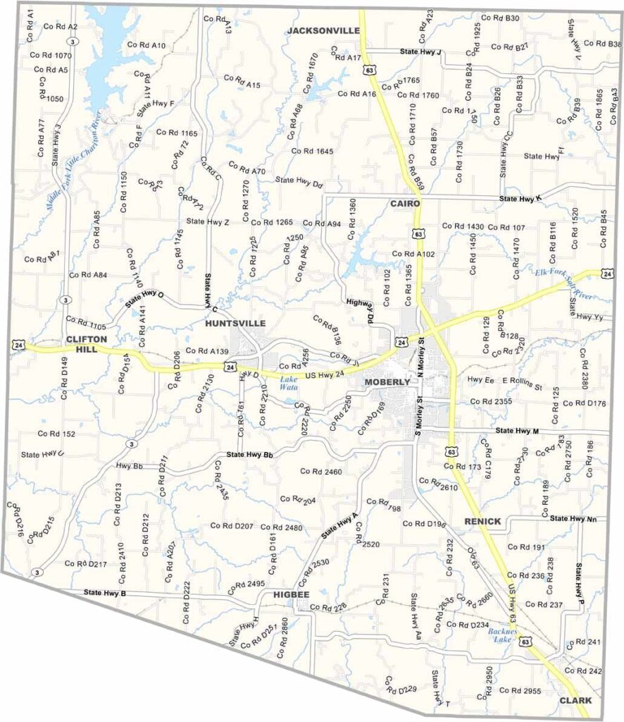
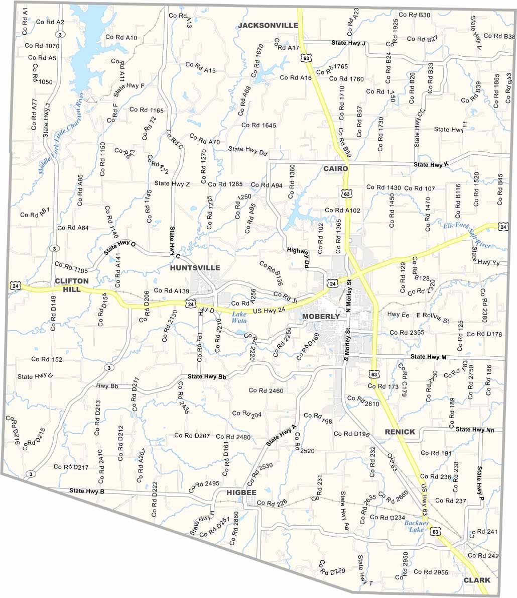
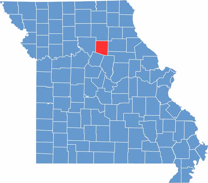
Randolph County is located in north-central Missouri and is known for its rich history, diverse economy, and welcoming communities. Moberly, the county’s largest city, earned the nickname “Magic City” due to its rapid growth during the railroad era and continues to serve as a major center for business and industry in the region.
While coal mining once played a significant role in the county’s economy, modern Randolph County is supported by industries such as healthcare, manufacturing, and education. Outdoor enthusiasts are drawn to Thomas Hill Reservoir, a popular destination for fishing, boating, and a variety of recreational activities.
The county also features several unique attractions and interesting pieces of local history. Among them is a cave system that was once used for aging cheese, reflecting the area’s distinctive heritage.

Wright County Map Missouri

Worth County Map Missouri
Wayne County Map Missouri
Warren County Map Missouri
Washington County Map Missouri
