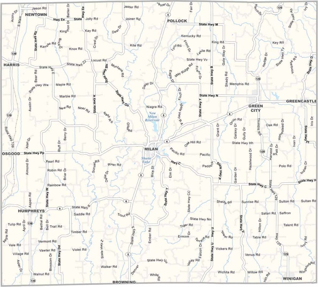
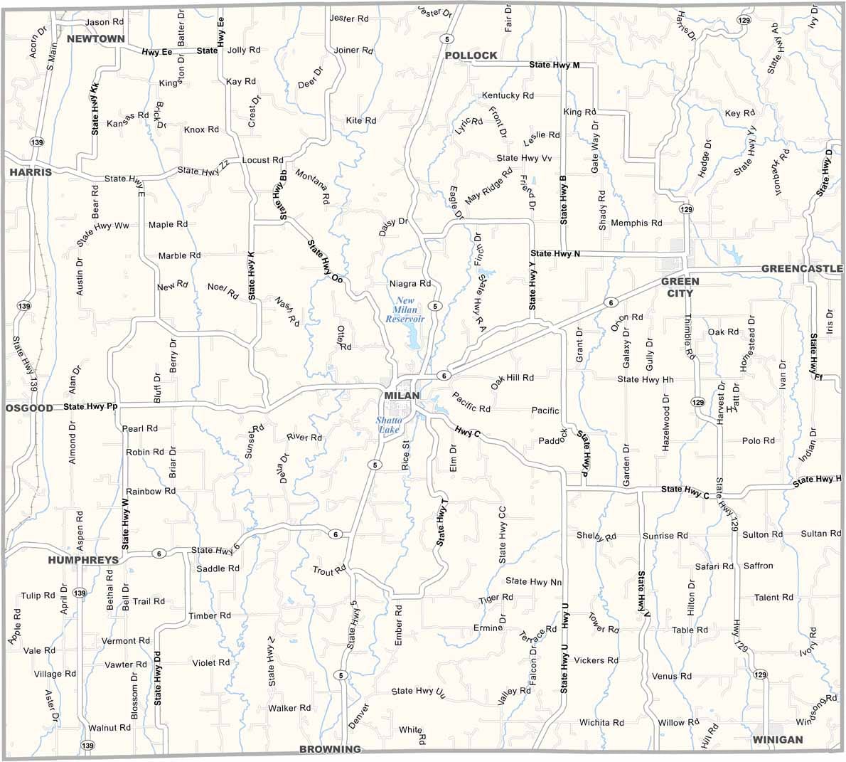
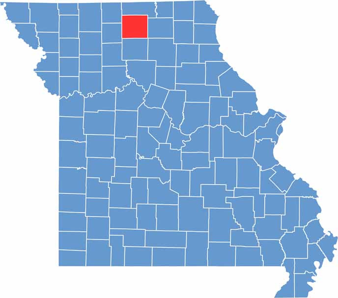
Sullivan County sits in northern Missouri, where green pastures and grazing cattle define the landscape. It’s classic farm country through and through.
Milan, the county seat, is known for its welcoming residents. The county’s history shines through its preserved buildings and local museums.
Nearby Lake Thunderhead offers great fishing and boating opportunities. It’s a relaxing place to escape, and while the area is rural, the community continues to embrace growth while holding onto its small-town values.

Missouri
Wright County Map Missouri

Missouri
Worth County Map Missouri
Missouri
Wayne County Map Missouri
Missouri
Warren County Map Missouri
Missouri
Washington County Map Missouri

Missouri