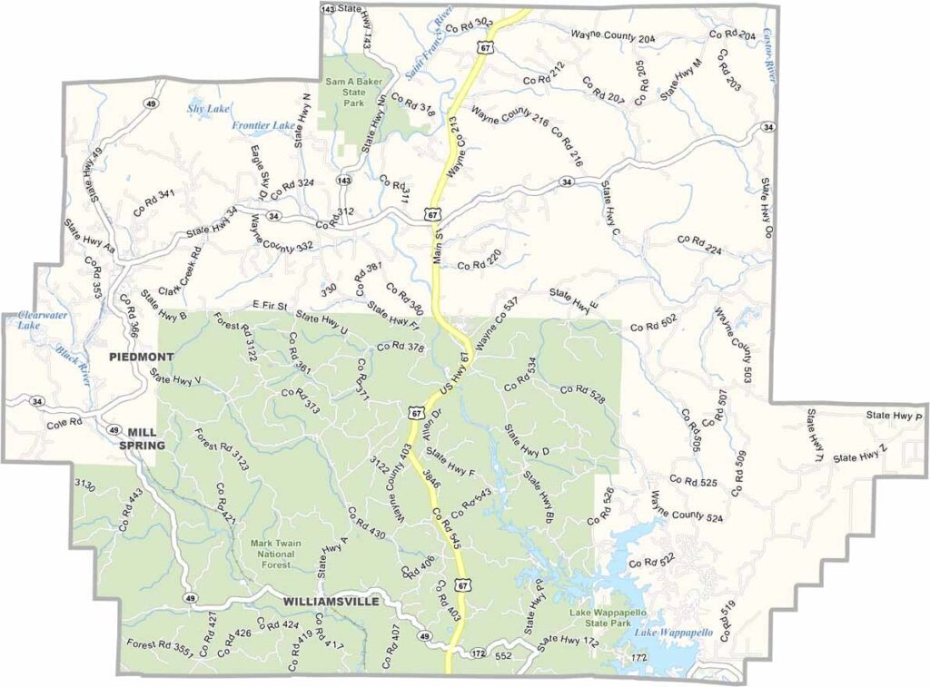
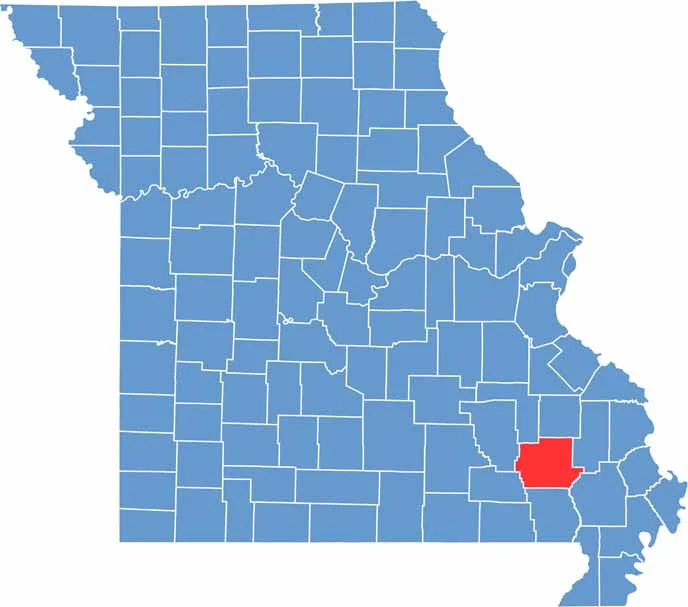
Wayne County is located in southeastern Missouri and is known for its diverse landscape. From rolling hills and fertile farmland to winding rivers and scenic waterways, the county offers a variety of natural attractions.
The St. Francis River flows through the county, creating excellent opportunities for fishing, floating, and other outdoor activities. Clearwater Lake is another popular destination, attracting visitors with its swimming areas, boating opportunities, and relaxing lakeside atmosphere.
Beyond its waterways, Wayne County is home to the beautiful Sam A. Baker State Park, where hiking trails meander through forested hills and the rugged terrain of the ancient Ozark Mountains. The county seat, Greenville, adds a touch of history and small-town charm with its welcoming downtown area and rich Civil War heritage.

Wright County Map Missouri

Worth County Map Missouri
Wayne County Map Missouri
Warren County Map Missouri
Washington County Map Missouri
