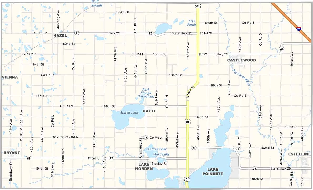
Hamlin County Map, South Dakota

Hamlin County, South Dakota

Hamlin County sits in eastern South Dakota, near the Minnesota border. It’s definitely lake country, with some great camping spots around Lake Poinsett.

Estelline, the largest town, puts on a lively summer festival. But Hayti serves as the county seat. The county is named after Hannibal Hamlin, Abraham Lincoln’s first vice president.

Farming is a big part of life here, with corn, soybeans, and other crops. The sunflower fields in late summer are a sight to see. The old courthouse in Hayti is a real looker.
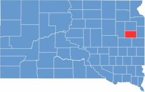

Hamlin County location map of South Dakota
CategoryDetails
County NameHamlin County
County SeatHayti
EtymologyNamed after Hannibal Hamlin, the 15th Vice President of the United States
Cities, Towns, and CommunitiesHayti, Castlewood, Estelline, Bryant, Lake Norden
Interstates and HighwaysInterstate 29, U.S. Highway 81, State Highway 28
FIPS Code46-057
Total Area (Land and Water)538 square miles (507 sq mi land, 31 sq mi water)
Adjacent Counties (and Direction)Codington County (North), Deuel County (East), Brookings County (Southeast), Kingsbury County (Southwest), Clark County (West)
Time ZoneCentral Time Zone (CST)
StateSouth Dakota
Coordinates44°40’N, 97°10’W
Major LandmarksLake Poinsett, Lake Albert, Hamlin County Museum
PopulationApproximately 6,500
Scroll to Top