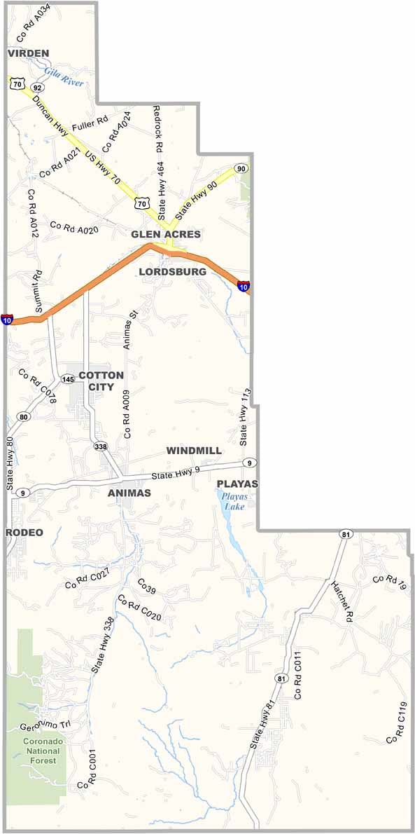
Hidalgo County Map, New Mexico

Hidalgo County, New Mexico

Hidalgo County lies way down in the boot heel of New Mexico, about as far south and west as you can get in the state. Coronado National Forest occupies the southwest corner.

Lordsburg is the largest town, but this place is remote. Really remote. The landscape is classic Chihuahuan Desert, with rugged mountains rising from the plains. It's beautiful, in a harsh sort of way.

Ranching is big here, and so is mining. The county sits right on the Arizona border, and from some spots you can see two states and one country: New Mexico, Arizona, and Mexico. The people here are tough and independent.
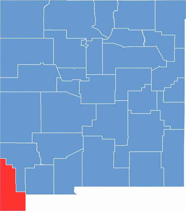

Hidalgo County location map of New Mexico
CategoryDetails
County NameHidalgo County
County SeatLordsburg
EtymologyNamed after Miguel Hidalgo y Costilla, a leader in the Mexican War of Independence
Cities, Towns, and CommunitiesLordsburg, Animas, Rodeo, Virden
Interstates and HighwaysInterstate 10, U.S. Route 70, New Mexico State Road 80
FIPS Code35-023
Total Area (Land and Water)3,446 square miles (3,438 sq mi land, 8 sq mi water)
Adjacent Counties (and Direction)Grant County (North), Luna County (East), Cochise County, Arizona (West), Greenlee County, Arizona (Northwest)
Time ZoneMountain Time Zone (MT)
StateNew Mexico
Coordinates31.8653° N, 108.8413° W
Major LandmarksGila National Forest (nearby), Shakespeare Ghost Town, Peloncillo Mountains
PopulationApproximately 4,200
Scroll to Top