
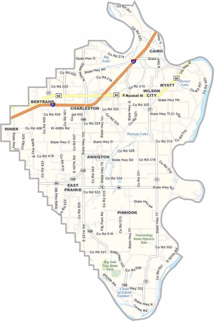
Mississippi County, Missouri

The Bootheel of Missouri is home to Mississippi County. It’s flanked by the Mississippi River to the east and Ohio to the northeast. This county borders both Kentucky and Illinois.

Inland, cotton fields stretch to the horizon here. The soil is some of the richest in the world, thanks to centuries of river flooding. Charleston, the county seat, has a charming historic district.

Bird watchers flock to Big Oak Tree State Park for its ancient forests. Folks here are resilient. They’ve weathered nature’s ups and downs. But overall, rich farmland and mighty rivers define Mississippi County.
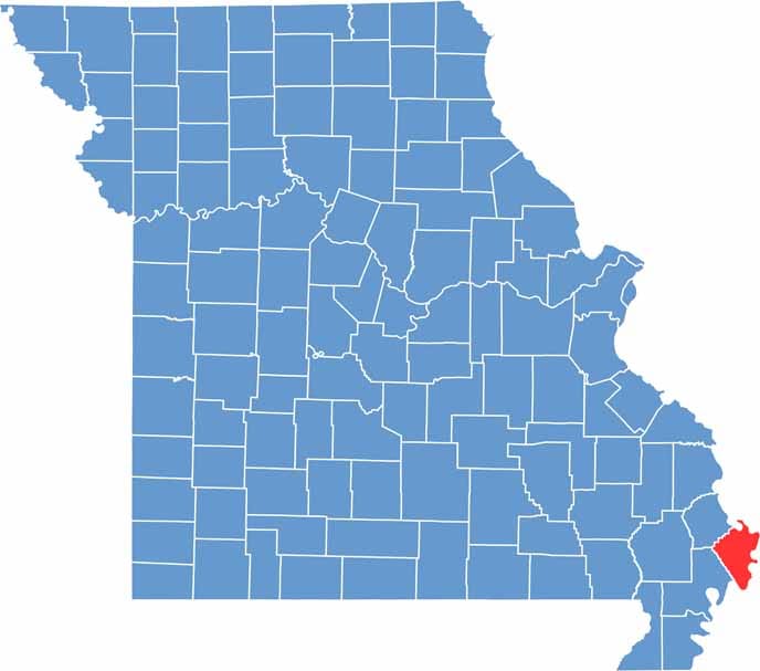

Printable Mississippi County Missouri location map showing county location and boundaries
Category Details
County Name Mississippi County
County Seat Charleston
Cities, Towns, and Communities Charleston, East Prairie, Anniston, Bertrand, Wilson City
Interstates and Highways I-57, US 60, US 62, MO 77
Population Approximately 12,000
FIPS Code 29-133
Total Area (Land and Water) 429 square miles (Land: 412 sq mi, Water: 17 sq mi)
Time Zone Central Time Zone (CT)
State Missouri
Coordinates 36.8460° N, 89.3500° W
Etymology Named after the Mississippi River, which forms its eastern boundary
Major Landmarks Big Oak Tree State Park, Towosahgy State Historic Site, Ten Mile Pond Conservation Area
Adjacent Counties (and Direction) Alexander County, Illinois (North), Ballard County, Kentucky (Northeast), Carlisle County, Kentucky (East), Hickman County, Kentucky (Southeast), Fulton County, Kentucky (South), New Madrid County (Southwest), Scott County (Northwest)
Scroll to Top


