
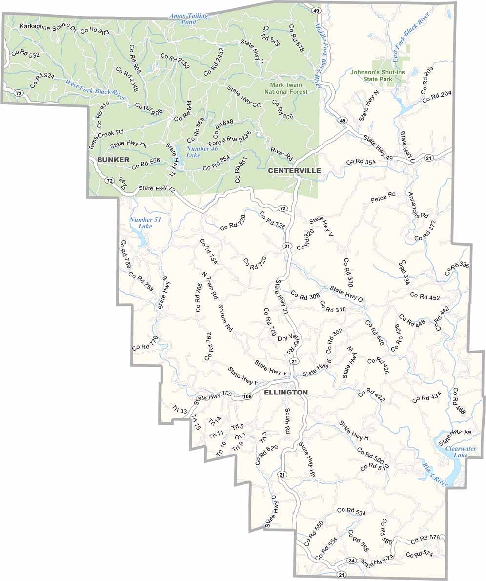
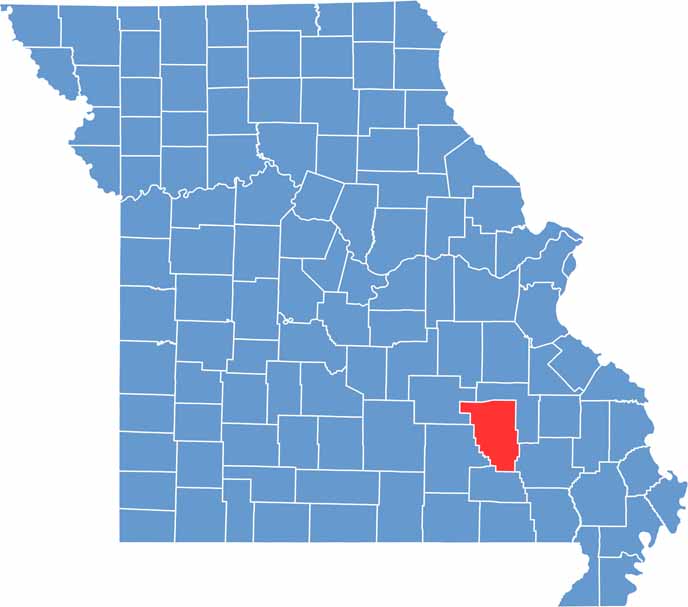
Reynolds County is located in southeastern Missouri, deep within the scenic Ozark region. Known for its rugged landscapes and abundant natural beauty, it is a favorite destination for outdoor enthusiasts and visitors seeking a peaceful escape.
The Black River flows through the county, creating breathtaking scenery and providing opportunities for fishing, floating, and recreation. Its winding course through forests and rocky terrain showcases some of the most picturesque views in the region.
One of the county’s most popular attractions is Johnson’s Shut-Ins State Park. Famous for its unique rock formations, clear waters, and natural swimming areas, the park offers a one-of-a-kind outdoor experience that draws visitors from across Missouri and beyond.

Wright County Map Missouri

Worth County Map Missouri
Wayne County Map Missouri
Warren County Map Missouri
Washington County Map Missouri
