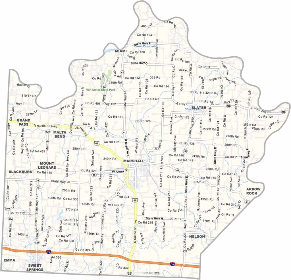
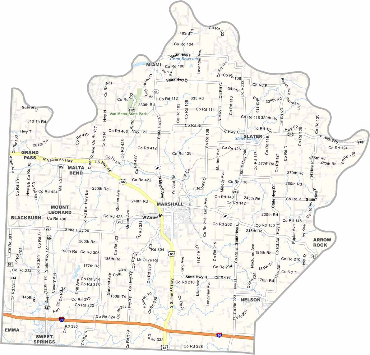
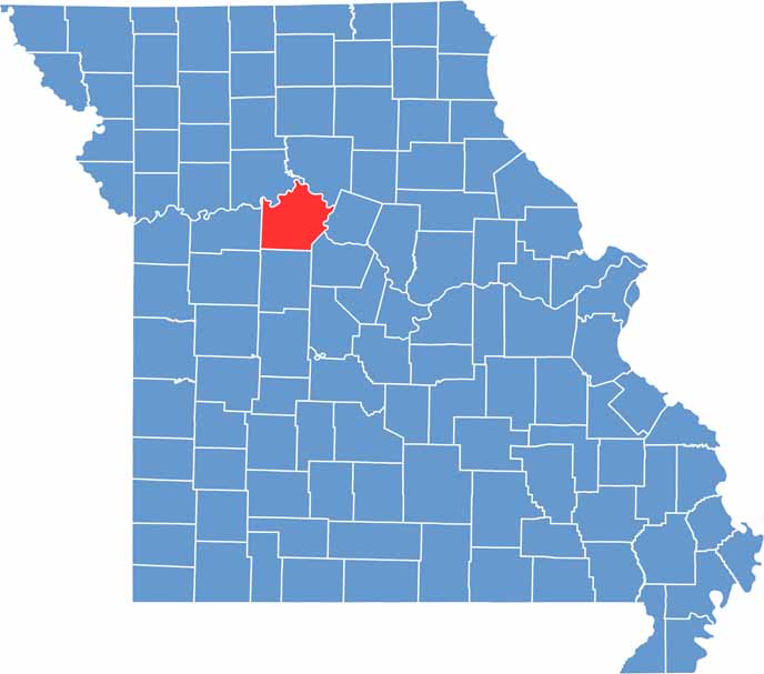
Located in north-central Missouri, Saline County is a region rich in history and natural beauty. The county takes its name from the salt springs that once attracted Native American tribes and early settlers, making it an important area long before Missouri achieved statehood.
The Missouri River forms much of the county’s northern and eastern boundaries, contributing to the region’s fertile farmland and scenic landscapes. Marshall, the county seat, embodies the charm of a traditional Midwestern community while serving as a center for commerce, education, and local culture.
Saline County played an important role in America’s westward expansion and was a significant location during the Civil War era. Today, visitors can explore a variety of museums, historic landmarks, and cultural attractions that showcase the county’s fascinating past and enduring heritage.

Wright County Map Missouri

Worth County Map Missouri
Wayne County Map Missouri
Warren County Map Missouri
Washington County Map Missouri
