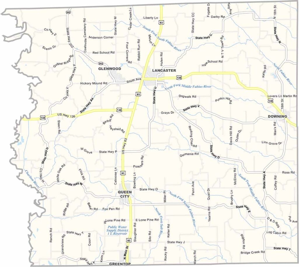
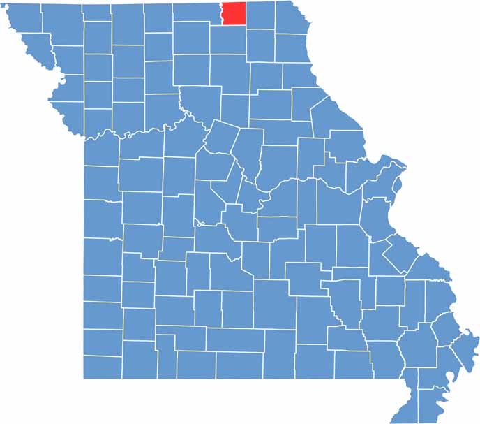
Located in northern Missouri along the Iowa border, Schuyler County is a rural community known for its agricultural heritage, welcoming atmosphere, and strong sense of local pride. Lancaster, the county seat, is situated along U.S. Highway 63 and serves as the center of government and community life.
Established in 1845, Schuyler County has a rich history that reflects the development of rural Missouri. Agriculture remains the backbone of the local economy, with farms and open countryside shaping much of the landscape.
Friendly residents and a close-knit community spirit are hallmarks of Schuyler County. Visitors are often drawn to its peaceful setting, small-town charm, and authentic Midwestern lifestyle.

Missouri
Wright County Map Missouri

Missouri
Worth County Map Missouri
Missouri
Wayne County Map Missouri
Missouri
Warren County Map Missouri
Missouri
Washington County Map Missouri

Missouri