
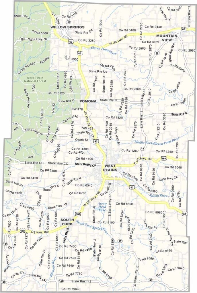
Howell County, Missouri

Howell County is located in the Ozarks of southern Missouri and is known for its scenic landscapes, outdoor recreation, and rural charm. The county seat, West Plains, is a historic community that serves as the county’s economic and cultural center.

Outdoor activities are a major part of life in the county. Residents and visitors enjoy fishing, floating, and exploring the region’s rivers, while numerous caves attract those interested in spelunking and adventure.

The area experiences a typical Ozark climate, with hot, humid summers and cool winters. A blend of forests and farmland defines the landscape, creating a peaceful rural setting. Known for its welcoming atmosphere, Howell County reflects the friendly spirit and strong community values of southern Missouri.
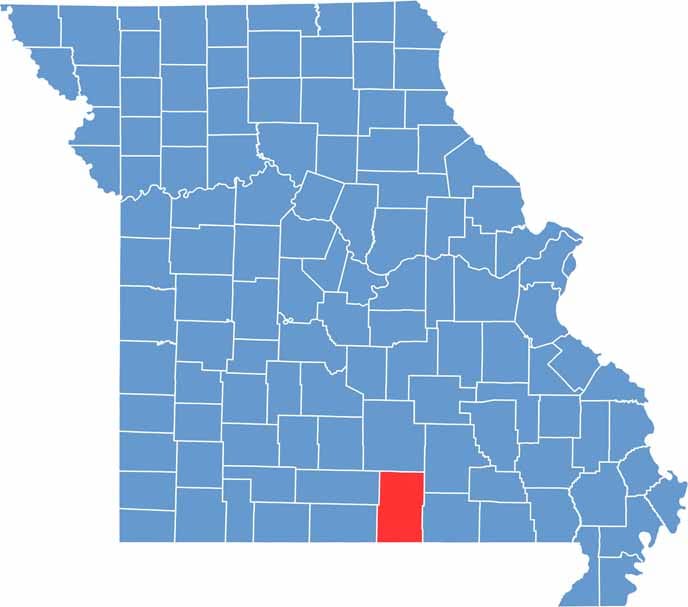

Printable Howell County Missouri location map showing county location and boundaries
Category Details
County Name Howell County
County Seat West Plains
Cities, Towns, and Communities West Plains, Willow Springs, Mountain View, Brandsville, Pomona, Moody, Peace Valley, Koshkonong
Interstates and Highways US 63, US 160, MO 17, MO 142
Population Approximately 39,000
FIPS Code 29-091
Total Area (Land and Water) 928 square miles (Land: 927 sq mi, Water: 1 sq mi)
Time Zone Central Time Zone (CT)
State Missouri
Coordinates 36.7727° N, 91.8797° W
Etymology Named after Josiah Howell, a pioneer settler
Major Landmarks Mark Twain National Forest, Grand Gulf State Park, Ozark Heritage Welcome Center
Adjacent Counties (and Direction) Texas County (North), Shannon County (Northeast), Oregon County (East), Fulton County, Arkansas (South), Ozark County (Southwest), Douglas County (Northwest),
Scroll to Top


