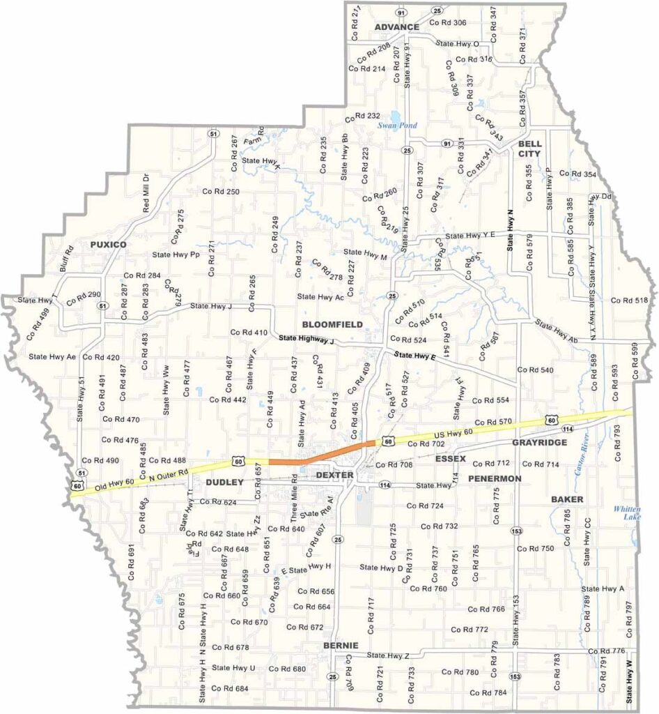
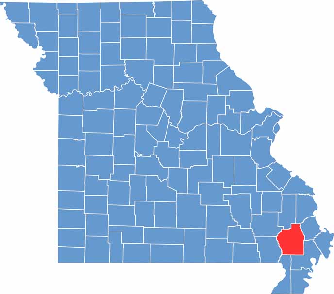
Located in Missouri’s Bootheel region, Stoddard County is a vibrant area known for its agricultural roots, natural beauty, and historical attractions. While Dexter is the county’s largest city and serves as a major commercial hub, Bloomfield holds the distinction of being the county seat.
One of the county’s most notable natural attractions is the Mingo National Wildlife Refuge, a sprawling wetland ecosystem that offers excellent opportunities for birdwatching, fishing, wildlife photography, and outdoor recreation. Its peaceful marshes and forests provide a unique glimpse into Missouri’s natural landscape.
Agriculture remains a cornerstone of the local economy, with cotton and soybeans among the county’s most important crops. Visitors interested in history can explore the Stars and Stripes Museum, which celebrates the legacy of the famous military newspaper and its role in documenting the experiences of American service members throughout history.

Wright County Map Missouri

Worth County Map Missouri
Wayne County Map Missouri
Warren County Map Missouri
Washington County Map Missouri
