Phelps County, Missouri
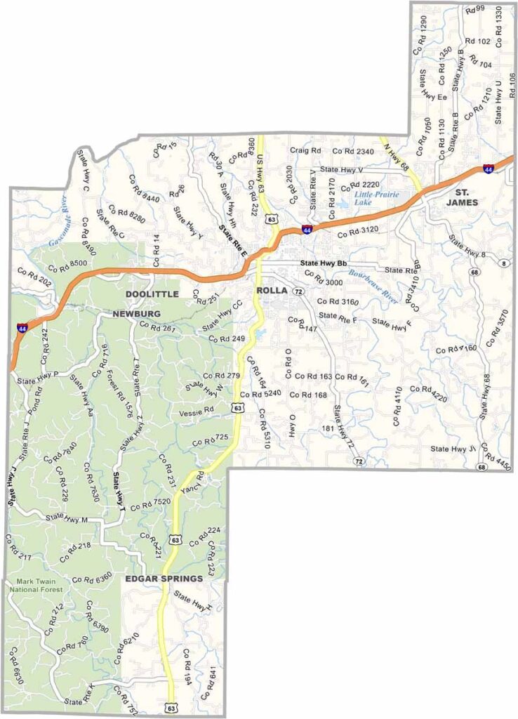
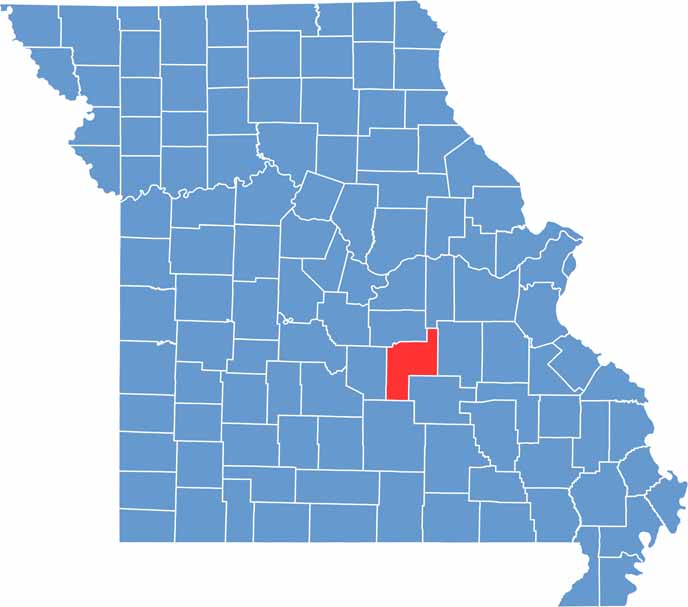
Phelps County is located in central Missouri and is part of the Ozarks region. Rolla serves as the county seat and sits roughly halfway between St. Louis and Springfield along Interstate 44.
The county features rolling hills, forests, and numerous rivers and streams. Outdoor recreation is easy to find here, and portions of the Mark Twain National Forest extend into the area.
Phelps County lies along the northern edge of the Ozark Plateau. This unique setting creates a blend of prairie and forest landscapes, making it a great destination for nature lovers and outdoor enthusiasts.
| Category | Details |
|---|---|
| County Name | Phelps County |
| County Seat | Rolla |
| Cities, Towns, and Communities | Rolla, St. James, Newburg, Doolittle, Edgar Springs, Northwye |
| Interstates and Highways | I-44, US 63, MO 68, MO 72 |
| Population | Approximately 45,000 |
| FIPS Code | 29-161 |
| Total Area (Land and Water) | 674 square miles (Land: 672 sq mi, Water: 2 sq mi) |
| Time Zone | Central Time Zone (CT) |
| State | Missouri |
| Coordinates | 37.9366° N, 91.7715° W |
| Etymology | Named after John S. Phelps, a former U.S. Congressman and Governor of Missouri |
| Major Landmarks | Mark Twain National Forest, Missouri University of Science and Technology, Rolla Downtown Historic District |
| Adjacent Counties (and Direction) | Maries County (Northwest), Gasconade County (Northeast), Crawford County (East), Dent County (Southeast), Texas County (South), Pulaski County (West) |
Missouri
Wright County Map Missouri
Missouri
Worth County Map Missouri
Missouri
Wayne County Map Missouri
Missouri
Warren County Map Missouri
Missouri
Washington County Map Missouri
Missouri


